MyTopo
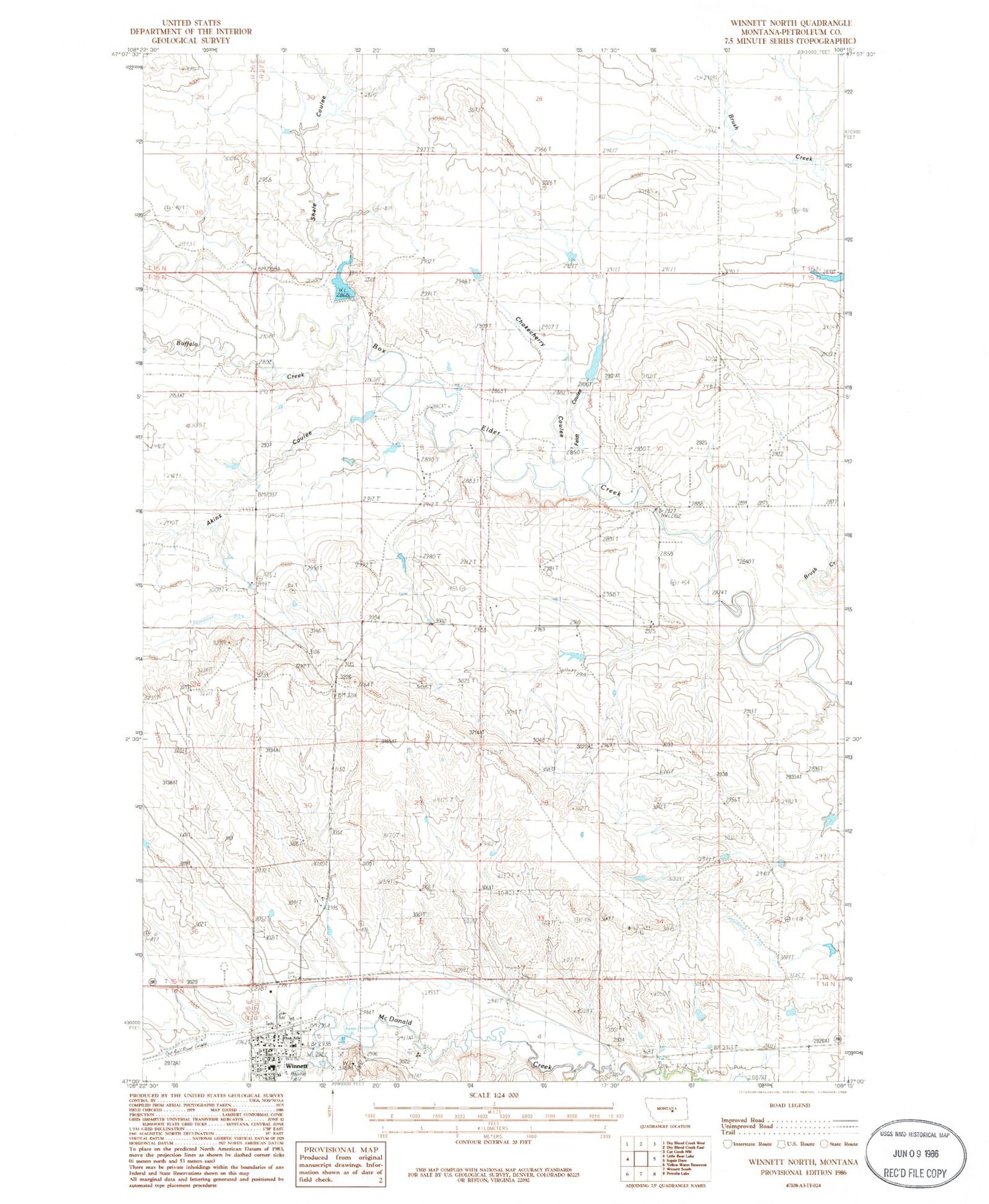
Classic USGS Winnett North Montana 7.5'x7.5' Topo Map
Couldn't load pickup availability
Historical USGS topographic quad map of Winnett North in the state of Montana. Map scale may vary for some years, but is generally around 1:24,000. Print size is approximately 24" x 27"
This quadrangle is in the following counties: Petroleum.
The map contains contour lines, roads, rivers, towns, and lakes. Printed on high-quality waterproof paper with UV fade-resistant inks, and shipped rolled.
Contains the following named places: 14N27E05DBB_01 Well, 15N26E13DD__01 Well, Akins Coulee, Bohn Number 3 Dam, Box Elder Creek Bridge, Brush Creek School, Buffalo Creek, Chokecherry Coulee, DE Stewart Number 1 Dam, Farmers Union Elevator, Feldt Coulee, First Lutheran Church, George Ore Memorial Park, Jim Bartlett Field, Montana Elevator, Petroleum County, Petroleum County Ambulance Service, Petroleum County Courthouse, Petroleum County Public Library, Petroleum County Sheriff's Department, Rimrock Hospital, Saint Aloysius Church, Shale Coulee, Shale Creek Dam, Shale Ridge School, Town of Winnett, United Methodist Church, Winnett, Winnett Cemetery, Winnett Hospital, Winnett Irrigation County Ditch, Winnett Post Office, Winnett Public Schools, Winnett Volunteer Fire Department