MyTopo
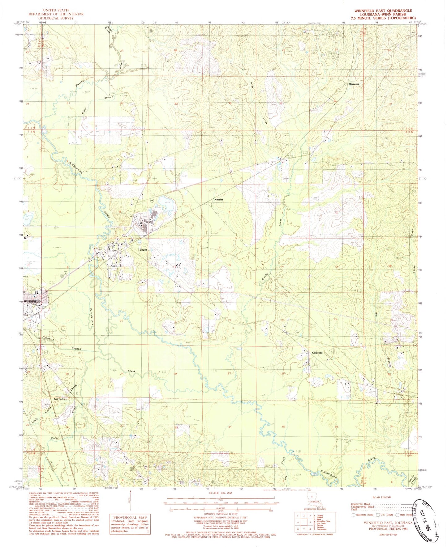
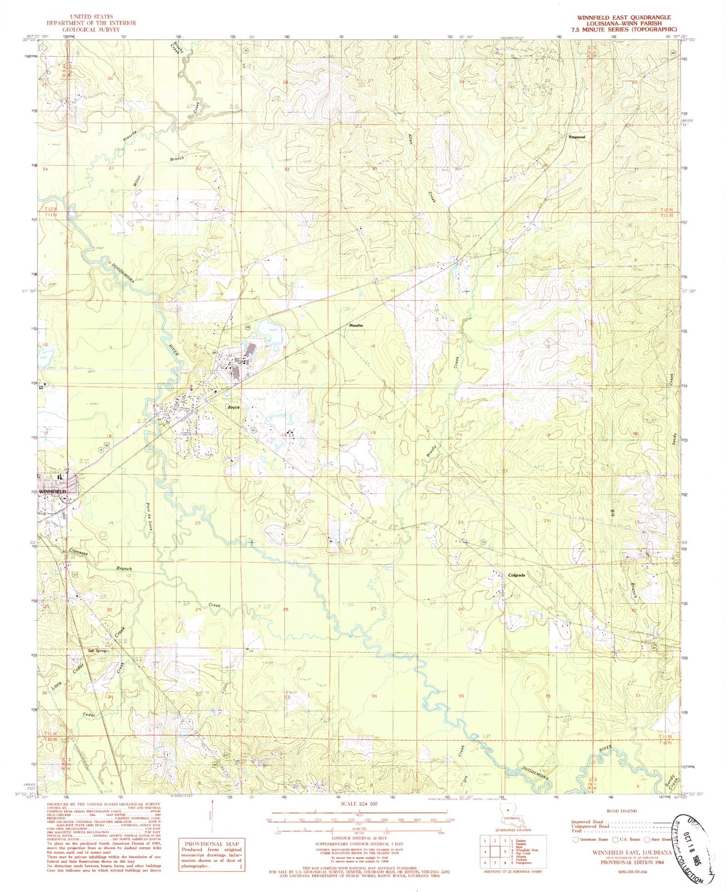
Classic USGS Winnfield East Louisiana 7.5'x7.5' Topo Map
Couldn't load pickup availability
Historical USGS topographic quad map of Winnfield East in the state of Louisiana. Map scale may vary for some years, but is generally around 1:24,000. Print size is approximately 24" x 27"
This quadrangle is in the following counties: Winn.
The map contains contour lines, roads, rivers, towns, and lakes. Printed on high-quality waterproof paper with UV fade-resistant inks, and shipped rolled.
Contains the following named places: Allen Creek, Big Branch, Boyett Cemetery, Brushy Creek, Cedar Creek, Cedar Creek Salt Lick, Colgrade, Colgrade Lookout Tower, Corinth Church, Corinth Tabernacle, Creosote Branch, Dry Creek, Joyce, Joyce Census Designated Place, Joyce Post Office, Kiesche Creek, Little Cedar Creek, Menefee, Miller Branch, Old Pleasant Hill Cemetery, Pleasent Hill Baptist Church Cemetery, Port de Luce Creek, Ringwood, Salt Spring, Sandy Creek, Tremont Pond Dam, Union Church, Ward Two, WINNFIELD KINDERGARTEN, Winnfield Mini Park