MyTopo
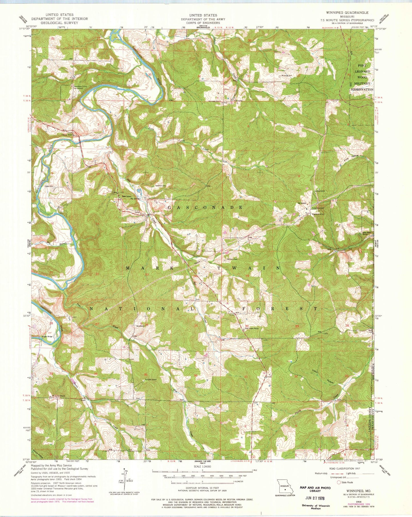
Classic USGS Winnipeg Missouri 7.5'x7.5' Topo Map
Couldn't load pickup availability
Historical USGS topographic quad map of Winnipeg in the state of Missouri. Map scale may vary for some years, but is generally around 1:24,000. Print size is approximately 24" x 27"
This quadrangle is in the following counties: Laclede, Texas.
The map contains contour lines, roads, rivers, towns, and lakes. Printed on high-quality waterproof paper with UV fade-resistant inks, and shipped rolled.
Contains the following named places: Big Spring, Blackbird School, Casey - Dougan Cemetery, Casey Ford, Cedar Bluff Church, Central School, Chatham Cemetery, Dougan Bridge, Dry Branch, Fairview School, Kuhn Creek, McGinnis Cemetery, Mill Creek, Morehouse School, Mount Carney Church, Nebo, Nebo Falcon Rural Volunteer Fire Department Station 1, Nebo School, Norris Creek, Osage Gasconade Hills, Pine Creek, Pine Creek Church, Pine Creek Post Office, Pinecreek, Saint Annie, South Central Ozarks Planning Region, Southard, Success School, Township of Gasconade, Tracy Hollow, Winning Church, Winnipeg, Winnipeg Cemetery