MyTopo
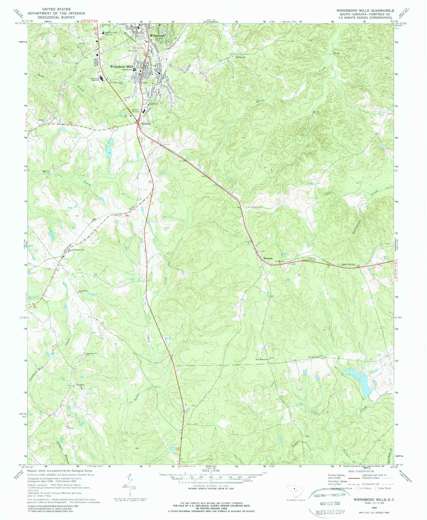
Classic USGS Winnsboro Mills South Carolina 7.5'x7.5' Topo Map
Couldn't load pickup availability
Historical USGS topographic quad map of Winnsboro Mills in the state of South Carolina. Map scale may vary for some years, but is generally around 1:24,000. Print size is approximately 24" x 27"
This quadrangle is in the following counties: Fairfield.
The map contains contour lines, roads, rivers, towns, and lakes. Printed on high-quality waterproof paper with UV fade-resistant inks, and shipped rolled.
Contains the following named places: Calvary Cemetery, Calvary Church, Calvary School, Center Creek, Church of God, Church of the Nazarene, Ebenezer Church, Everett School, Fairfield County Airport, Fairfield County Community Fire Department, Fairfield County Fire Department Greenbrier Bethel, Fairfield County Fire Department Greenbrier Substation, Fairfield Memorial Hospital, Greenbrier Cemetery, Greenbrier Church, Greenbrier School, New Buffalo Cemetery, New Haven Church, Richardson Cemetery, Rockton, Rockton Church, Saint Johns Church, Saint Lukes Church, Saint Mark School, Saint Marks Church, Saint Theresa Church, Simpson, Simpson Lookout Tower, South Carolina Noname 20002 D-0530 Dam, South Carolina Noname 20010 D-0527 Dam, South Carolina Noname 20022 D-0528 Dam, Stephen Green Memorial Baptist Church, Thomas Woodward Cemetery, Town of Winnsboro, Waymaon Methodist Church, Winnsboro High School, Winnsboro Mills, Winnsboro Mills Cemetery, Winnsboro Mills Census Designated Place, Winnsboro Mills Methodist Church, ZIP Code: 29180