MyTopo
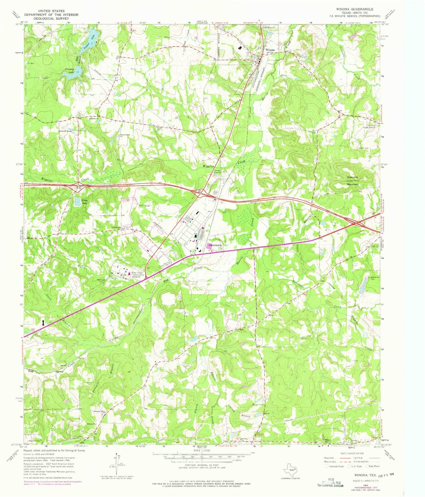
Classic USGS Winona Texas 7.5'x7.5' Topo Map
Couldn't load pickup availability
Historical USGS topographic quad map of Winona in the state of Texas. Map scale may vary for some years, but is generally around 1:24,000. Print size is approximately 24" x 27"
This quadrangle is in the following counties: Smith.
The map contains contour lines, roads, rivers, towns, and lakes. Printed on high-quality waterproof paper with UV fade-resistant inks, and shipped rolled.
Contains the following named places: Alden Branch, Antioch Branch, Antioch Cemetery, Atascocita Branch Library, Auburn Creek, Bracewell Branch Library, Center Church, Coldhill Church, Cole Hill Church, Driscoll Lake, Fivemile Branch, Greys Lake, Greys Lake Dam, Harris Creek Baptist Church, Harris Creek Church, Hebron Church, Henrys Church, High Cemetery, Higher Hope Fellowship Church, Ingram Cemetery, Jackson Elementary School, Jones Branch, Kay Ranch Airport, KTYL-FM (Tyler), Liberty Church, Loves Branch, Marsh Cemetery, McDougal Cemetery, New Zion Church, Owentown, Pinedale Dam, Pinedale Lake, Pineland Lake, Pineland Lake Dam, Pleasant Grove Church, Ray Creek, Saint Viola Church, Seastrunk Cemetery, Smith County Constable's Office Precinct 4, Starrville Mountain, Starrville Rodeo Ground, Sunstroke Creek, Timber Lake, Timber Lake Dam, Town of Winona, Triumph Church, University of Texas Health Science Center at Tyler, Walsh Creek, Wiggins Creek, Winona, Winona Elementary School, Winona High School, Winona Middle School, Winona Police Department, Winona Post Office, Winona Volunteer Fire Department Station 1, Winona Volunteer Fire Department Station 2, ZIP Code: 75708