MyTopo
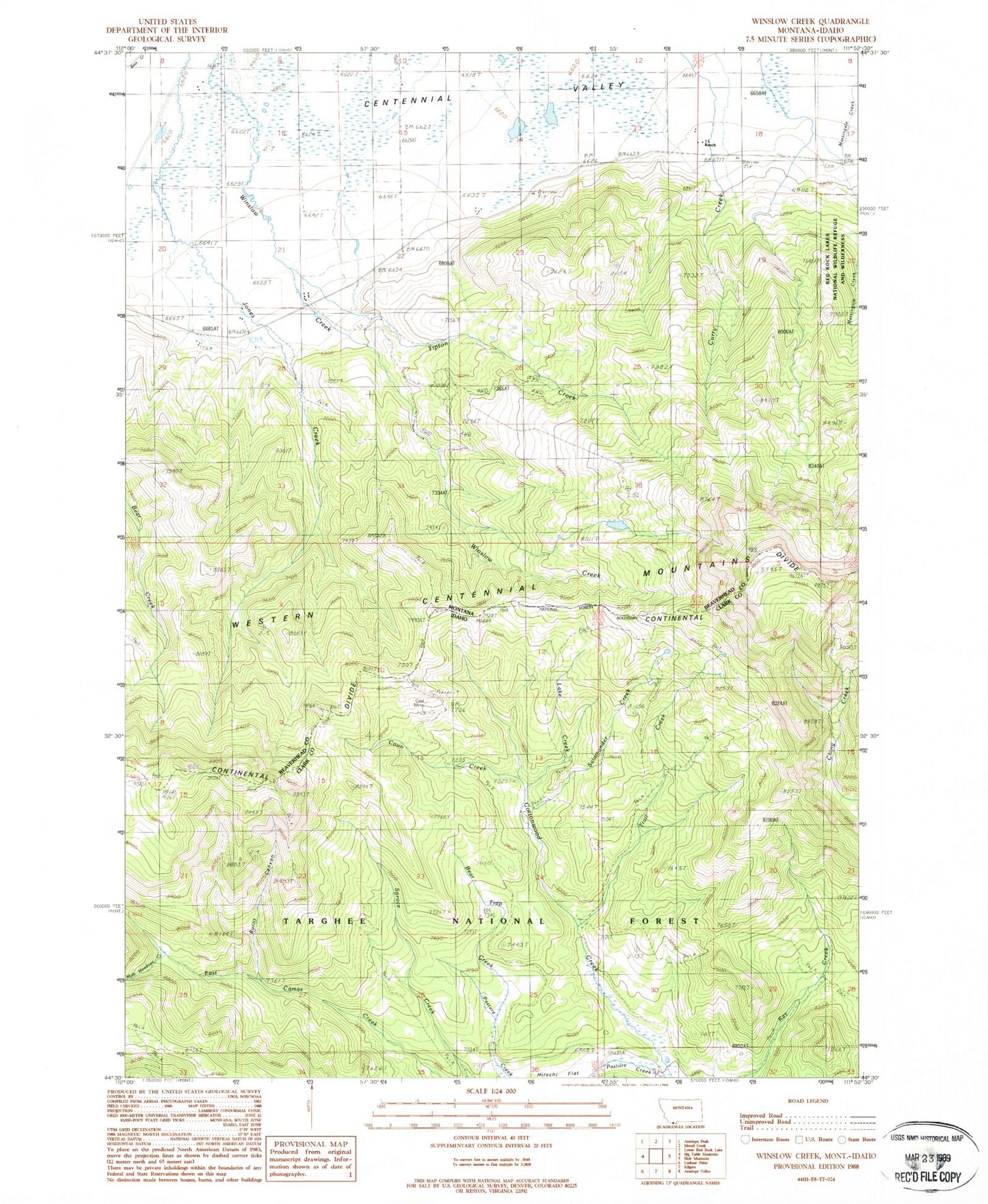
Classic USGS Winslow Creek Montana 7.5'x7.5' Topo Map
Couldn't load pickup availability
Historical USGS topographic quad map of Winslow Creek in the states of Montana, Idaho. Typical map scale is 1:24,000, but may vary for certain years, if available. Print size: 24" x 27"
This quadrangle is in the following counties: Beaverhead, Clark.
The map contains contour lines, roads, rivers, towns, and lakes. Printed on high-quality waterproof paper with UV fade-resistant inks, and shipped rolled.
Contains the following named places: Doyle School (historical), Seven L Ranch, Tipton Creek, 14S03W21DDCC01 Well, 14S03W22CABD01 Well, 14S03W23BBD_01 Spring, 14S03W13DBCB01 Well, Bear Trap Creek, Burnt Canyon, Coon Creek, Lake Creek, Mule Meadows Creek, Salamander Creek, Table Mountain Trail, Trail Creek, Coal Mine