MyTopo
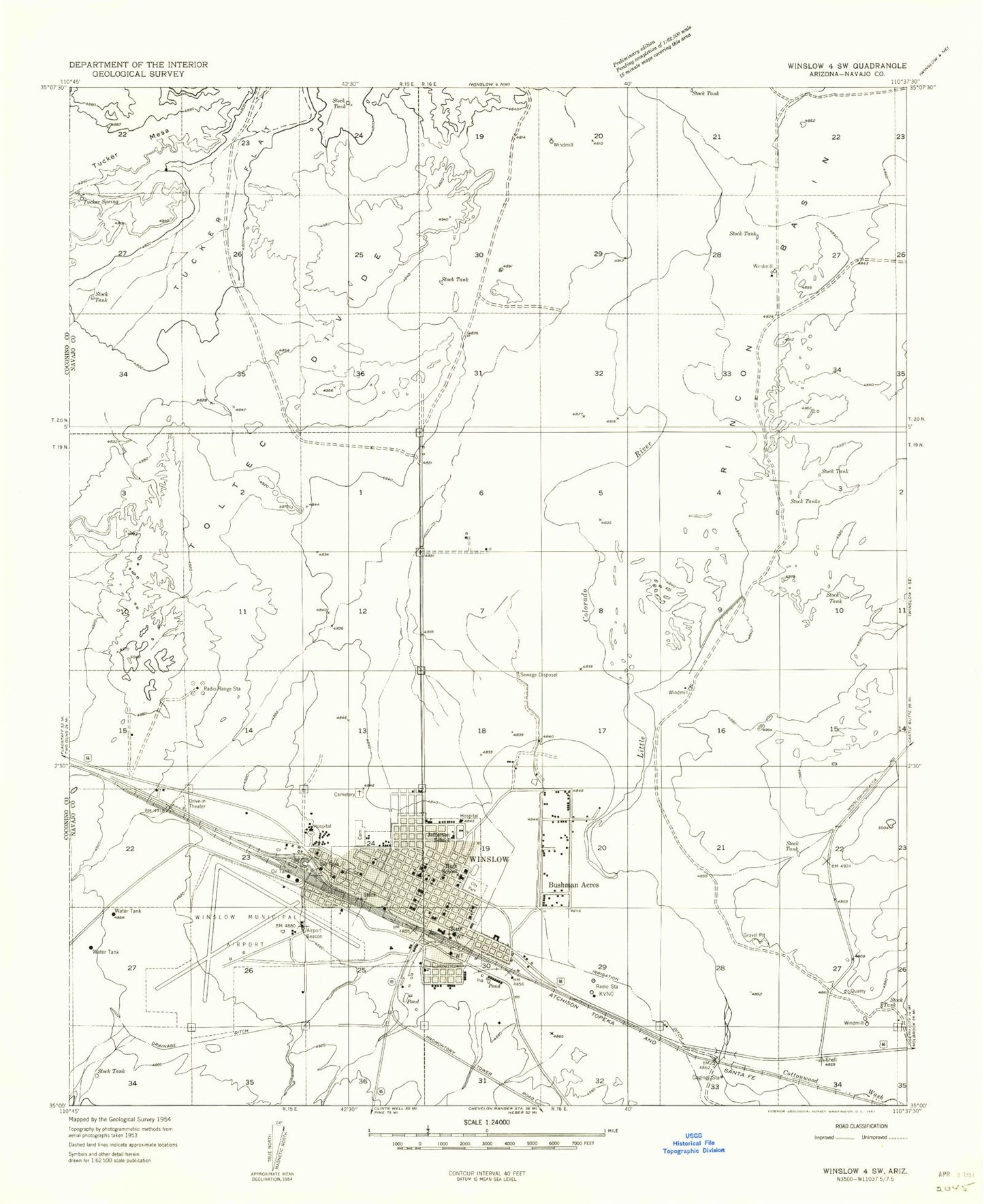
Classic USGS Winslow Arizona 7.5'x7.5' Topo Map
Couldn't load pickup availability
Historical USGS topographic quad map of Winslow in the state of Arizona. Map scale may vary for some years, but is generally around 1:24,000. Print size is approximately 24" x 27"
This quadrangle is in the following counties: Navajo.
The map contains contour lines, roads, rivers, towns, and lakes. Printed on high-quality waterproof paper with UV fade-resistant inks, and shipped rolled.
Contains the following named places: Bonnie Brennan Elementary School, Brigham City, Bushman Acres, City of Winslow, City of Winslow Wastewater Treatment Plant, Cottonwood Wash, Cottonwood Wash Bridge, Desert View Baptist Church, Desert View Cemetery, First Assembly of God, First Baptist Church of Winslow, First Christian Church, First United Methodist Church, Hopi-Winslow District, Jefferson Elementary School, KINO-AM (Winslow), KRIM-FM (Winslow), Lincoln Elementary School, Little Colorado Medical Center, Navajo County Sheriff's Office Winslow, North Park Plaza Shopping Center, Northern Arizona Academy For Career Development Winslow, Northland Pioneer College Little Colorado Campus, Northland Pioneer College Little Colorado Campus Blunk Health Sciences Center, Northland Pioneer College Little Colorado Campus Ruby Hall Building, Roosevelt Elementary School, Saint Josephs Catholic School, Saint Joseph's Church, Saint Pauls Episcopal Church, Sundown Mobile Home Park, Sunset Cemetery, Sunset City, Sunset Crossing, Tucker Spring, Warren Avenue Church of Christ, Washington Elementary School, West Winslow, Whipple Memorial Park, Winslow, Winslow City Hall, Winslow City Park, Winslow Civic Center, Winslow Fire Department, Winslow High School, Winslow Indian Health Care Center, Winslow Junior High School, Winslow Police Department, Winslow Post Office, Winslow Public Library, Winslow Railroad Station, Winslow Residential Hall, Winslow-Lindbergh Regional Airport, Zion Baptist Church, ZIP Code: 86047


