MyTopo
Classic USGS Winston Missouri 7.5'x7.5' Topo Map
Couldn't load pickup availability
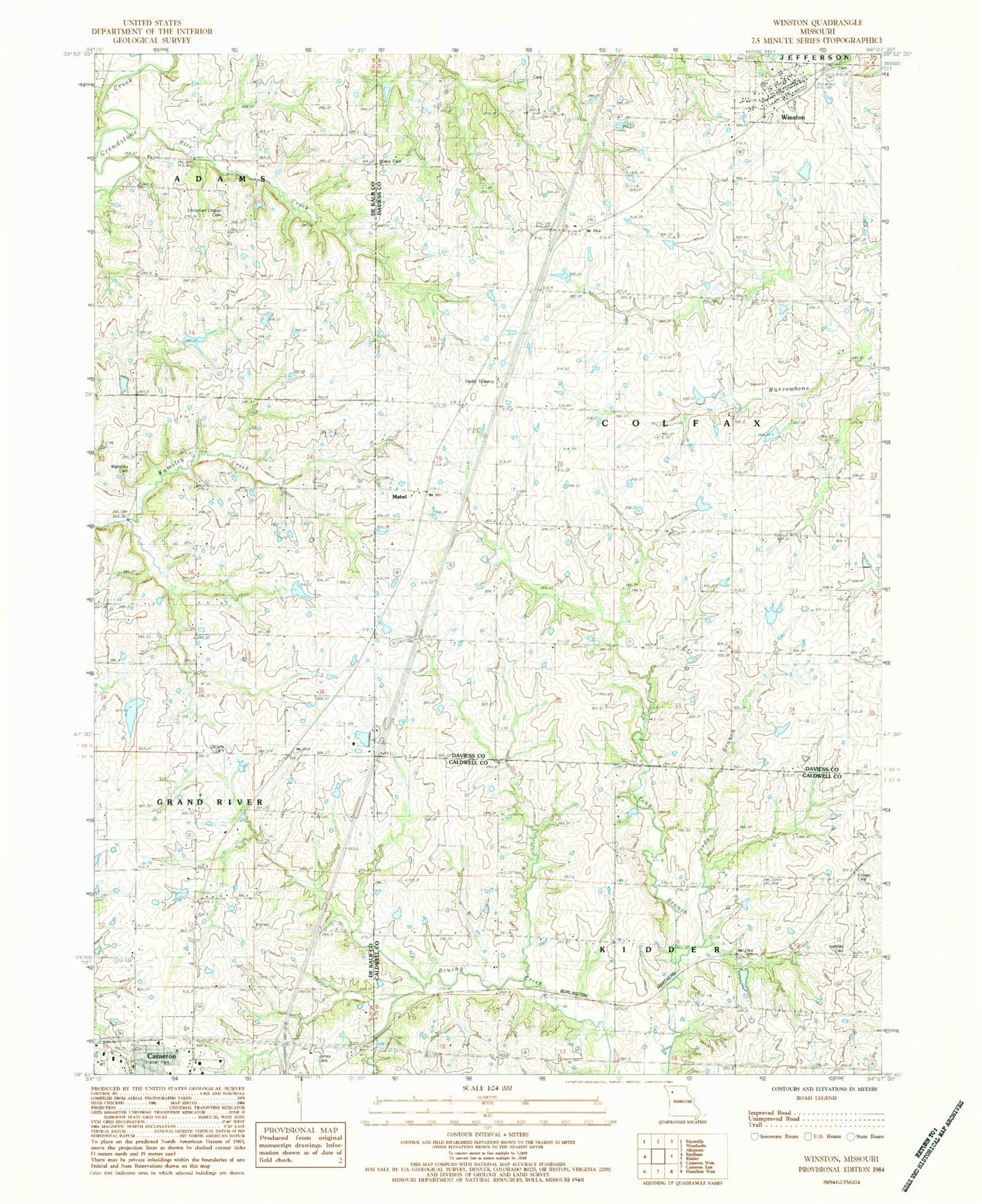
Historical USGS topographic quad map of Winston in the state of Missouri. Map scale may vary for some years, but is generally around 1:24,000. Print size is approximately 24" x 27"
This quadrangle is in the following counties: Caldwell, Daviess, DeKalb.
The map contains contour lines, roads, rivers, towns, and lakes. Printed on high-quality waterproof paper with UV fade-resistant inks, and shipped rolled.
Contains the following named places: A-26 Lake, Christian Chapel Cemetery, Crossroads Correctional Center, DeKalb A-33 Lake, Delano Cemetery, Eureka School, Finkle Lake Dam, Four County Plaza, Grindstone-Lost-Muddy Creek Watershed Dam A-26, Grindstone-Lost-Muddy Creek Watershed Dam A-33, Harris School, Island Number 10 School, Jones Cemetery, Jordan Branch, Karr Lake Dam, Kenney Cemetery, Kidder - Altamont - Winston Fire Protection District Winston, Kidder Cemetery, Kinney School, Lone Cottage School, Mabel, Mount Pleasant School, Prairie Gem School, Ray School, Rice Creek, Rogers School, Severling Lake Dam, Taylor Mills School, Township of Colfax, Village of Winston, Wamsley Cemetery, Wamsley Church, Wamsley School, Western Missouri Correctional Center, Winston, Winston Cemetery, Winston Elementary School, Winston High School, Winston Post Office, Wood School, ZIP Code: 64689