MyTopo
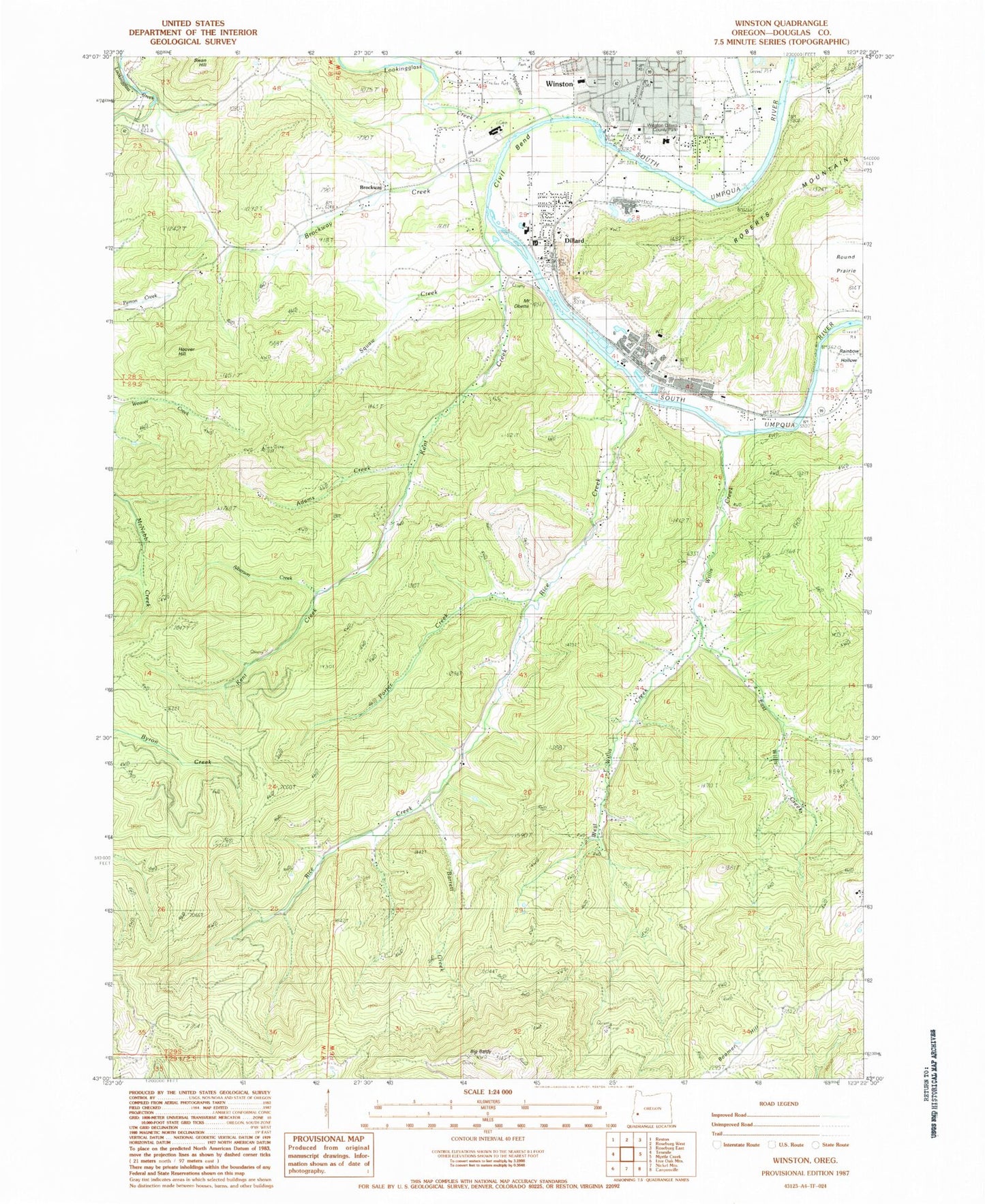
Classic USGS Winston Oregon 7.5'x7.5' Topo Map
Couldn't load pickup availability
Historical USGS topographic quad map of Winston in the state of Oregon. Map scale may vary for some years, but is generally around 1:24,000. Print size is approximately 24" x 27"
This quadrangle is in the following counties: Douglas.
The map contains contour lines, roads, rivers, towns, and lakes. Printed on high-quality waterproof paper with UV fade-resistant inks, and shipped rolled.
Contains the following named places: Adams Creek, Alberson Creek, Alsea Log Pond, Barrett Creek, Big Baldy, Brockway, Brockway Creek, Brockway Elementary School, Brockway Post Office, City of Winston, Civil Bend, Civil Bend Cemetery, Civil Bend Post Office, Community Center Winston Branch Library, Cox Cemetery, Dillard, Dillard Census Designated Place, Dillard Log Pond, Dillard Post Office, Douglas High School, East Willis Creek, Hoover Hill, Kent Creek, Kent Station, KGRV-AM, Lookingglass Creek, Martha Rice Bridge, McGovern Elementary School, Mount Obette, Ornoname 11 Dam, Pacific Plywood Corporation Log Pond, Pacific Plywood Dam, Porter Creek, Rainbow Hollow, Rice Creek, Roseburg Forest Products Biomass Production, Squaw Creek, West Willis Creek, Willis Creek, Willis Creek Cemetery, Winston, Winston - Dillard Water District Water Treatment Plant, Winston City Hall, Winston Dillard County Park, Winston Dillard Rural Fire Protection District, Winston Middle School, Winston Municipal Court, Winston Police Department, Winston Post Office, Winston Public Works, ZIP Code: 97496