MyTopo
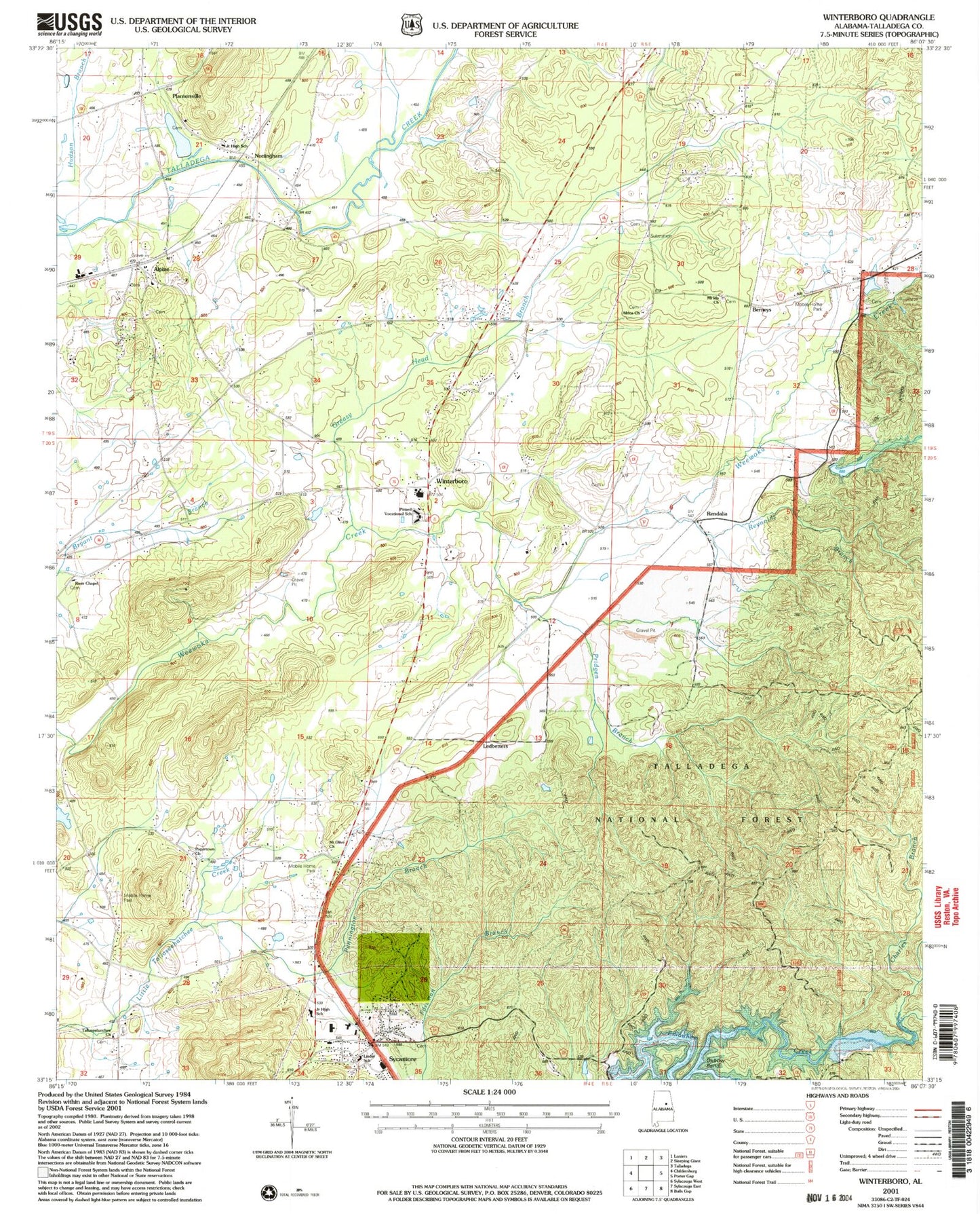
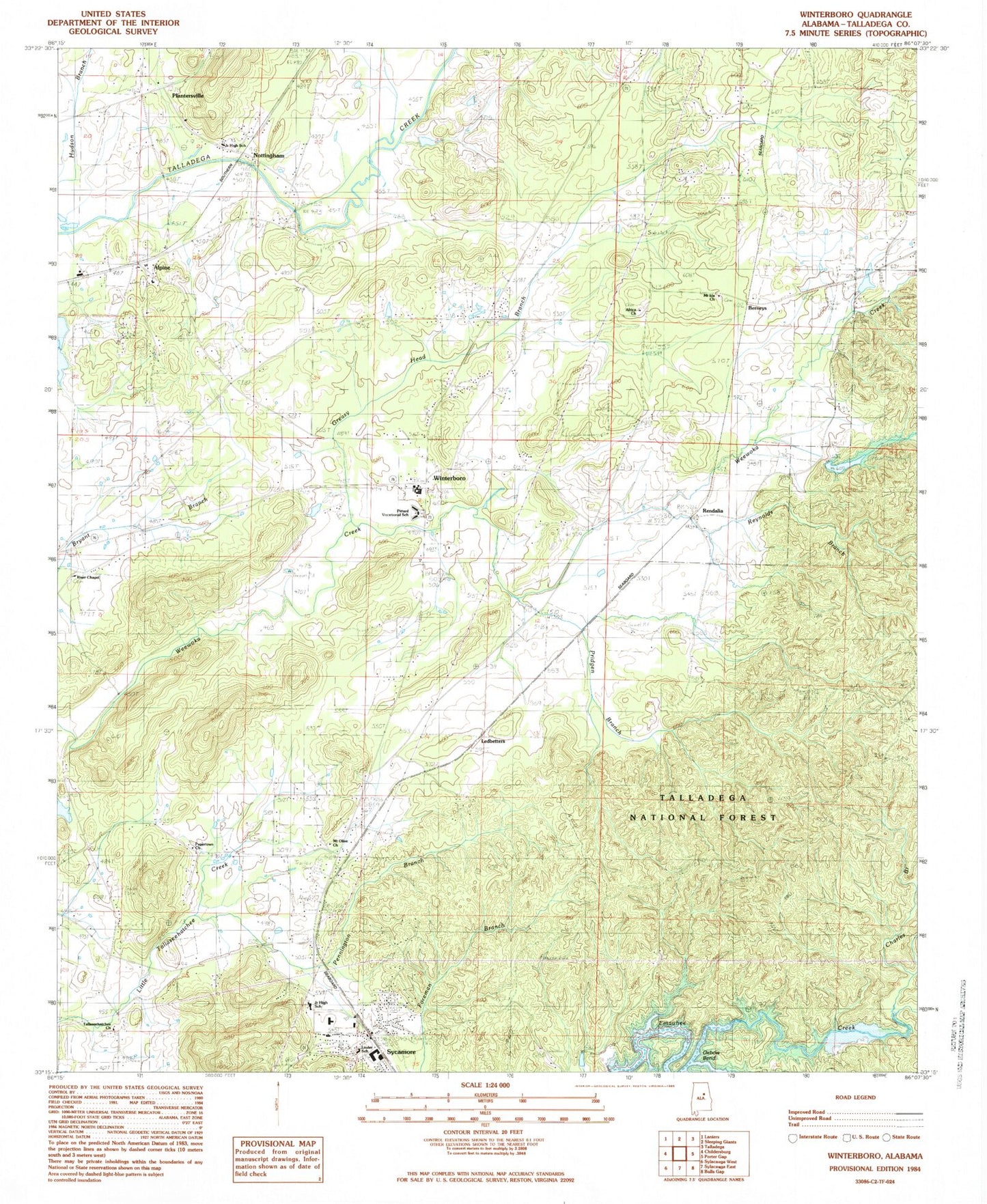
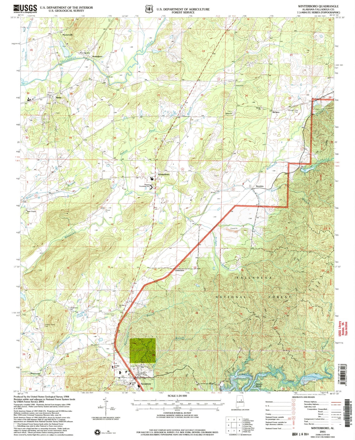
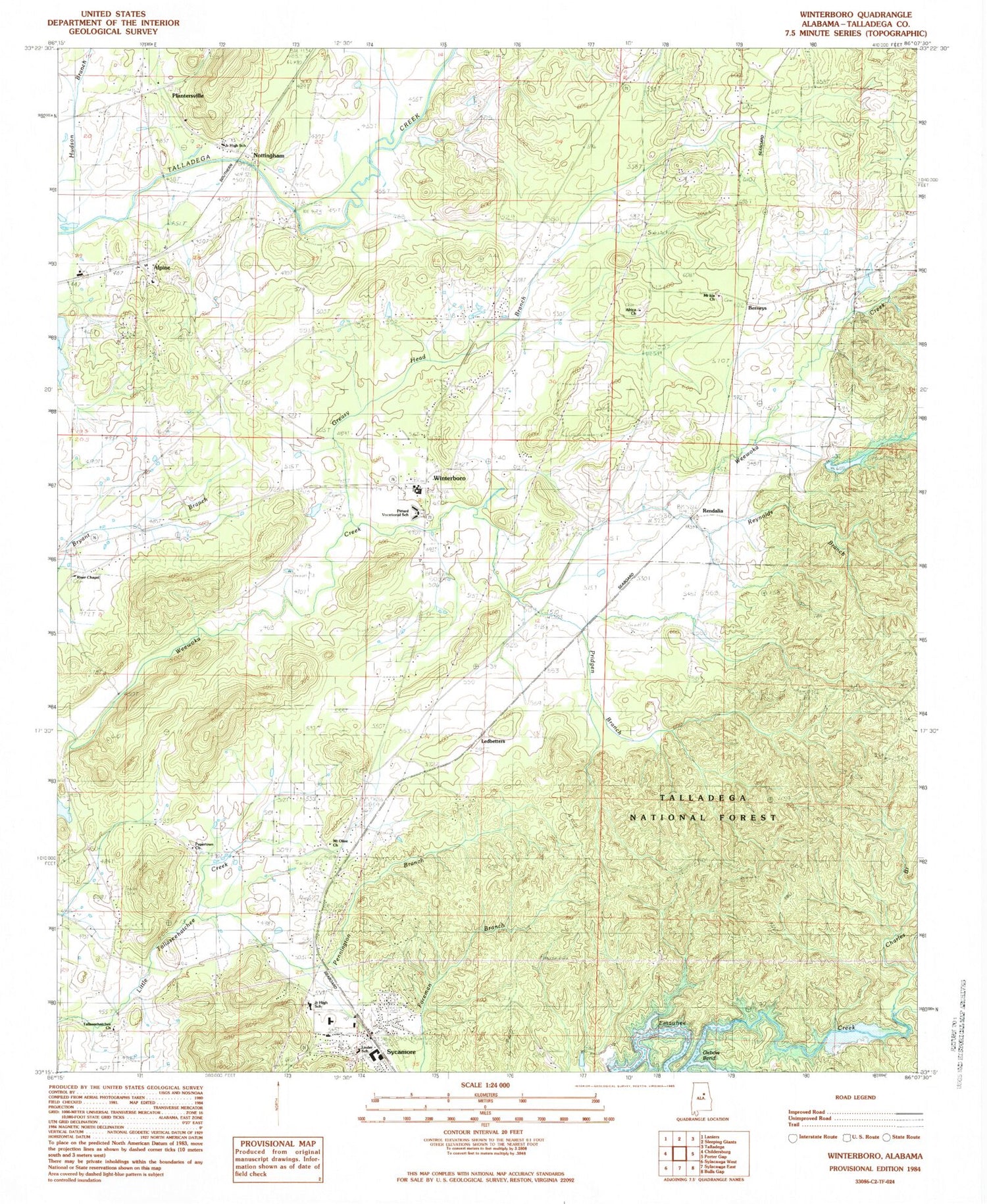
Classic USGS Winterboro Alabama 7.5'x7.5' Topo Map
Couldn't load pickup availability
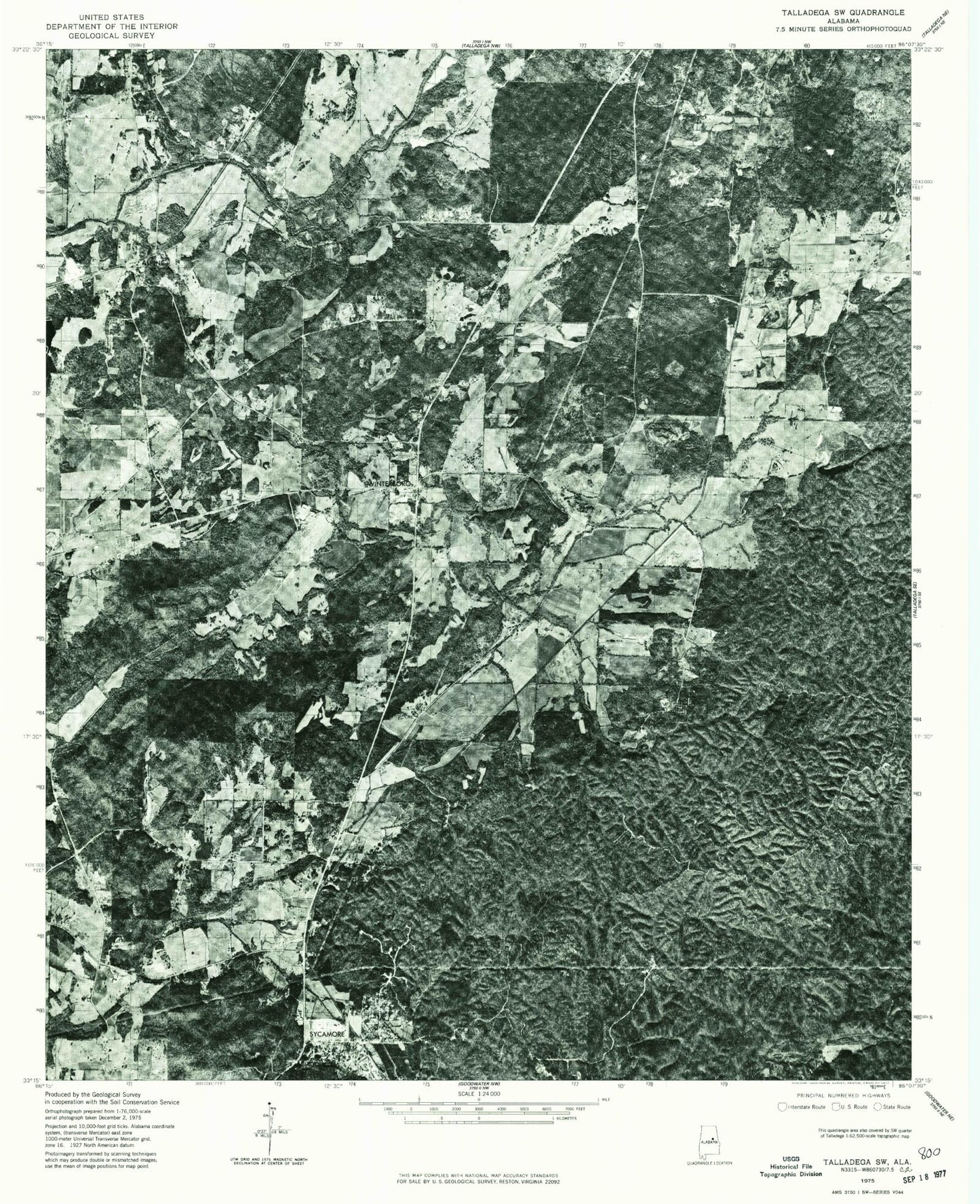
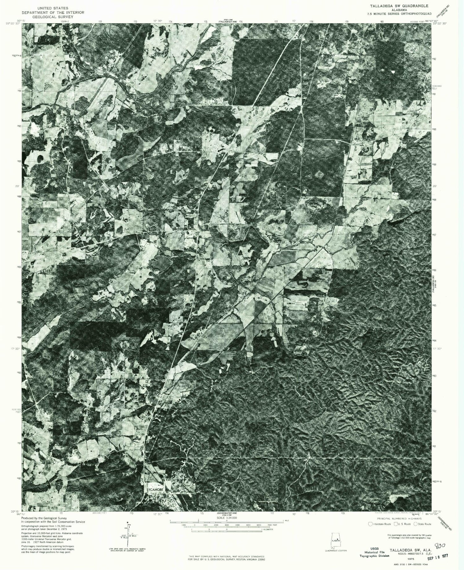
Historical USGS topographic quad map of Winterboro in the state of Alabama. Typical map scale is 1:24,000, but may vary for certain years, if available. Print size: 24" x 27"
This quadrangle is in the following counties: Talladega.
The map contains contour lines, roads, rivers, towns, and lakes. Printed on high-quality waterproof paper with UV fade-resistant inks, and shipped rolled.
Contains the following named places: Africa Church, Alpine, Baker Branch, Charles Branch, Greasy Head Branch, Oxbow Bend, Pennington Branch, Pine Hill School, Plantersville, Swept Creek, Sycamore, Tallaseehatchee Church, Winterboro, Riser Dam, Riser Lake, Kellys Lake, Killough Dam, Adairs (historical), Alpine Baptist Church, Andeluvia Mountain, Arizola (historical), Autreys (historical), Carletons Station (historical), Darby Spring, Glovers (historical), Greasy Head Swamp, Hammond (historical), Heacock Mountain, Jack Mountain, Kingston, Kingston Baptist Church, Kingston Plantation (historical), Lawler Place Plantation (historical), Linder School, Mallory Mountain, Mount Ida Baptist Church, Mount Ida Plantation (historical), Mountain Home Church, New Light Methodist Church, New Light School (historical), Papertown, Papertown Church, Pittard Vocational School, Rendalia Water Falls, Reubenville, Sycamore Baptist Church, Sycamore Junior High School, Tallaseehatchee, Trinity Episcopal Church, Wewoka Camp Ground (historical), Wewoka Junction (historical), Wilson Cemetery, Winterboro Baptist Church, Winterboro High School, Mount Olive Baptist Church, New Maryland Baptist Church, Pridgen Branch, Reynolds Branch, Riser Chapel, Berneys, Ledbetters, Nottingham, Rendalia, Reynolds Mill, Bowies Quarry, Risers, Abihka (historical), Sycamore-Winterboro Division, Kingston Cemetery, Sycamore Volunteer Fire Department, Winterboro Volunteer Fire Department, Berney Station Volunteer Fire Department, Alpine Post Office, Sycamore Post Office, Africa Church, Alpine, Baker Branch, Charles Branch, Greasy Head Branch, Oxbow Bend, Pennington Branch, Pine Hill School, Plantersville, Swept Creek, Sycamore, Tallaseehatchee Church, Winterboro, Riser Dam, Riser Lake, Kellys Lake, Killough Dam, Adairs (historical), Alpine Baptist Church, Andeluvia Mountain, Arizola (historical), Autreys (historical), Carletons Station (historical), Darby Spring, Glovers (historical), Greasy Head Swamp, Hammond (historical), Heacock Mountain, Jack Mountain, Kingston, Kingston Baptist Church, Kingston Plantation (historical), Lawler Place Plantation (historical), Linder School, Mallory Mountain, Mount Ida Baptist Church, Mount Ida Plantation (historical), Mountain Home Church, New Light Methodist Church, New Light School (historical), Papertown, Papertown Church, Pittard Vocational School, Rendalia Water Falls, Reubenville, Sycamore Baptist Church, Sycamore Junior High School, Tallaseehatchee, Trinity Episcopal Church, Wewoka Camp Ground (historical), Wewoka Junction (historical), Wilson Cemetery, Winterboro Baptist Church, Winterboro High School, Mount Olive Baptist Church, New Maryland Baptist Church, Pridgen Branch, Reynolds Branch, Riser Chapel, Berneys, Ledbetters, Nottingham, Rendalia, Reynolds Mill, Bowies Quarry, Risers, Abihka (historical), Sycamore-Winterboro Division, Kingston Cemetery, Sycamore Volunteer Fire Department, Winterboro Volunteer Fire Department, Berney Station Volunteer Fire Department, Alpine Post Office, Sycamore Post Office