MyTopo
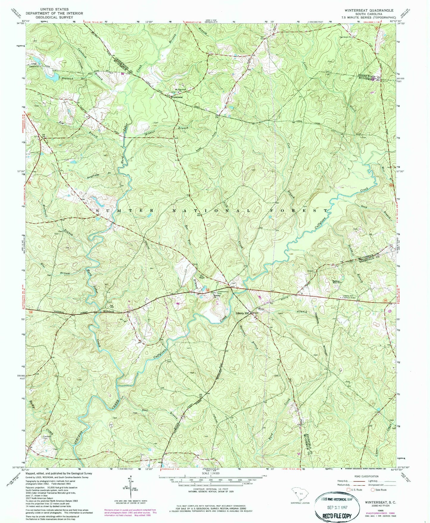
Classic USGS Winterseat South Carolina 7.5'x7.5' Topo Map
Couldn't load pickup availability
Historical USGS topographic quad map of Winterseat in the state of South Carolina. Map scale may vary for some years, but is generally around 1:24,000. Print size is approximately 24" x 27"
This quadrangle is in the following counties: Edgefield, Greenwood, McCormick.
The map contains contour lines, roads, rivers, towns, and lakes. Printed on high-quality waterproof paper with UV fade-resistant inks, and shipped rolled.
Contains the following named places: Bee Tree Branch, Bethany Cemetery, Bethany Church, Bethany School, Big Branch, Blue Branch, Blue Branch School, Bracknell Branch, Brissey Branch, Buncombe Branch, Calabash Branch, Canfield Cemetery, Cow Branch, Cuffytown Creek, Deal Branch, Doctors Branch, Dornville, Flat Rock School, Goatneck Branch, Hard Labor Creek, Hibbler Branch, Hibler School, Highway Holy Church, Hill Branch, Liberty Hill, Liberty Hill Lookout Tower, Lick Creek, Little Creek, Lyon School, McCormick Correctional Institution Infirmary, McCormick Division, Mill Branch, Mount Harmony Church, Oak Grove Church, Old Bethany Cemetery, Old Whitetown Church, Piney Grove School, Robinson Church, Robinson School, Rock Grove School, Rocky Creek, Sand Branch, Sand Hill School, Sandhill Branch, Shinburg Mill, South Carolina Noname 35008 D-0637 Dam, Tranquil Church, West Pond School, Whites Cross Roads, Winn Store, Winterseat, Zion Chapel, Zion Chapel School