MyTopo
Classic USGS Winterville Maine 7.5'x7.5' Topo Map
Regular price
$16.95
Regular price
Sale price
$16.95
Unit price
per
Couldn't load pickup availability
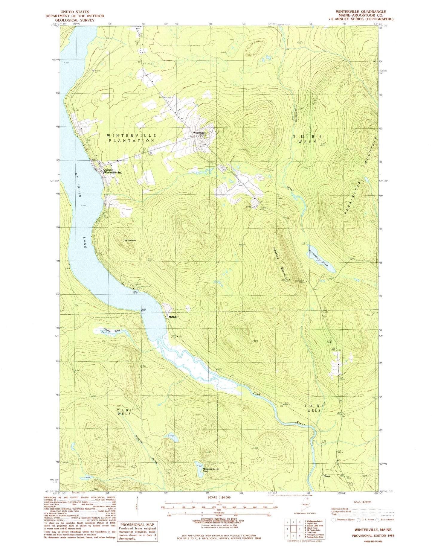
Historical USGS topographic quad map of Winterville in the state of Maine. Map scale may vary for some years, but is generally around 1:24,000. Print size is approximately 24" x 27"
This quadrangle is in the following counties: Aroostook.
The map contains contour lines, roads, rivers, towns, and lakes. Printed on high-quality waterproof paper with UV fade-resistant inks, and shipped rolled.
Contains the following named places: Hedgehog Mountain, McNally, Mosquito Brook Pond, Nadeau Pond, Nixon, Pennington Mountain, Pennington Pond, Quimby, Quimby Post Office, Saint Froid Lake, T14 R6 WELS, T15 R6 WELS, The Pinnacle, Togue Point, Winterville, Winterville Post Office, Winterville Station