MyTopo
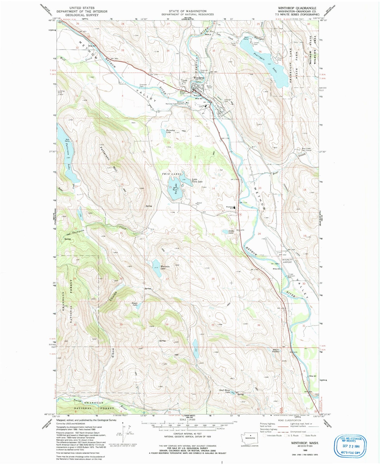
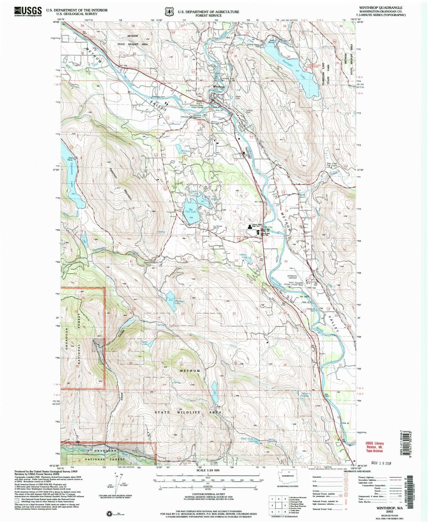
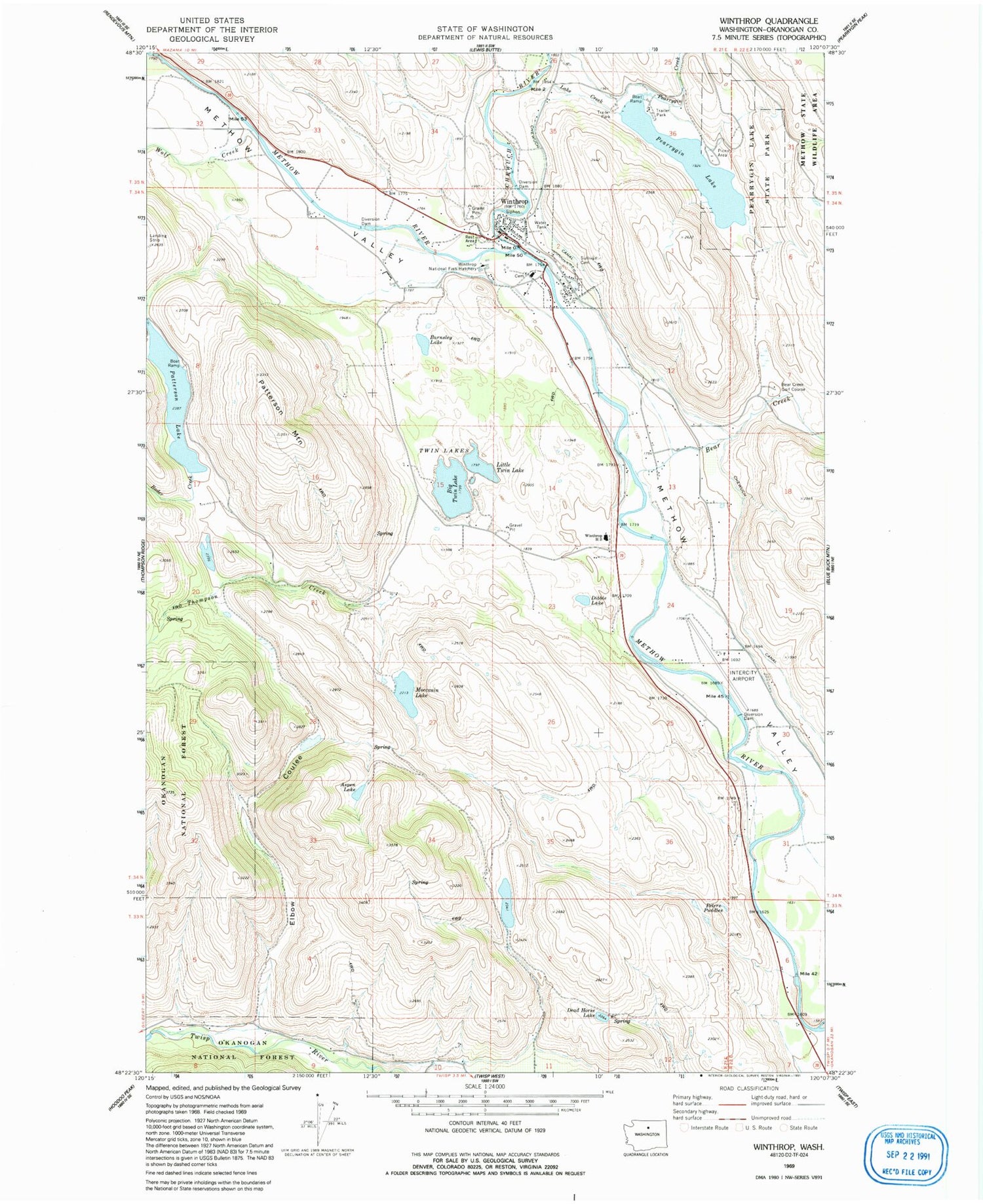
Classic USGS Winthrop Washington 7.5'x7.5' Topo Map
Couldn't load pickup availability
Historical USGS topographic quad map of Winthrop in the state of Washington. Map scale may vary for some years, but is generally around 1:24,000. Print size is approximately 24" x 27"
This quadrangle is in the following counties: Okanogan.
The map contains contour lines, roads, rivers, towns, and lakes. Printed on high-quality waterproof paper with UV fade-resistant inks, and shipped rolled.
Contains the following named places: Aero Methow Rescue Service, Aspen Lake, Barnsley Lake, Bear Creek, Bear Creek Golf Course, Big Twin Lake, Big Twin Lake Campground, Calvary Chapel Methow Valley, Chewuch Canal, Chewuch River, Dead Horse Lake, Dibble Lake, Elbow Coulee, Lake Creek, Liberty Bell Junior Senior High School, Little Twin Lake, Methow River Bridge, Methow Valley Elementary School, Methow Valley Intermediate School, Methow Valley State Airport, Methow Valley United Methodist Church, Moccasin Lake, Moccasin Lake Dam, North Cascades Smokejumper Base, Okanogan County Fire District 6 Winthrop Fire Department, Patterson Lake, Patterson Mountain, Pearrygin Creek, Pearrygin Lake, Pearrygin Lake State Park, Peters Puddles, Peters Reservoir Number One Dam, Peters Reservoir Number Two Dam, Rader Creek, Reward Sand and Gravel Quarry, Shafer Museum, Silverline Resort Recreational Vehicle Park, Sullivan Cemetery, Thompson Creek, Town of Winthrop, Twin Lakes, Twin Lakes Quarry, Winthrop, Winthrop Community Library, Winthrop High School, Winthrop National Fish Hatchery, Winthrop Police Department, Winthrop Post Office, Winthrop Sewage Treatment Plant, Wolf Creek