MyTopo
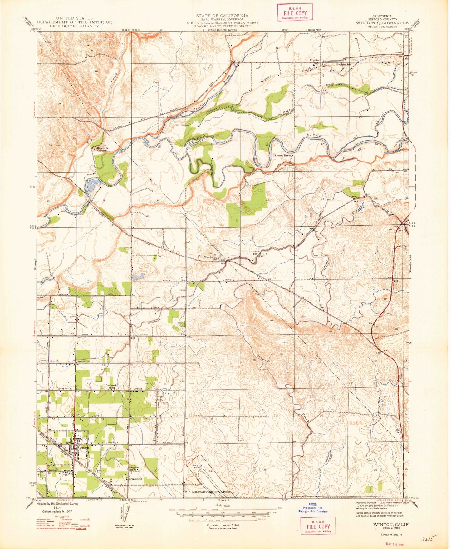
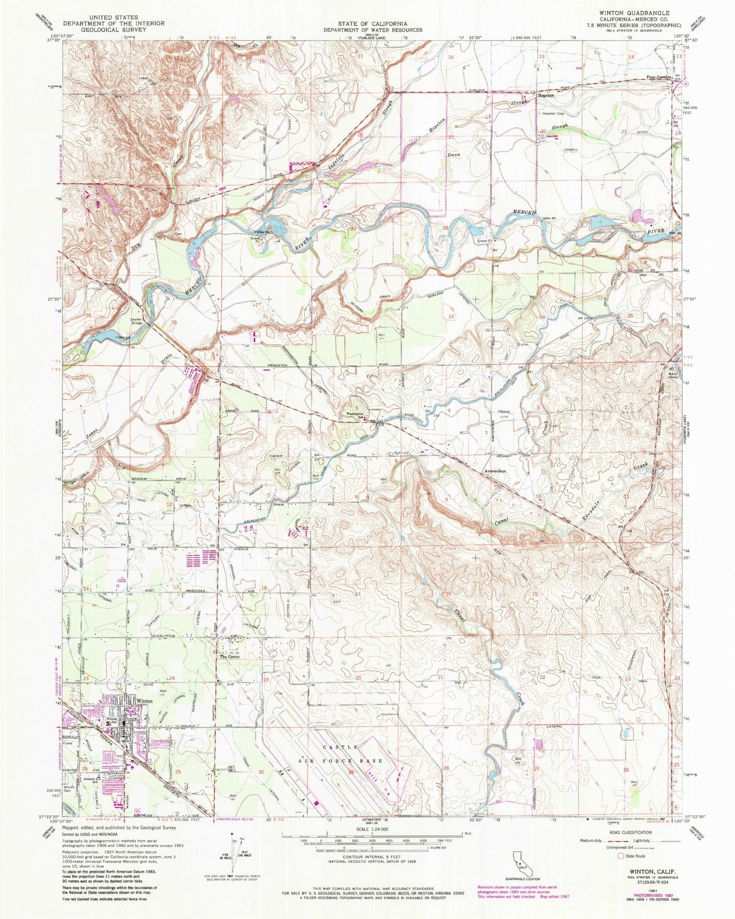
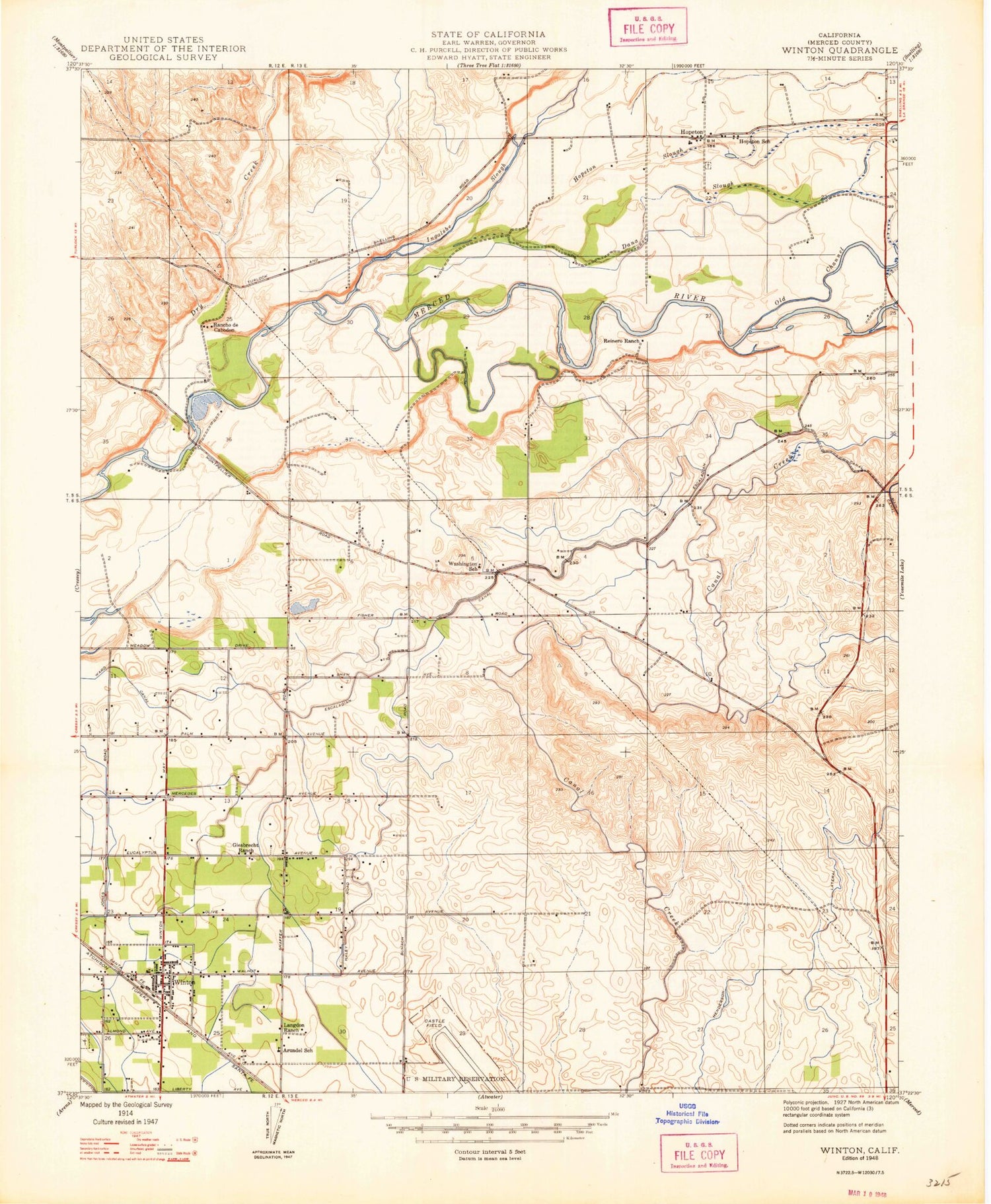
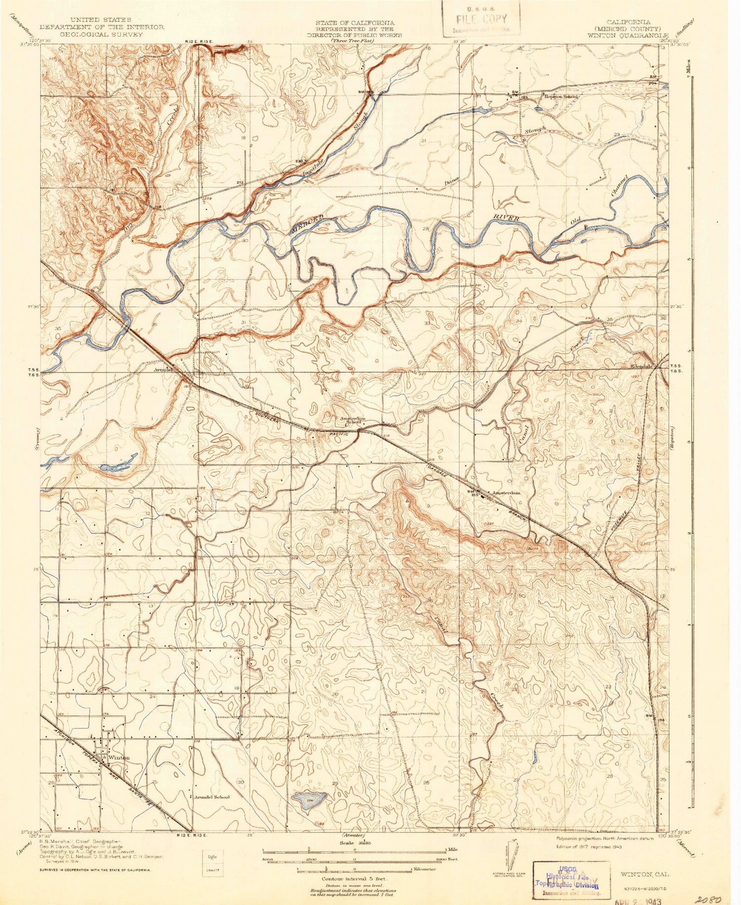
Classic USGS Winton California 7.5'x7.5' Topo Map
Couldn't load pickup availability
Historical USGS topographic quad map of Winton in the state of California. Map scale may vary for some years, but is generally around 1:24,000. Print size is approximately 24" x 27"
This quadrangle is in the following counties: Merced.
The map contains contour lines, roads, rivers, towns, and lakes. Printed on high-quality waterproof paper with UV fade-resistant inks, and shipped rolled.
Contains the following named places: Amsterdam, Arundel, Arundel Lateral, Arundel School, Atwater Division, Borland Lateral, Casad Lateral, Castle Air Force Base, Caton Lateral, Church of God in Christ, Cotton Lateral, Cowell Ditch, Crane Lateral, Cressey Lateral East, Dana Slough, Davis Lateral, Edendale, Edendale Creek, Escaladian Shaw Canal, First Southern Baptist Church of Winton, Fisher Lateral, Frank Sparkes Elementary School, Gertrude Lateral, Henderson Lateral, Hopeton, Hopeton Cemetery, Hopeton School, Hopeton Slough, Ingalsbe Slough, Little Ward Canal, Merced County Fire Department Winton Fire Station 63, Merced County Sheriff's Office Winton, Middle Lateral, Milk Made Dairy, P H Ranch, Pachaud Lateral, Pentecostal Church of God, Reinero Drain, Shaffer Bridge, Sherman Dairy, Sybil N Crookham Elementary School, The Grove, Town and Country Shopping Center, United States Penitentiary Atwater, Washington Elementary School, Washington Lateral, Winton, Winton Census Designated Place, Winton Community Park, Winton Lateral, Winton Middle School, Winton Post Office, ZIP Code: 95388