MyTopo
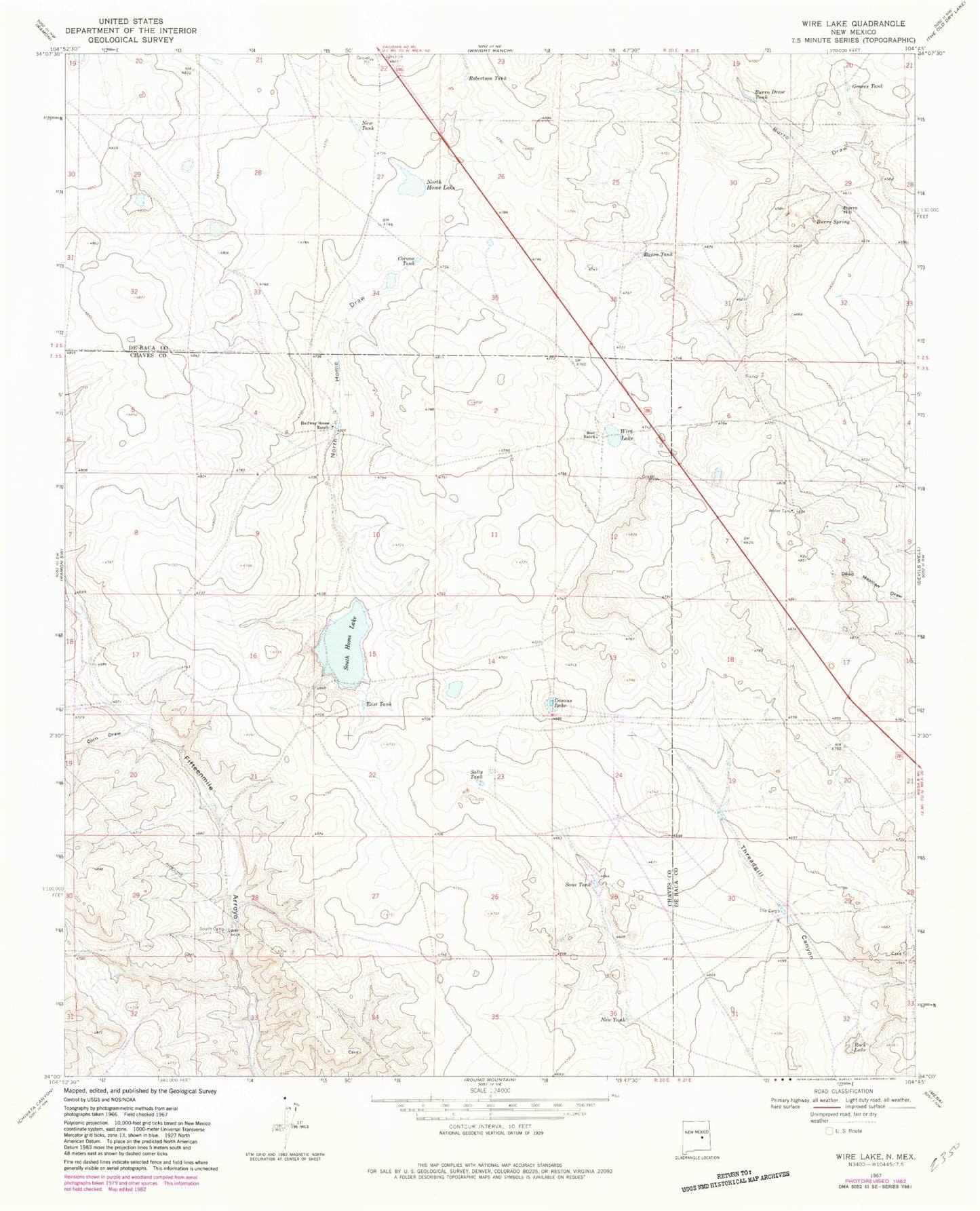
Classic USGS Wire Lake New Mexico 7.5'x7.5' Topo Map
Couldn't load pickup availability
Historical USGS topographic quad map of Wire Lake in the state of New Mexico. Map scale may vary for some years, but is generally around 1:24,000. Print size is approximately 24" x 27"
This quadrangle is in the following counties: Chaves, De Baca.
The map contains contour lines, roads, rivers, towns, and lakes. Printed on high-quality waterproof paper with UV fade-resistant inks, and shipped rolled.
Contains the following named places: Automobile Draw, Boot Ranch, Burro Draw Tank, Burro Hill, Burro Spring, Burro Tank, Casaus Lake, Corn Draw, Corona Tank, Dunlap, East Tank, Graces Tank, Halfway House Ranch, New Tank, North Home Draw, North Home Lake, Robertson Tank, Rock Lake, Sally Tank, Sons Tank, South Camp, South Home Lake, Wire Lake