MyTopo
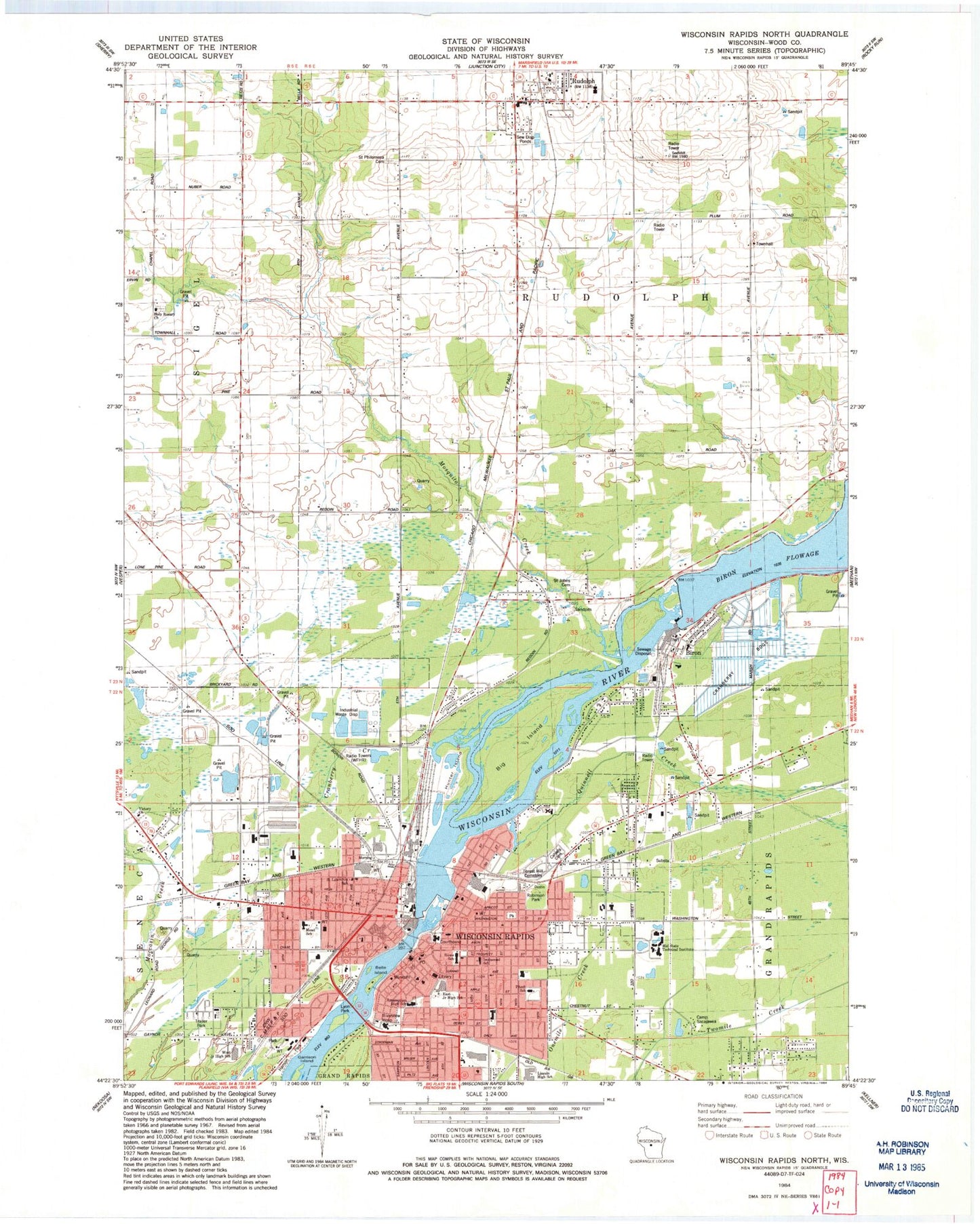
Classic USGS Wisconsin Rapids North Wisconsin 7.5'x7.5' Topo Map
Couldn't load pickup availability
Historical USGS topographic quad map of Wisconsin Rapids North in the state of Wisconsin. Map scale may vary for some years, but is generally around 1:24,000. Print size is approximately 24" x 27"
This quadrangle is in the following counties: Wood.
The map contains contour lines, roads, rivers, towns, and lakes. Printed on high-quality waterproof paper with UV fade-resistant inks, and shipped rolled.
Contains the following named places: Aspirus Riverview Hospital, Assumption High School, Assumption Middle School, Belle Island, Big Island, Biron, Biron 2WP71 Dam, Biron Volunteer Fire Department, Calvary Cemetery, Camp Sacajawea, Central Cities Health Institute, Christian Reformed Church, City of Wisconsin Rapids, Community Christian Academy, Cranberry Creek, Demitz Park, East Junior High School, First Baptist Church, First Church of Christ Scientist, First Congregational Church, First English Lutheran Church, First Moravian Church, Forest Hill Cemetery, Garrison Island, Gaynor Park, Hanson Park, Higgins Ambulance Service, Holy Rosary Catholic Church, Holy Rosary Cemetery, Howe Elementary School, Hunter Island, Immanuel Evangelical Lutheran Church, Immanuel Lutheran School, Irving School, Lincoln High School, Lone Birch School, Lowell Public School, Lyon Park, McMillian Memorial Library, Mead Elementary Charter School, Mead Field, Mid - State Technical College - Wisconsin Rapids Campus, Mosquito Creek, Our Lady Queen of Heaven Church, Our Lady Queen of Heaven Elementary School, Pentecostal Church of God, Pitsch Elementary School, Pleasant View School, Quinnell Creek, Rapids Mall Shopping Center, Rapids Municipal Zoo, Robinson Park, Rudolph, Rudolph Post Office, Rudolph Volunteer Fire Department Station 1, Saint Jacobs Church, Saint John the Evangelist Church, Saint Johns Cemetery, Saint Lawrence Early Childhood Center, Saint Lawrence Roman Catholic Church, Saint Pauls Evangelical Lutheran Church, Saint Paul's Lutheran School, Saint Philip Catholic Cemetery, Saint Philip Catholic School, Saint Philips Church, Saint Vincent de Paul School, Saints Peter and Paul Church, Saints Peter and Paul Grade School, Shopko Plaza Mall Shopping Center, South Wood County Historical Society Museum, Sunnyside School, THINK Academy, Town of Grand Rapids, Town of Rudolph, Victory Christian Outreach Center, Village of Biron, Village of Rudolph, Washington Elementary School, Wesleyan Methodist Church, WFHR-AM (Wisconsin Rapids), Wisconsin Rapids, Wisconsin Rapids 2WP44 Dam, Wisconsin Rapids Area Middle School, Wisconsin Rapids City Hall, Wisconsin Rapids Fire Department - Station 1, Wisconsin Rapids Fire Department - Station 2, Wisconsin Rapids Flowage 5391, Wisconsin Rapids Police Department, Wisconsin Rapids Post Office, Wisconsin Rapids Public Schools Four - Year- Old Kindergarten, Witter Field, Wood County Courthouse, Wood County Jail, Wood County Sheriff's Department, WWRW-FM (Wisconsin Rapids), ZIP Code: 54475


