MyTopo
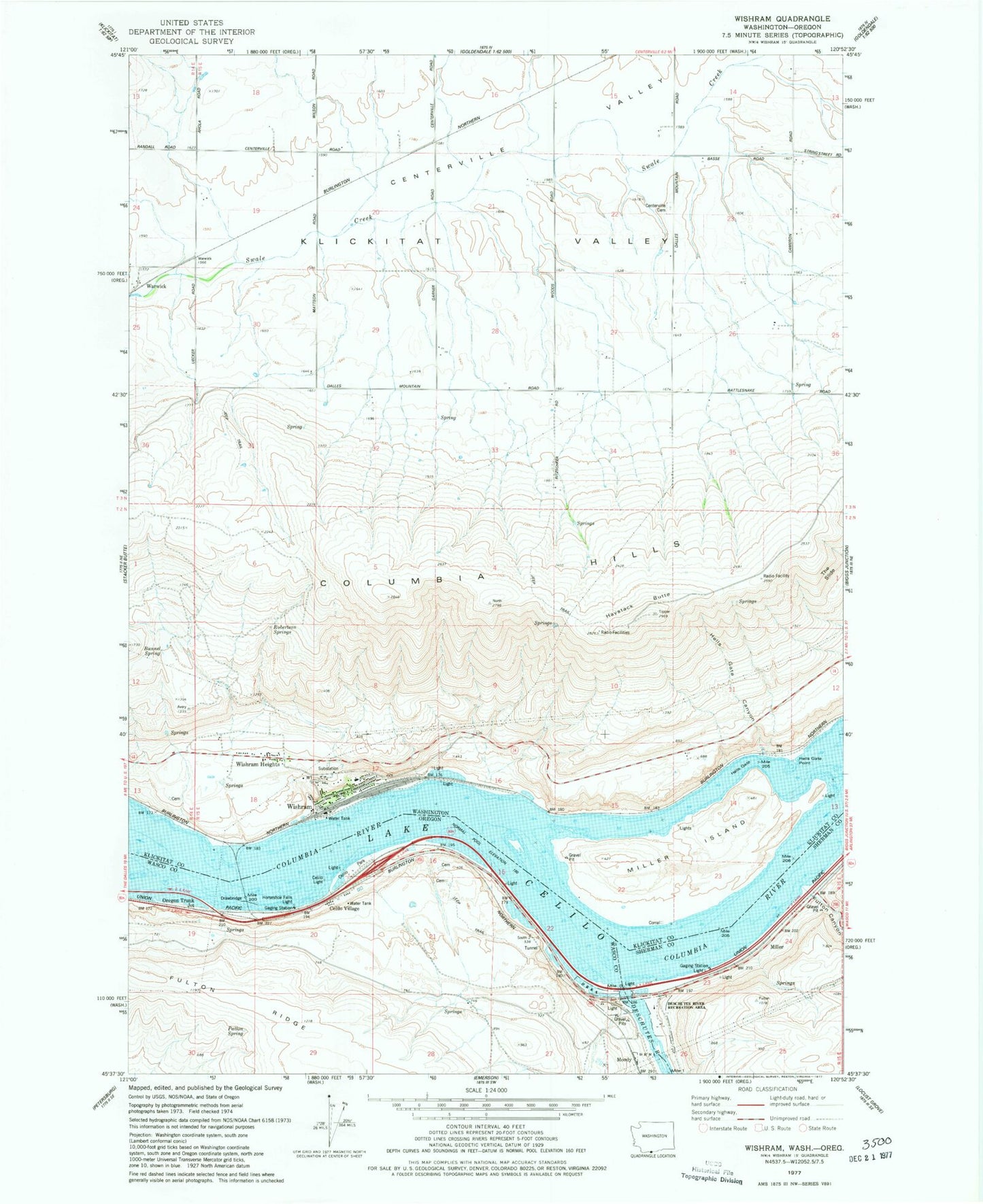
Classic USGS Wishram Washington 7.5'x7.5' Topo Map
Couldn't load pickup availability
Historical USGS topographic quad map of Wishram in the states of Washington, Oregon. Map scale may vary for some years, but is generally around 1:24,000. Print size is approximately 24" x 27"
This quadrangle is in the following counties: Klickitat, Sherman, Wasco.
The map contains contour lines, roads, rivers, towns, and lakes. Printed on high-quality waterproof paper with UV fade-resistant inks, and shipped rolled.
Contains the following named places: Ainsworth, Bunnel Spring, Carlisle Spring, Celilo Falls, Celilo Indian Cemetery, Celilo Light, Celilo Park, Celilo Park Boat Ramp, Celilo Post Office, Celilo Treaty Fishing Access Site, Celilo Village, Centerville Cemetery, Centerville Valley, Dechutes Post Office, Des Chutes, Deschutes Bridge Post Office, Deschutes River, Deschutes River Scenic Waterway, Deschutes River State Park, Dillon, Dillon Post Office, Fulton Canyon, Haystack Butte, Hells Gate, Hells Gate Canyon, Hells Gate Point, Hells Gate Range B, Hellsgate Range A, Heritage Landing, Horseshoe Falls Light, Klickitat County Fire District 11, Miller, Miller Island, Miller Post Office, Moody, Moody Island, Moody Post Office, Oregon Trunk Junction, Patton Spring, Robertson Springs, South Channel, South Channel Range A, South Channel Range B, South Channel Range C, The Slide, Tumwater, Warwick, Wild Hair Airport, Wishram, Wishram Census Designated Place, Wishram Heights, Wishram High and Elementary School, ZIP Code: 98613