MyTopo
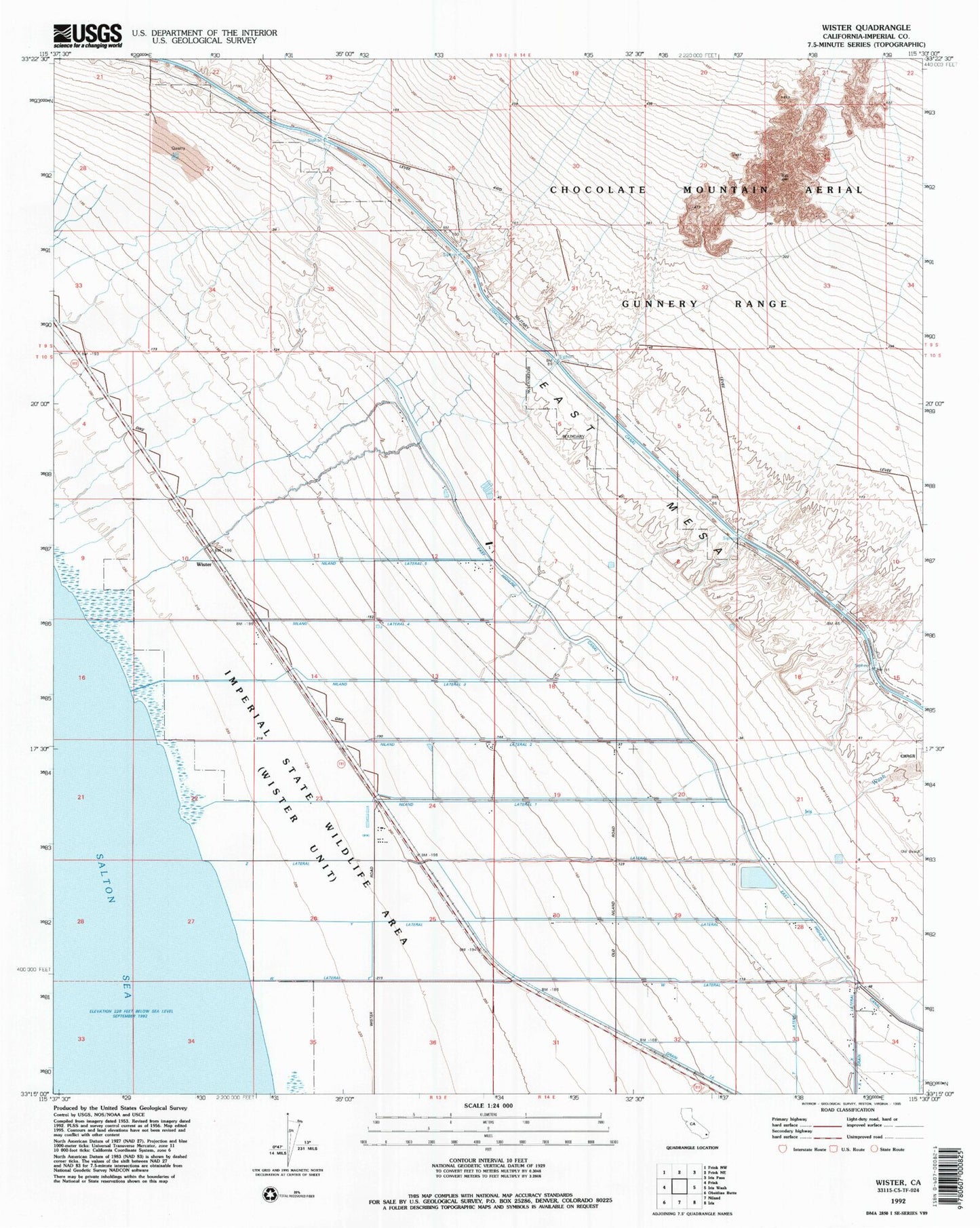
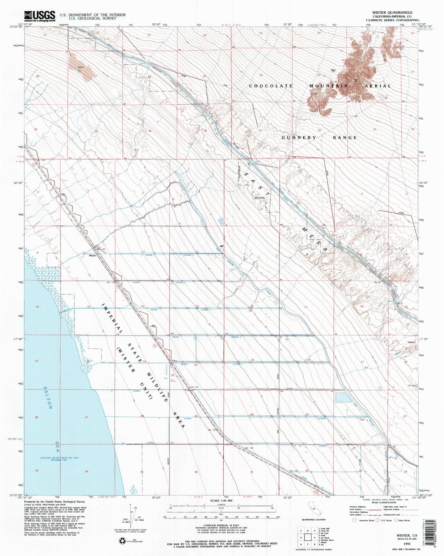
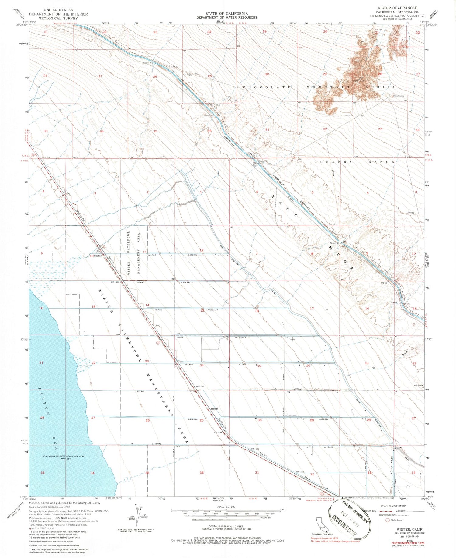
Classic USGS Wister California 7.5'x7.5' Topo Map
Couldn't load pickup availability
Historical USGS topographic quad map of Wister in the state of California. Map scale may vary for some years, but is generally around 1:24,000. Print size is approximately 24" x 27"
This quadrangle is in the following counties: Imperial.
The map contains contour lines, roads, rivers, towns, and lakes. Printed on high-quality waterproof paper with UV fade-resistant inks, and shipped rolled.
Contains the following named places: Coachella Canal, Drain 1-A, Greer Ranch, Iris Wash, Mundo, Niland Lateral Five, Niland Lateral Four, Niland Lateral One, Niland Lateral Three, Niland Lateral Two, Siphon Eleven, Siphon Fifteen, Siphon Fourteen, Siphon Thirteen, Siphon Twelve, W Lateral, Wister, Wister Waterfowl Management Area, Y Lateral, Z Lateral