MyTopo
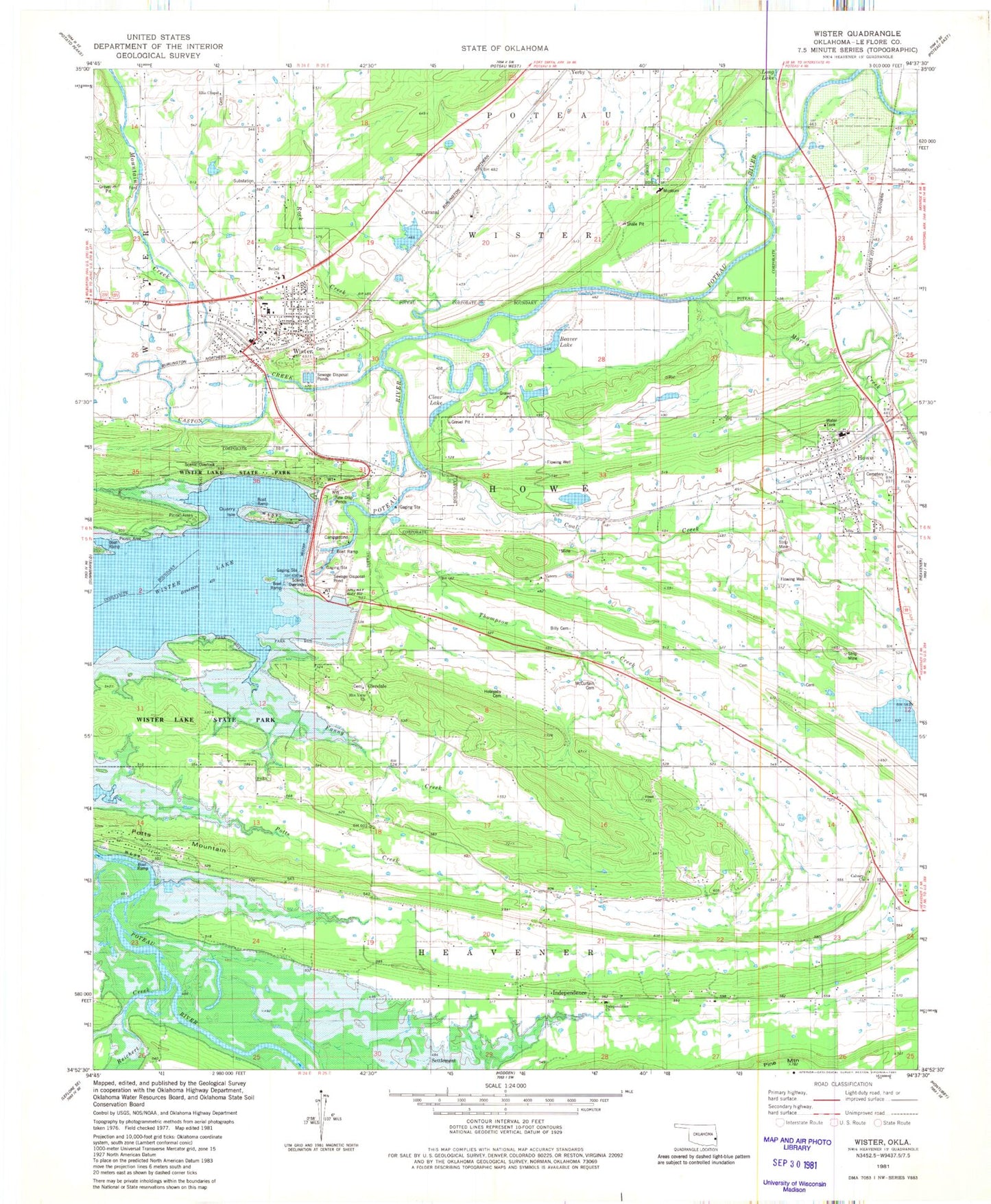
Classic USGS Wister Oklahoma 7.5'x7.5' Topo Map
Couldn't load pickup availability
Historical USGS topographic quad map of Wister in the state of Oklahoma. Map scale may vary for some years, but is generally around 1:24,000. Print size is approximately 24" x 27"
This quadrangle is in the following counties: Le Flore.
The map contains contour lines, roads, rivers, towns, and lakes. Printed on high-quality waterproof paper with UV fade-resistant inks, and shipped rolled.
Contains the following named places: Beaver Lake, Bethel Church, Calvary Church, Caston Creek, Cavanal, Cavanal Lake, Cavanal Lake Dam, Clear Lake, Coal Creek, Ellis Chapel, Ellis Chapel Cemetery, Faith Church, Fanny Creek, Gaither Lake, Gaither Lake Dam, Glendale, Hoteyaby Cemetery, Howe, Howe Cemetery, Howe Elementary School, Howe Fire Department, Howe High School, Howe Post Office, Independence, Independence Church, Le Flore County, McCurtain Cemetery, Morris Creek, Mount Pleasant Church, Mountain Creek, Mountain View Cemetery, Mountain View Church, Oknoname 079002 Dam, Oknoname 079002 Reservoir, Potts Creek, Potts Mountain, Quarry Isle, Reichert Creek, Rock Creek, Settlement, Shadwick Lake, Shadwick Lake Dam, Thompson Creek, Town of Howe, Town of Wister, Township of Howe, Victory Church, Wister, Wister Cemetery, Wister Dam, Wister Elementary School, Wister Fire Department, Wister High School, Wister Police Department, Wister Post Office, Wister State Park