MyTopo
Classic USGS Withlacoochee Bay Florida 7.5'x7.5' Topo Map
Couldn't load pickup availability
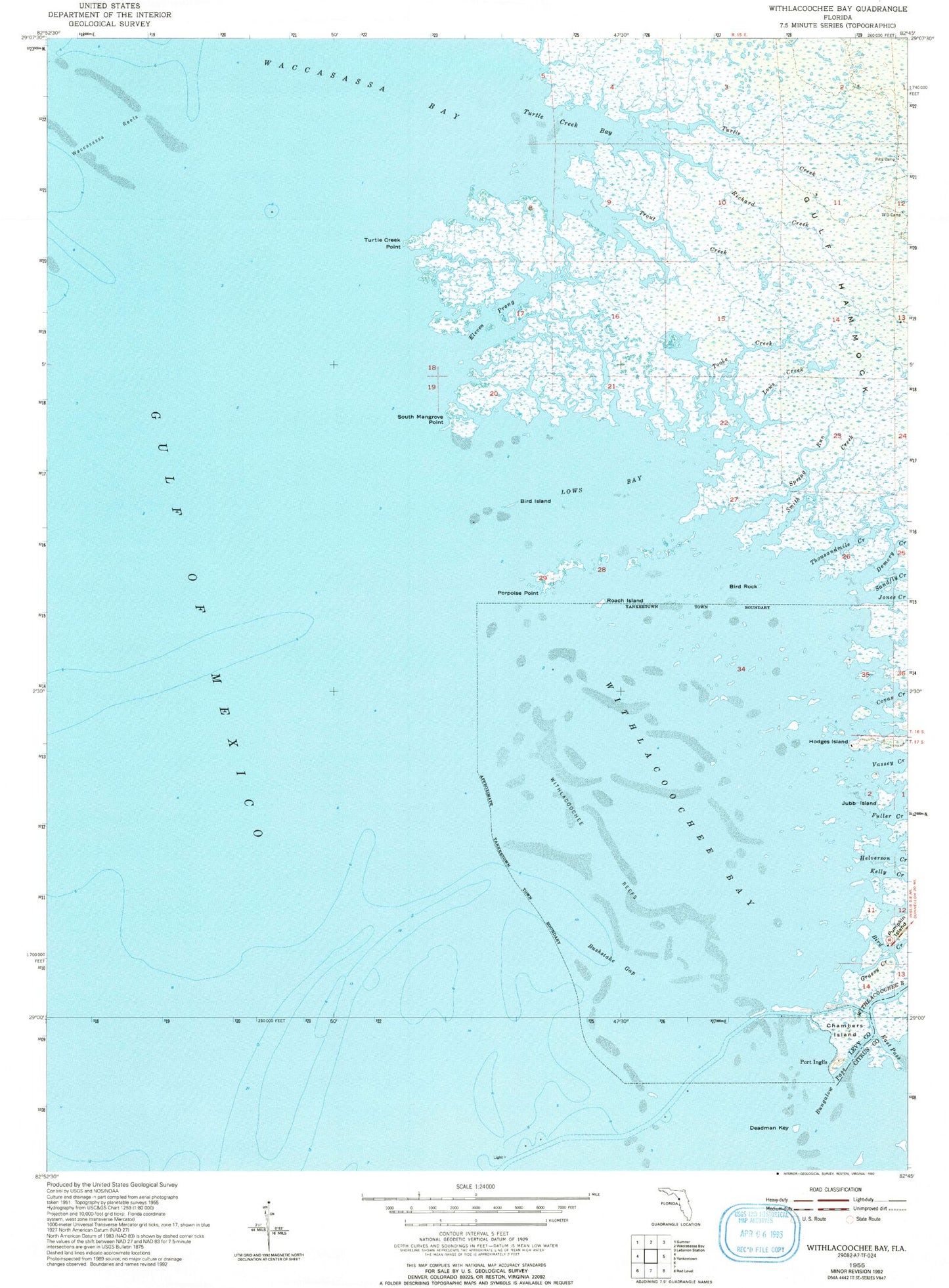
Historical USGS topographic quad map of Withlacoochee Bay in the state of Florida. Map scale may vary for some years, but is generally around 1:24,000. Print size is approximately 24" x 27"
This quadrangle is in the following counties: Citrus, Levy.
The map contains contour lines, roads, rivers, towns, and lakes. Printed on high-quality waterproof paper with UV fade-resistant inks, and shipped rolled.
Contains the following named places: Bird Creek, Bird Island, Bird Rock, Bushstake Gap, Covas Creek, Demory Creek, Eleven Prong, Fuller Creek, Grassy Creek, Helverson Creek, Hodges Island, Jones Creek, Jubb Island, Kelly Creek, Lows Bay, Lows Creek, MacDonald Creek, Pitts Camp, Porpoise Point, Pumpkin Island, Richard Creek, Roach Island, Smith Creek, South Mangrove Point, Spring Run, TFD Camp, Thousandmile Creek, Tooke Creek, Town of Yankeetown, Trout Creek, Turtle Creek, Turtle Creek Bay, Turtle Creek Point, Vassey Creek, Waccasassa Reefs, Withlacoochee Bay, Withlacoochee Reefs