
MyTopo
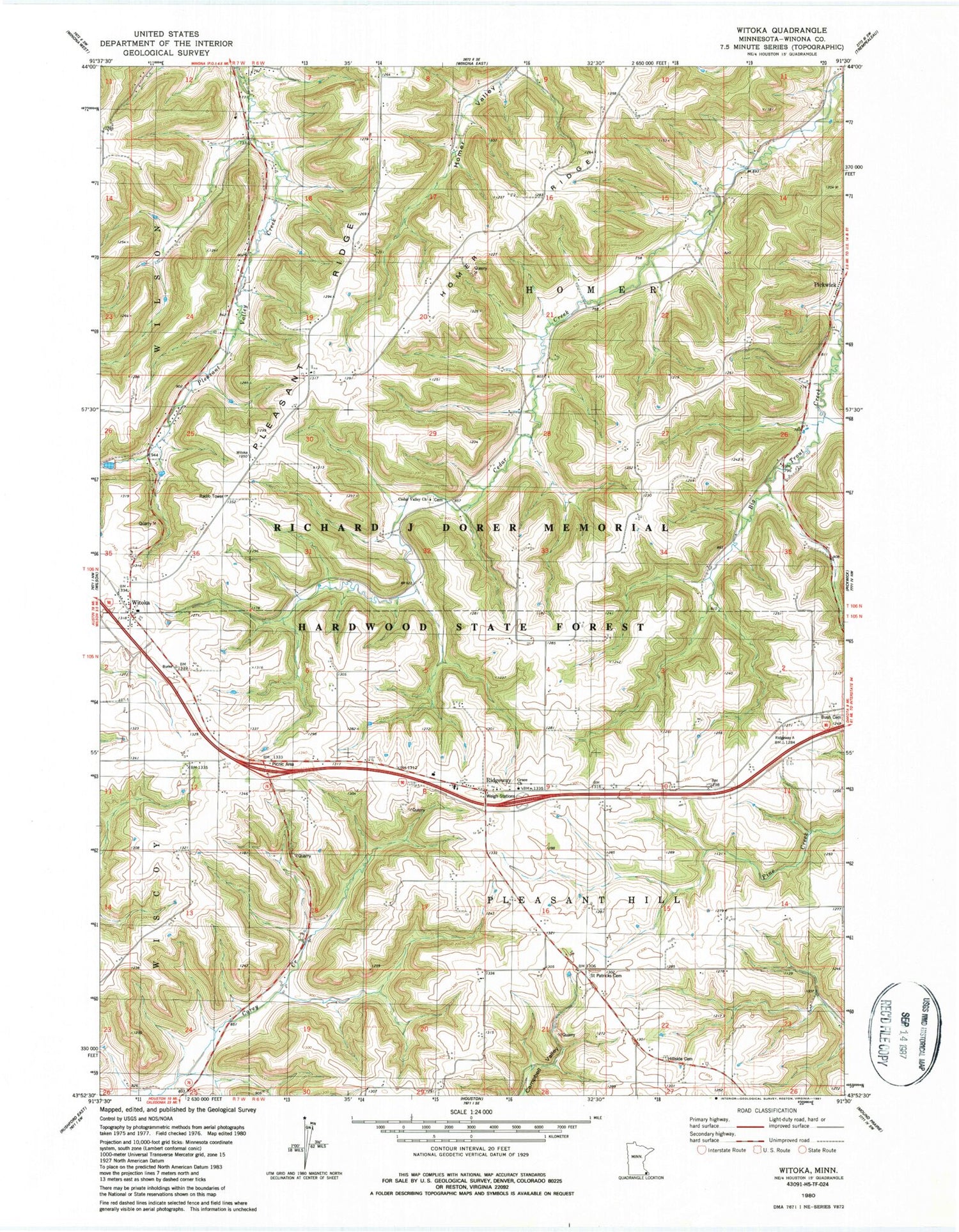
Classic USGS Witoka Minnesota 7.5'x7.5' Topo Map
Couldn't load pickup availability
Historical USGS topographic quad map of Witoka in the state of Minnesota. Map scale may vary for some years, but is generally around 1:24,000. Print size is approximately 24" x 27"
This quadrangle is in the following counties: Winona.
The map contains contour lines, roads, rivers, towns, and lakes. Printed on high-quality waterproof paper with UV fade-resistant inks, and shipped rolled.
Contains the following named places: Bush Cemetery, Cedar Valley Cemetery, Cedar Valley Lutheran Church, Grace Church, Hillside Cemetery, Homer Ridge, Hundorf Dam, Judy Dam, Loyal Hoseck Detention Structure Number 1 Dam, Loyal Hoseck Detention Structure Number 2 Dam, Pleasant Ridge, Pleasant Valley Site Number 10 Dam, Pleasant Valley Site Number 3 Dam, Pleasant Valley Site Number 6 Dam, Pleasant Valley Site Number 7 Dam, Pleasant Valley Site Number 8 Dam, Ridgeway, Ridgeway Post Office, Ridgeway Volunteer Fire Department, Saint Patricks Cemetery, Township of Homer, Township of Pleasant Hill, Witoka, Witoka Post Office


