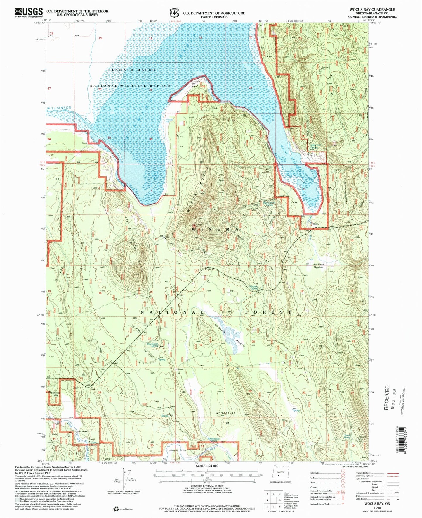
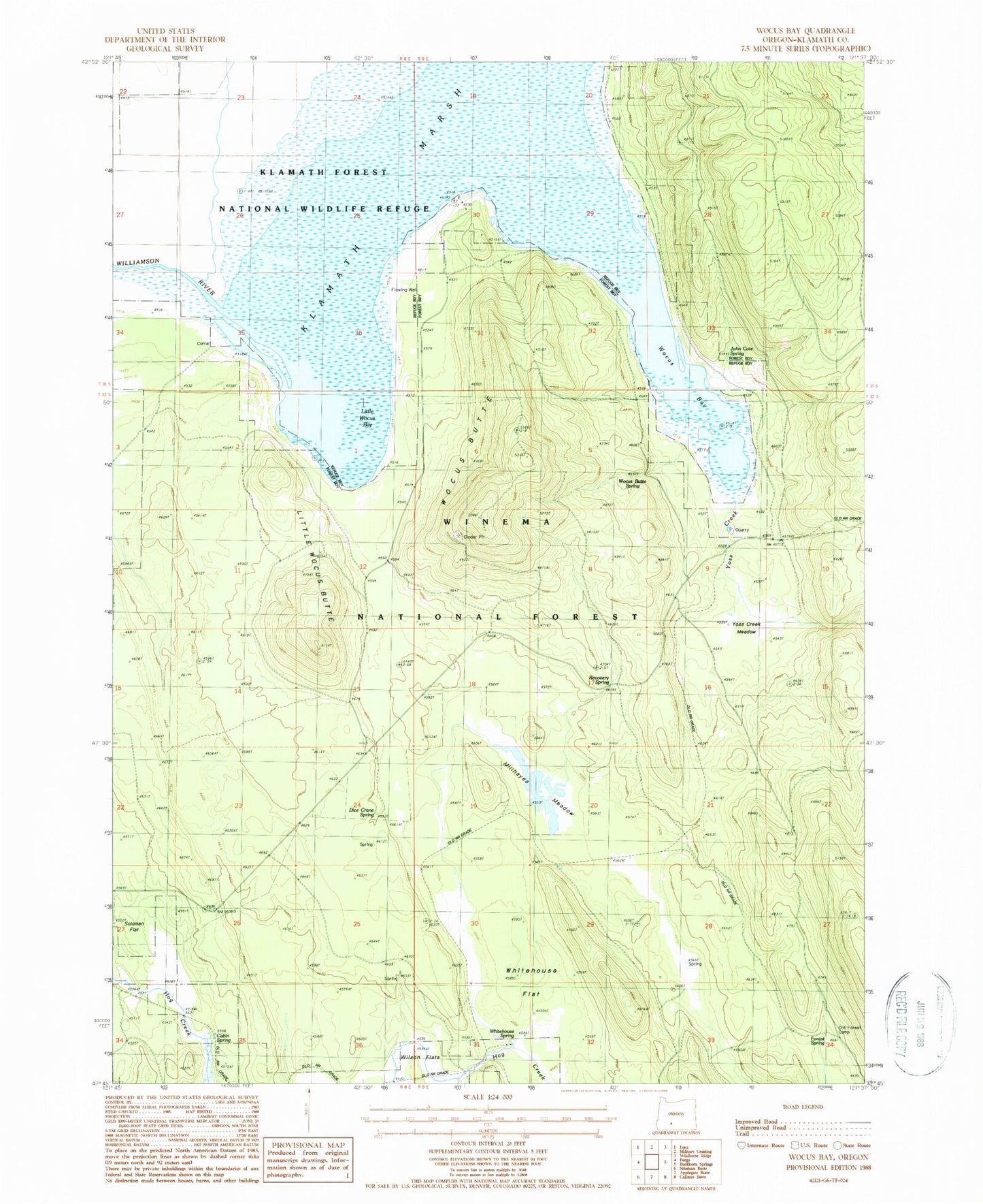
MyTopo
Classic USGS Wocus Bay Oregon 7.5'x7.5' Topo Map
Couldn't load pickup availability
Historical USGS topographic quad map of Wocus Bay in the state of Oregon. Map scale may vary for some years, but is generally around 1:24,000. Print size is approximately 24" x 27"
This quadrangle is in the following counties: Klamath.
The map contains contour lines, roads, rivers, towns, and lakes. Printed on high-quality waterproof paper with UV fade-resistant inks, and shipped rolled.
Contains the following named places: Cabin Spring, Dice Crane Spring, Forest Spring, John Cole Spring, Little Wocus Bay, Little Wocus Butte, Lucky Reservoir, Millhayes Meadow, Old Forest Camp, Recovery Spring, Whitehouse Flat, Whitehouse Spring, Winema National Forest, Wocus Bay, Wocus Bay Guard Station, Wocus Butte, Wocus Butte Spring, Yoss Creek, Yoss Creek Meadow