MyTopo
Classic USGS Wocus Oregon 7.5'x7.5' Topo Map
Couldn't load pickup availability
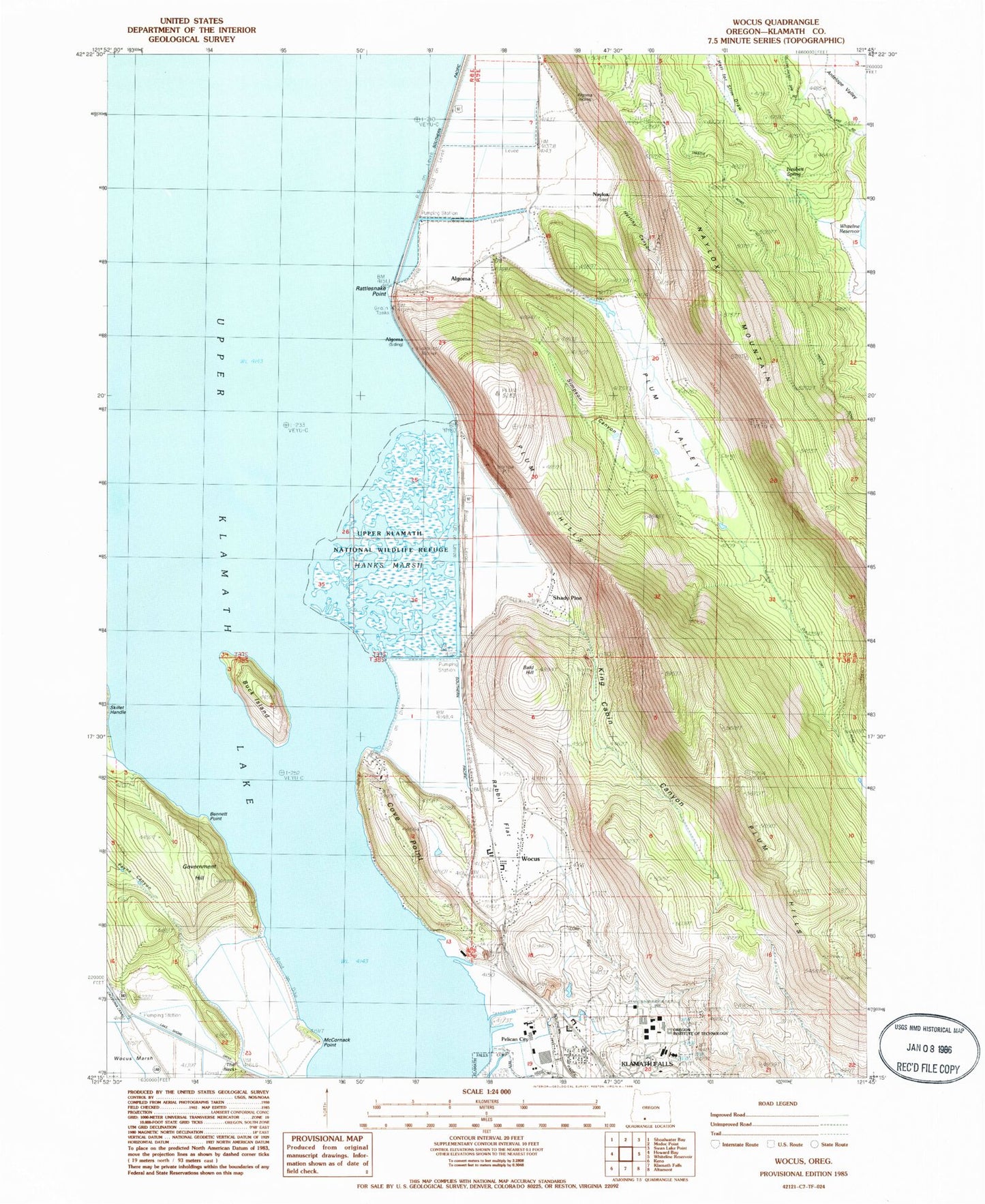
Historical USGS topographic quad map of Wocus in the state of Oregon. Map scale may vary for some years, but is generally around 1:24,000. Print size is approximately 24" x 27"
This quadrangle is in the following counties: Klamath.
The map contains contour lines, roads, rivers, towns, and lakes. Printed on high-quality waterproof paper with UV fade-resistant inks, and shipped rolled.
Contains the following named places: Algoma, Algoma Incline, Algoma Post Office, Algoma Siding, Bald Hill, Bennett Point, Buck Island, Cove Point, Government Hill, Hanks Marsh, Herlihy Canyon, Hummingbird Spring, John F Moehl Stadium, King Cabin Canyon, Klamath County Fire District 1 Station 5, Klamath Ranger District, KOTI-TV, McCornack Point, Merle West Medical Center Helipad, Naylox, Naylox Mountain, Naylox Post Office, Neubert Spring, Oregon Institute of Technology, Pelican, Pelican City, Plum Hills, Plum Valley, Rabbit Flat, Rattlesnake Point, Running Y Ranch Census Designated Place, Shady Pine, Shaw Historical Library, Simpson Canyon, Sky Lakes Medical Center, Sky Lakes Medical Center Heliport, Terminal City, The Neck, Whiteline Spring, Wocus