MyTopo
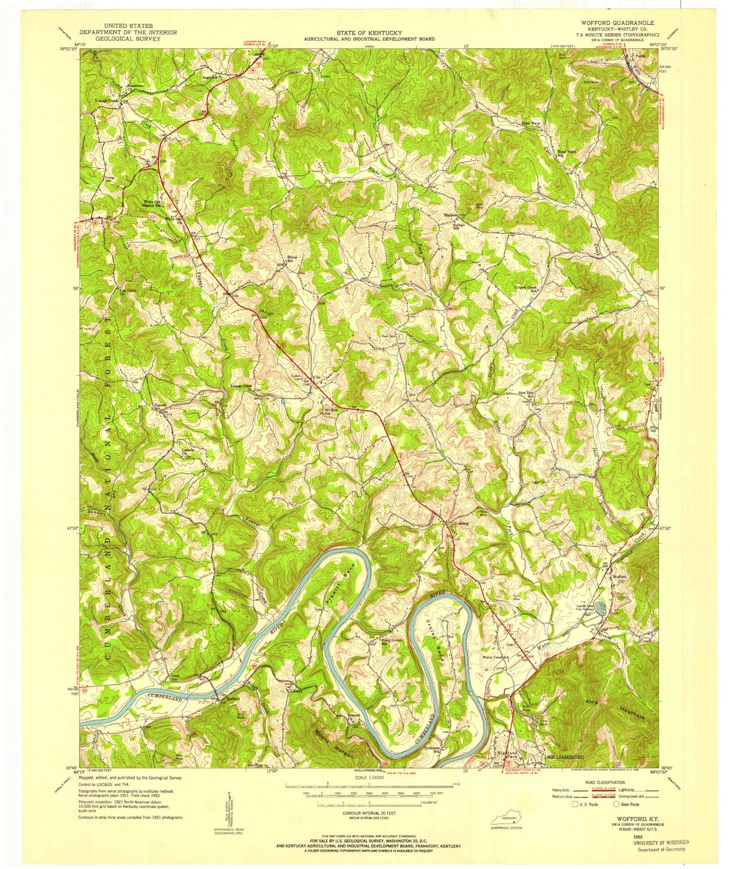
Classic USGS Wofford Kentucky 7.5'x7.5' Topo Map
Couldn't load pickup availability
Historical USGS topographic quad map of Wofford in the state of Kentucky. Map scale may vary for some years, but is generally around 1:24,000. Print size is approximately 24" x 27"
This quadrangle is in the following counties: Whitley.
The map contains contour lines, roads, rivers, towns, and lakes. Printed on high-quality waterproof paper with UV fade-resistant inks, and shipped rolled.
Contains the following named places: Blake Fork, Browns Creek, Canada Town Holiness Church, Carr Airport, Clio, Coalmont Railroad Station, Cripple Creek, Croley Bend, Doctor Thomas Walker Historical Marker, Faber, Faber Railroad Station, Freewill Church, Gatiffi State Fish Hatchery, Goldbug, Idiot Branch, King Mountain, Liberty, Log Cabin Church, Middle Fork Sanders Creek, New Mount Zion Church, New Zion Church, Piney Grove Church, Pocono Railroad Station, Prewitt Bend, Redbird, Rough Shoals Creek, Ryan Cemetery, Sanders Creek, Shiner Church, Steely Cemetery, Sutton Cemetery, Three Point Fire and Rescue Department, Tidal Wave Church, Tuggle Cemetery, Walden, Watts Creek, Watts Creek Railroad Station, WEKC-AM (Williamsburg), White Oak Church, Whitley County, Whitley County Emergency Medical Services, Whitley County High School, Whitley Memorial Gardens, Williamsburg Post Office, Williamsburg-Whitley County Airport, Wofford, Wofford Railroad Station, Youngs Cemetery, Youngs Creek, Youngs Creek Church