MyTopo
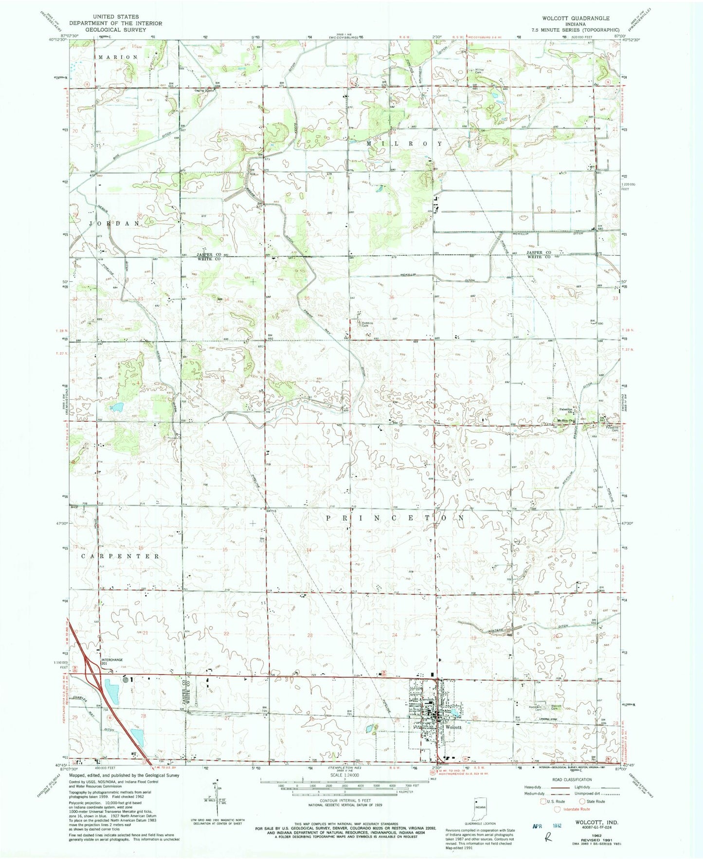
Classic USGS Wolcott Indiana 7.5'x7.5' Topo Map
Couldn't load pickup availability
Historical USGS topographic quad map of Wolcott in the state of Indiana. Map scale may vary for some years, but is generally around 1:24,000. Print size is approximately 24" x 27"
This quadrangle is in the following counties: Jasper, White.
The map contains contour lines, roads, rivers, towns, and lakes. Printed on high-quality waterproof paper with UV fade-resistant inks, and shipped rolled.
Contains the following named places: Culp Farms Airport, Dobbins Cemetery, Frank May Ditch, James Airport, Keefe Ditch, McKillip Branch Ditch, Milroy Cemetery, Mount Zion Church, Nesius Ditch, Palestine Cemetery, Palestine Church, Town of Wolcott, Township of Milroy, Township of Princeton, Wolcott, Wolcott Cemetery, Wolcott Community Airport, Wolcott Police Department, Wolcott Post Office, Wolcott Volunteer Ambulance Service, Wolcott Volunteer Fire Department, ZIP Code: 47995