MyTopo
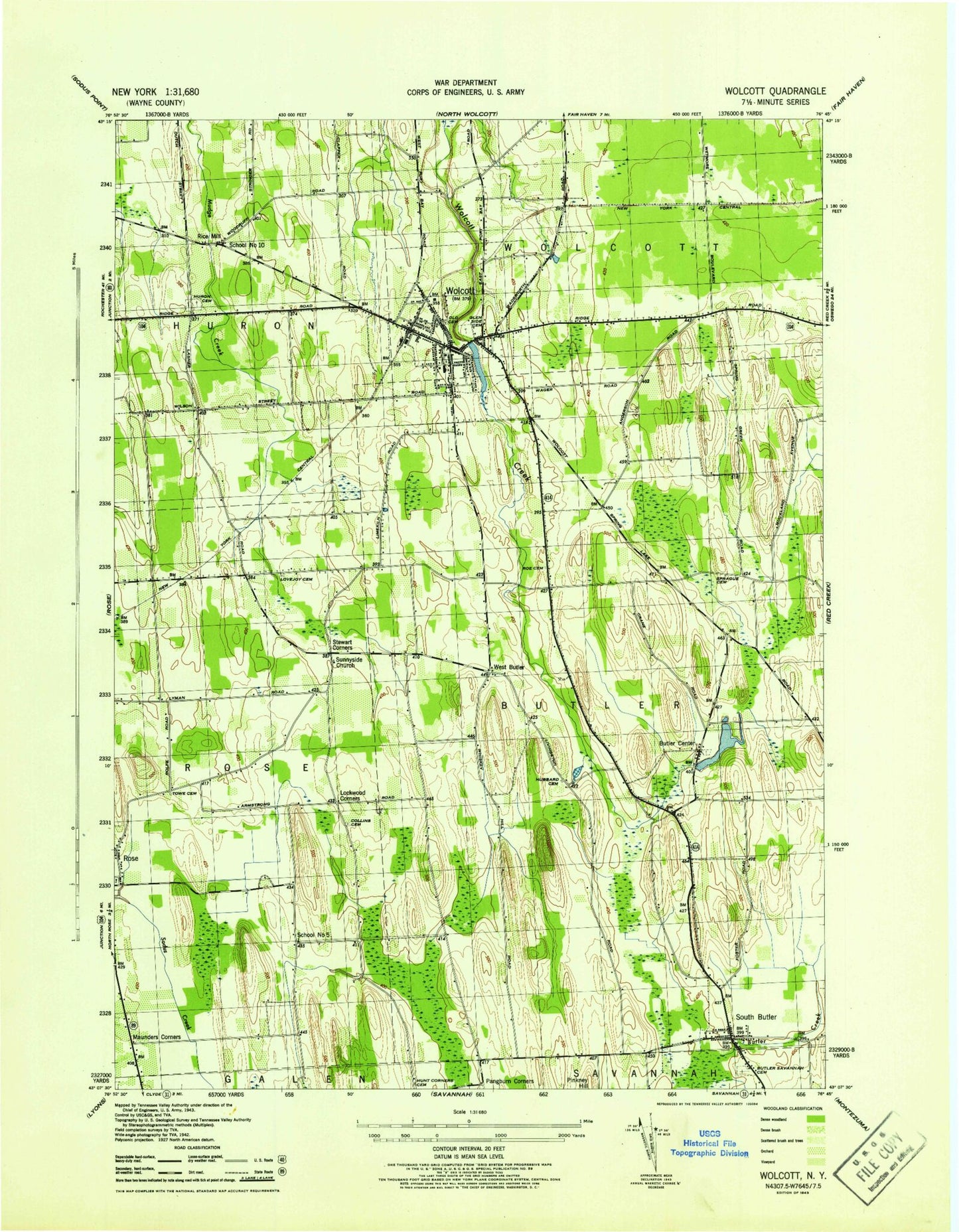
Classic USGS Wolcott New York 7.5'x7.5' Topo Map
Couldn't load pickup availability
Historical USGS topographic quad map of Wolcott in the state of New York. Map scale may vary for some years, but is generally around 1:24,000. Print size is approximately 24" x 27"
This quadrangle is in the following counties: Wayne.
The map contains contour lines, roads, rivers, towns, and lakes. Printed on high-quality waterproof paper with UV fade-resistant inks, and shipped rolled.
Contains the following named places: Batz Tree Farm, Blessed Trinity Church, Butler - Savannah Cemetery, Butler Center, Butler Center Cemetery, Butler United Methodist Church, Cherry Grove Campground, Collins Cemetery, Ellinwood Cemetery, First Baptist Church, First Methodist Episcopal Church, First United Methodist Church, Florentine Hendrick Elementary School, Furnace Village, Glenside Cemetery, Hickory Square, Hill Top Airpark, Hubbard Cemetery, Hunt Corners Cemetery, Huron Evergreen Cemetery, Kingdom Hall of Jehovah's Witnesses, Lakeshore Volunteer Ambulance, Leavenworth Central School, Leavenworth Middle School, Lockwood Corners, Lovejoy Cemetery, Maunders Corners, Millpond, New York State Police Troop E Zone 2 Wolcott Station, North Rose - Wolcott High School, Palace Theatre, Pangburn Corners, Pinkney Hill, Rice Mill, Roe Cemetery, Saint Mary Magdeline Roman Catholic Church, Saint Stephen's Episcopal Church, School Number 10, School Number 5, South Butler, South Butler Fire District, South Butler Post Office, Spirit and Truth Calvary Chapel, Sprague Cemetery, Stewart Corners, Sunnyside Community Church, Sunnyside Mission, Town of Butler, Village of Wolcott, West Butler, Wolcott, Wolcott Civic Free Library, Wolcott Hospital, Wolcott Police Department, Wolcott Post Office, Wolcott Presbyterian Church, Wolcott Village Hall, Wolcott Volunteer Fire Department, ZIP Codes: 14542, 14590


