MyTopo
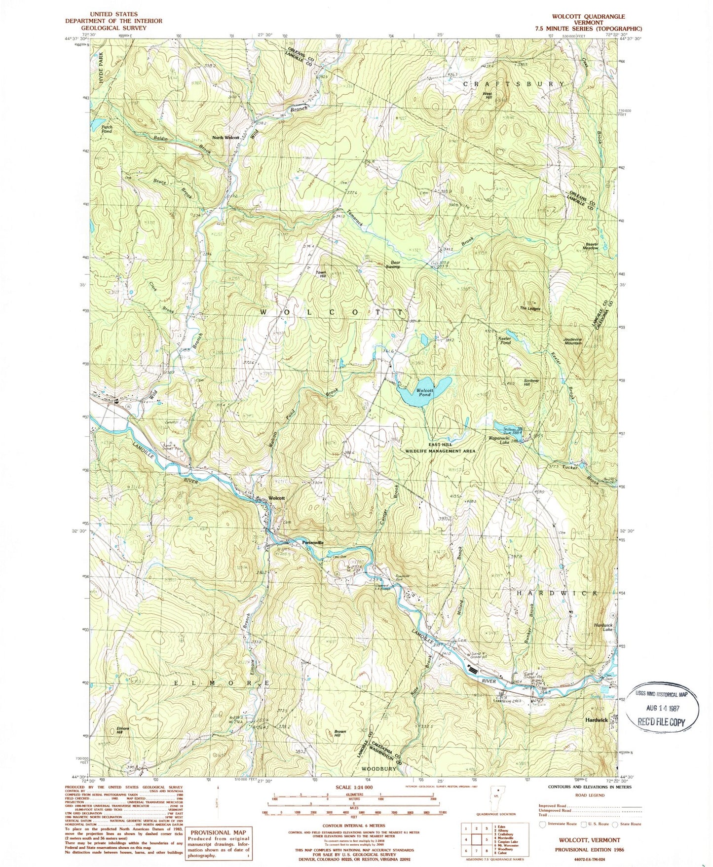
Classic USGS Wolcott Vermont 7.5'x7.5' Topo Map
Couldn't load pickup availability
Historical USGS topographic quad map of Wolcott in the state of Vermont. Typical map scale is 1:24,000, but may vary for certain years, if available. Print size: 24" x 27"
This quadrangle is in the following counties: Caledonia, Lamoille, Orleans, Washington.
The map contains contour lines, roads, rivers, towns, and lakes. Printed on high-quality waterproof paper with UV fade-resistant inks, and shipped rolled.
Contains the following named places: Baldin Brook, Bear Swamp, Beaver Meadow, Brown Hill, Bruce Brook, Bunker Brook, Clark Brook, Currier Brook, Elmore Branch, Elmore Hill, Hampshire School, Jackson Bridge, Jackson School, Jeudevine Mountain, Kate Brook, Keeler Brook, Keeler Pond, Millard Brook, North Wolcott, Perch Pond, Pleasant Valley School, Pottersville, Riverside School, Scribner Hill, Tamarack Brook, The Ledges, Town Hill, Town Hill School, Wapanacki Lake, West Hill, Wild Branch, Wolcott, Wolcott Pond, Wolcott Pond Brook, Taylor Airport, Town of Wolcott, Wolcott Dam, Lamoille River Reservoir, Wolcott Pond Dam, Hardwick Lake Dam, Camp Wapanacki, Church of the Nazarene, Davenport Cemetery, East Hill Wildlife Management Area, Fairmont Lower Cemetery, Fairmont Upper Cemetery, Fisher Covered Railroad Bridge, Hubbell Cemetery, Pierce Cemetery, Taylor Cemetery, West Hill Cemetery, Wolcott Elementary School, Wolcott Mennonite Church, Wolcott Post Office, Jacob Paine Cemetery, Wolcott Fire Department, Green Mountain Waldorf School, Center for Northern Studies, Wolcott Census Designated Place