MyTopo
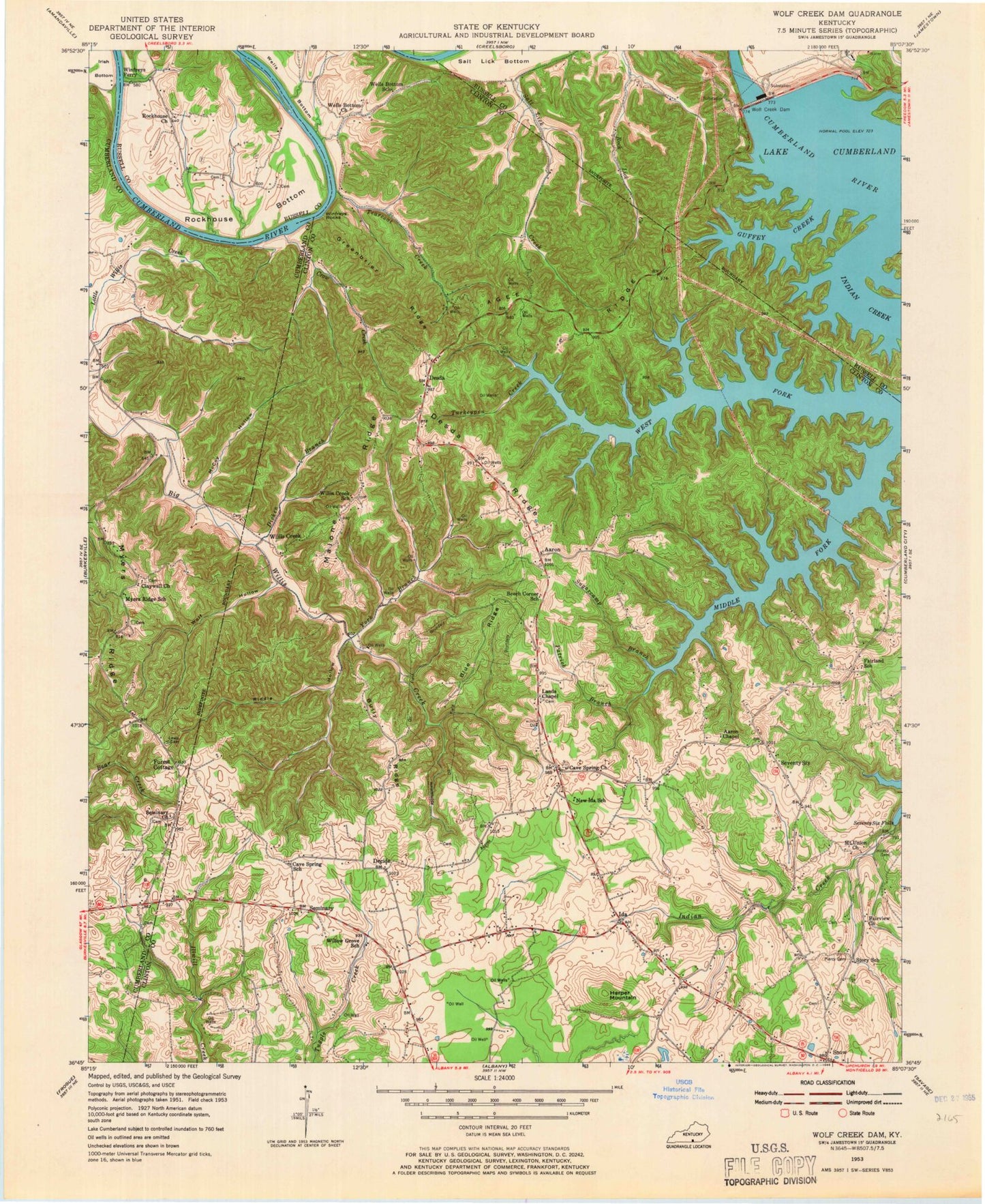
Classic USGS Wolf Creek Dam Kentucky 7.5'x7.5' Topo Map
Couldn't load pickup availability
Historical USGS topographic quad map of Wolf Creek Dam in the state of Kentucky. Typical map scale is 1:24,000, but may vary for certain years, if available. Print size: 24" x 27"
This quadrangle is in the following counties: Clinton, Cumberland, Russell.
The map contains contour lines, roads, rivers, towns, and lakes. Printed on high-quality waterproof paper with UV fade-resistant inks, and shipped rolled.
Contains the following named places: Aaron Chapel, Agee Ridge, Blue Ridge, Bully Ridge, Cave Spring Church, Crow Creek, Desda Ridge, Dicken Branch, Fairland School, Fairview Church, Forest Cottage, Greenbrier Ridge, Guffey Creek, Harper Mountain, Hilltop Cemetery, Lands Chapel, Lester Creek, Lewis Cemetery, Malone Ridge, McCoy Hollow, Mount Union Church, Myers Ridge, Claywill Church, Patrick Branch, Piercy Cemetery, Riddle Hollow, Rockhouse Bottom, Rockhouse Church, Seminary, Seventy Six Falls, Sugarcamp Branch, Tearcoat Creek, Turkeypen Creek, Winfreys Ferry, Winfreys Rocks, Wolf Creek Dam, Wolf Hollow, York Branch, Aaron, Decide, Desda, Ida, Seventy Six, Snow, Willis Creek, Cumberland City Division, Ariadne Post Office (historical), Simpsons Branch, Sprowls School (historical), Story School (historical), Tearcoat Post Office (historical), Warinners Gas Well (historical), Waterview (historical), Waterview School (historical), Wells Bottom School (historical), Willis Creek Post Office (historical), Willis Creek School (historical), Willow Grove School (historical), Withams Store (historical), Coops Mill (historical), Decide Post Office (historical), Fairland Church (historical), Goodson Post Office (historical), Hammonds Mill (historical), Indian Creek Church (historical), New Ida School (historical), Seminary Post Office (historical), Seventy Six Post Office (historical), West Fork, Aaron Post Office (historical), Beech Corner School (historical), Cave Spring School (historical), Desda Post Office (historical), Holsapple Gas Well (historical), Ida Post Office (historical), Ida School (historical), Lawsons Mill (historical), Mackeys Mill (historical), Willow Grove (historical), Wolf Creek National Fish Hatchery, Reeder Family Cemetery