MyTopo
Classic USGS Wolf Island Missouri 7.5'x7.5' Topo Map
Couldn't load pickup availability
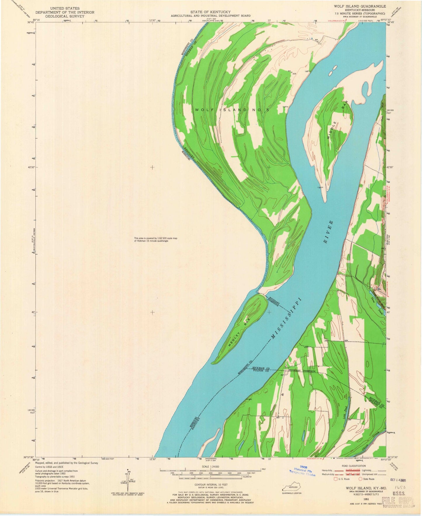
Historical USGS topographic quad map of Wolf Island in the states of Missouri, Kentucky. Map scale may vary for some years, but is generally around 1:24,000. Print size is approximately 24" x 27"
This quadrangle is in the following counties: Fulton, Hickman, Mississippi.
The map contains contour lines, roads, rivers, towns, and lakes. Printed on high-quality waterproof paper with UV fade-resistant inks, and shipped rolled.
Contains the following named places: Barnes Cemetery, Beckwith Bend, Chalk Bluff, Grey School, Ivie Cemetery, Lateral Number 7, Lee Cemetery, Little Eagle Pond, Long Pond, Macedonia Church, Medley Bar, Medley Landing, Medley School, Middle Bar, Moore Island, Mount Zion Church, Muscovalley Landing, Muscovalley Post Light, Pinhook School, Samuels Landing, Sassafras Ridge Church, Sassafras Ridge School, Three Ponds, Three Ponds Bluff, Towosahgy State Park, Walnut Grove, Williams Landing, Wolf Island, Wolf Island Cemetery, Wolf Island Church, Wolf Island Number 5, Wolf Island School