MyTopo
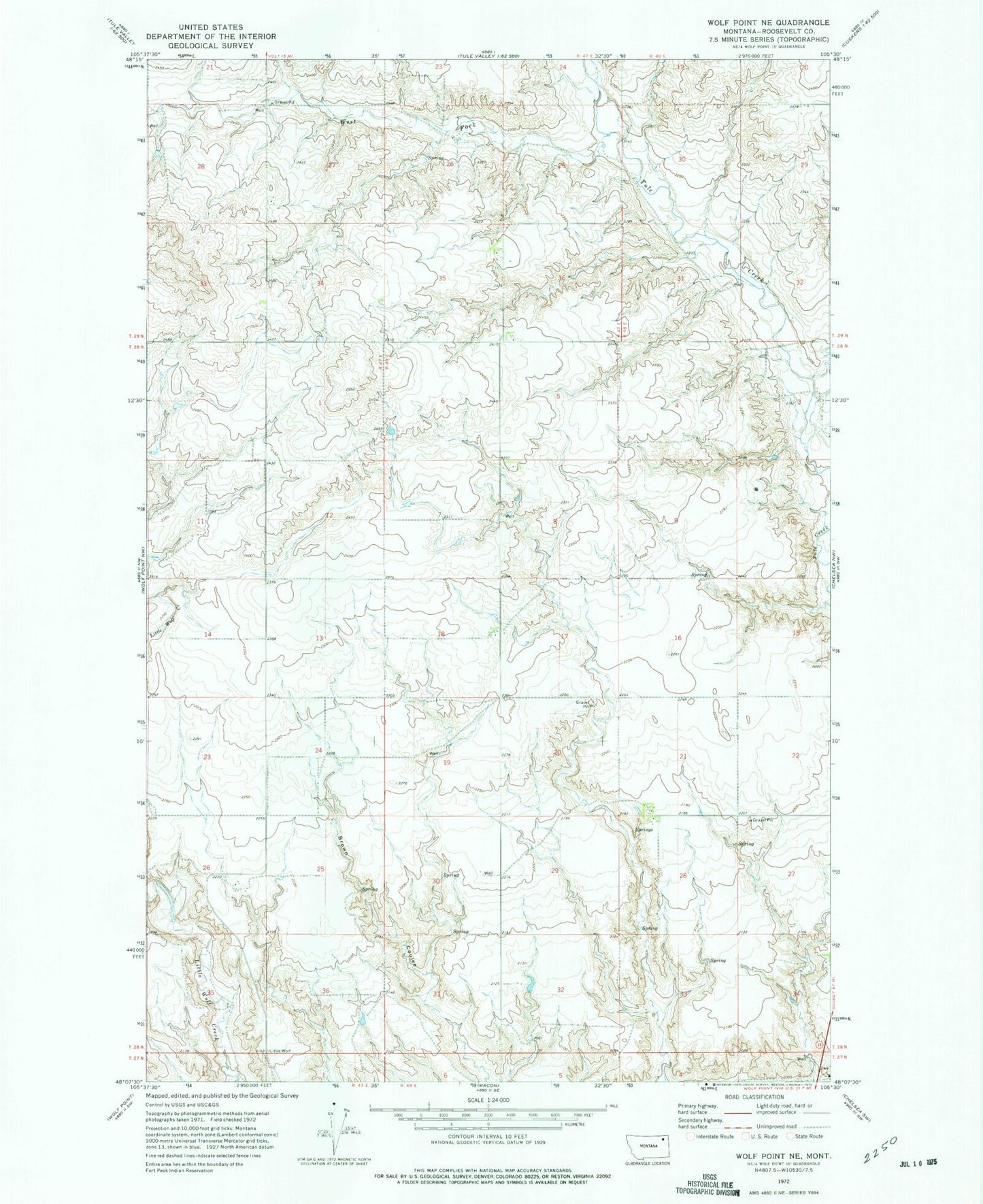
Classic USGS Wolf Point NE Montana 7.5'x7.5' Topo Map
Couldn't load pickup availability
Historical USGS topographic quad map of Wolf Point NE in the state of Montana. Map scale may vary for some years, but is generally around 1:24,000. Print size is approximately 24" x 27"
This quadrangle is in the following counties: Roosevelt.
The map contains contour lines, roads, rivers, towns, and lakes. Printed on high-quality waterproof paper with UV fade-resistant inks, and shipped rolled.
Contains the following named places: 28N47E02CBBD01 Well, 28N47E26DBAD01 Well, 28N47E26DBAD02 Well, 28N47E35DCBA01 Well, 28N48E03AC__01 Well, 28N48E03AC__02 Well, 28N48E03DA__01 Well, 28N48E03DD__01 Well, 28N48E03DD__02 Well, 28N48E03DD__03 Well, 28N48E03DDBB01 Well, 28N48E04AACC01 Well, 28N48E08BB__01 Well, 28N48E08BBBA01 Well, 28N48E08BCCC01 Well, 28N48E09DDCC01 Spring, 28N48E17BA__01 Well, 28N48E18AD__01 Well, 28N48E18AD__02 Well, 28N48E18AD__03 Well, 28N48E20AA__01 Well, 28N48E21CD__01 Well, 28N48E21DD__01 Well, 28N48E28AADD01 Spring, 28N48E28BABB01 Well, 28N48E28BABC01 Well, 28N48E28BBBD01 Spring, 28N48E28BBDB01 Spring, 28N48E28CCDC01 Spring, 28N48E30ACCC01 Spring, 28N48E30AD__01 Well, 28N48E30DCCD01 Spring, 28N48E31AB__01 Well, 28N48E31AB__02 Well, 28N48E32BC__01 Well, 28N48E32BC__02 Well, 28N48E34AC__01 Well, 29N47E26ACBA01 Well, 29N47E26BDCA01 Spring, 29N47E28AAAA01 Well, Marquardt School, West Fork Tule Creek