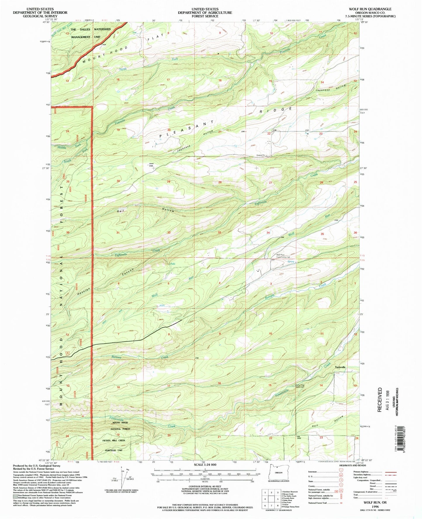
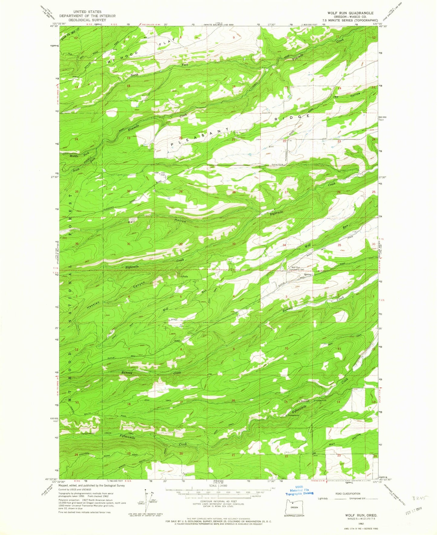
MyTopo
Classic USGS Wolf Run Oregon 7.5'x7.5' Topo Map
Couldn't load pickup availability
Historical USGS topographic quad map of Wolf Run in the state of Oregon. Map scale may vary for some years, but is generally around 1:24,000. Print size is approximately 24" x 27"
This quadrangle is in the following counties: Wasco.
The map contains contour lines, roads, rivers, towns, and lakes. Printed on high-quality waterproof paper with UV fade-resistant inks, and shipped rolled.
Contains the following named places: Dufur City Reservoir, Hesslan Canyon, Kelly Cistern, Liechti Pond Number One, Lyda Ranch Airstrip, Marvel Reservoir, Middle Fork Fivemile Creek, North Fork Fivemile Creek, Orchard Ridge Ditch, Pleasant Ridge, Pleasant Ridge School, Rail Hollow, South Fork Fivemile Creek, Spring Gulch, Tamarack Creek, Tamarack Springs, Taylor Post Office, Taylorville, Wolf Run, Wolf Run Community Hall, Wolf Run Ditch