MyTopo
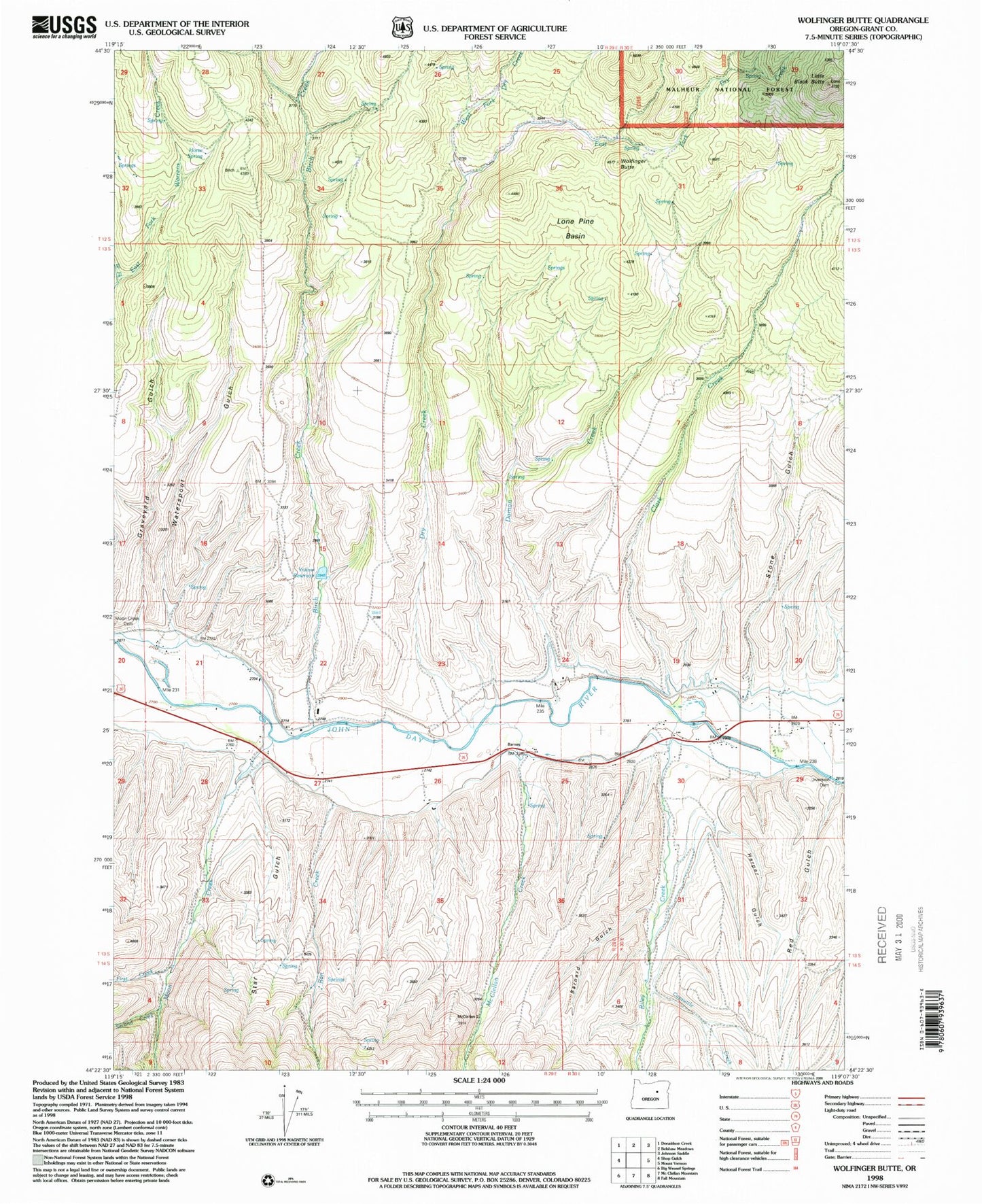
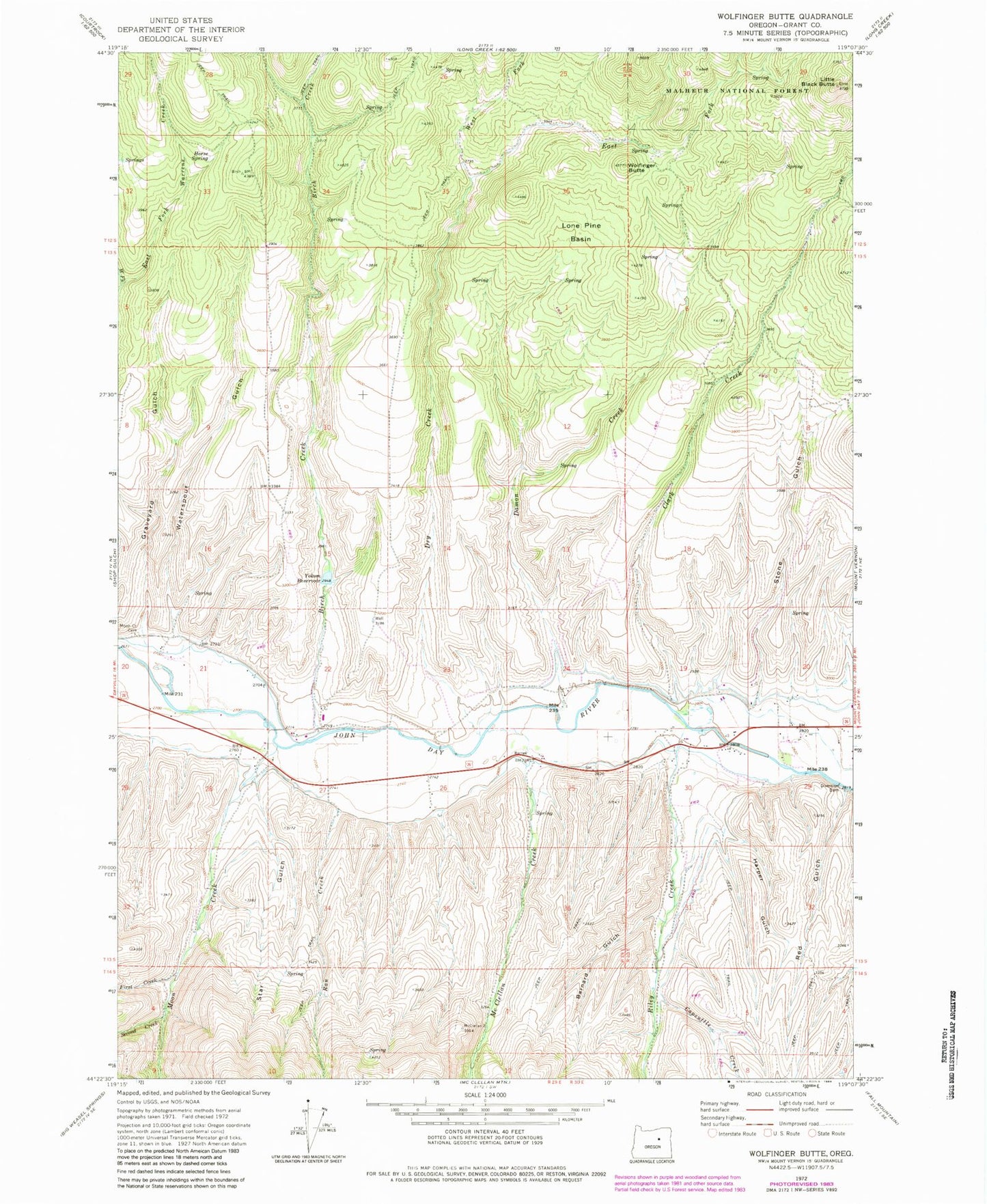
Classic USGS Wolfinger Butte Oregon 7.5'x7.5' Topo Map
Couldn't load pickup availability
Historical USGS topographic quad map of Wolfinger Butte in the state of Oregon. Map scale may vary for some years, but is generally around 1:24,000. Print size is approximately 24" x 27"
This quadrangle is in the following counties: Grant.
The map contains contour lines, roads, rivers, towns, and lakes. Printed on high-quality waterproof paper with UV fade-resistant inks, and shipped rolled.
Contains the following named places: Barnard Gulch, Birch Creek, Blue Mountain Ditch, Capsuttle Creek, Clark Creek, Damon Creek, Dry Creek, Dunlap Cabin, East Fork Dry Creek, First Creek, Graveyard Gulch, Harper Gulch, Horse Spring, Jenkins Cabin, Lemons Ditch, Lemons Ranch, Little Black Butte, Lone Pine Basin, McClellan Creek, Moon Creek, Moon Creek Cemetery, Moon Creek School, Morse Gulch, Ran Creek, Red Gulch, Riley Creek, Second Creek, Star Gulch, Stone Gulch, Waterspout Gulch, West Fork Dry Creek, Wolfinger Butte, Yokum Reservoir, ZIP Code: 97865