MyTopo
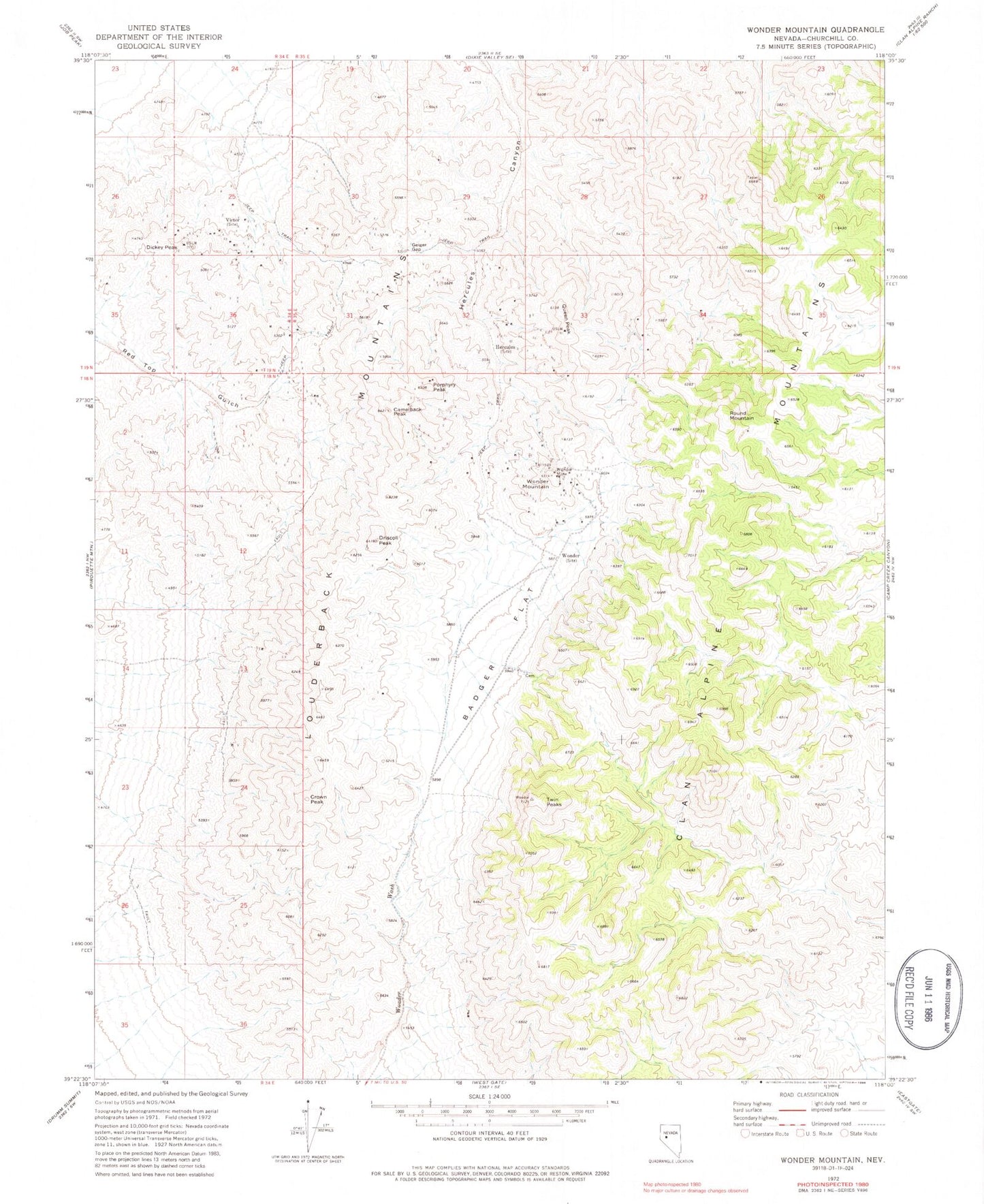
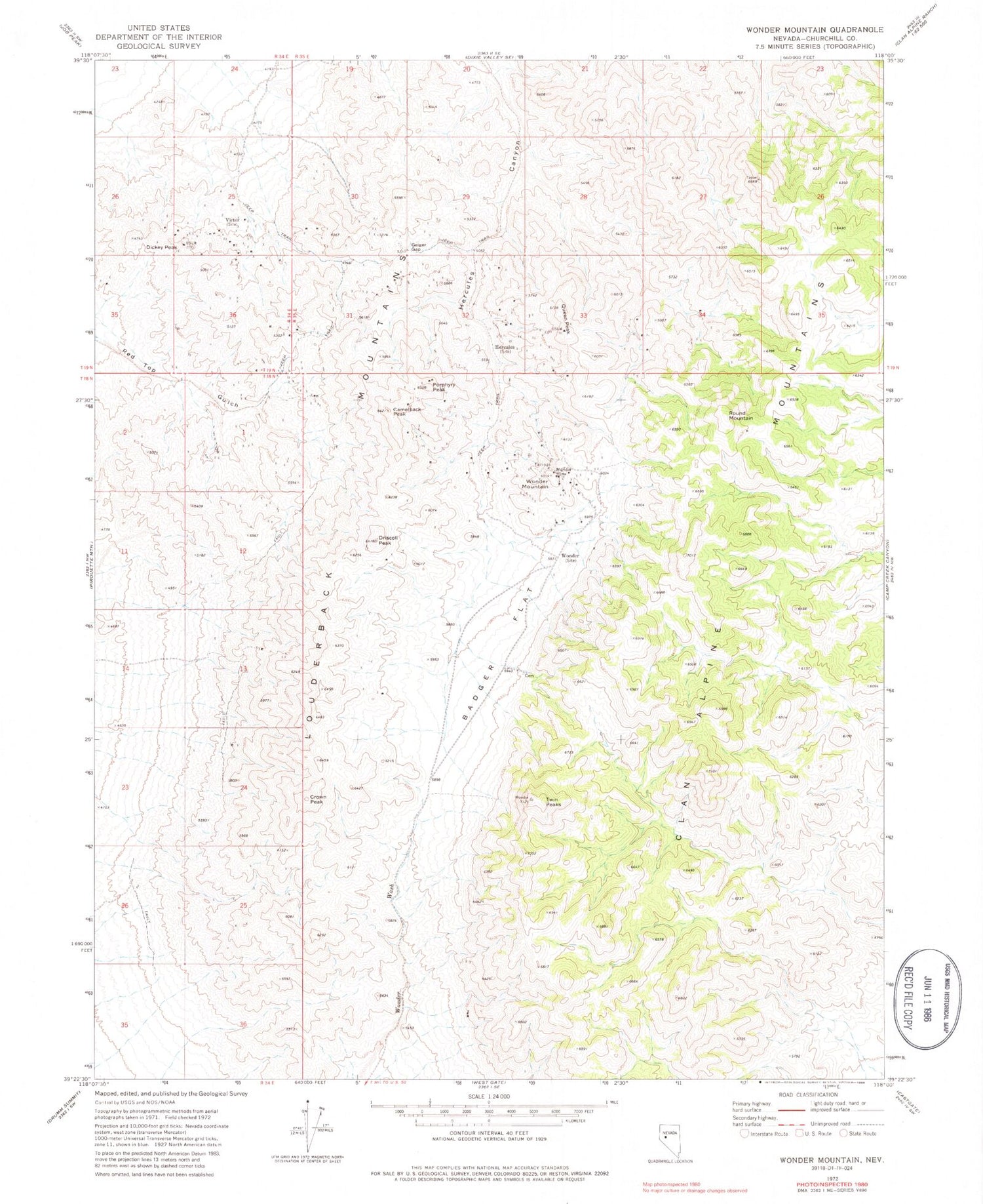
Classic USGS Wonder Mountain Nevada 7.5'x7.5' Topo Map
Couldn't load pickup availability
Historical USGS topographic quad map of Wonder Mountain in the state of Nevada. Map scale may vary for some years, but is generally around 1:24,000. Print size is approximately 24" x 27"
This quadrangle is in the following counties: Churchill.
The map contains contour lines, roads, rivers, towns, and lakes. Printed on high-quality waterproof paper with UV fade-resistant inks, and shipped rolled.
Contains the following named places: Badger Flat, Camelback Peak, Crown Peak, Dickey Peak, Driscoll Peak, Geiger Gap, Hercules, Hercules Post Office, Hercules Spring, Jack Pot Mine, Kingston, Kingston Post Office, Louderback Mountains, Nevada Wonder Mill, Porphyry Peak, Queen Peak, Red Top, Round Mountain, Strayhorse Gulch, Twin Peaks, Victor, Victor Post Office, Vulcher Mine, Wonder, Wonder Mine, Wonder Mining District, Wonder Mountain, Wonder Post Office