MyTopo
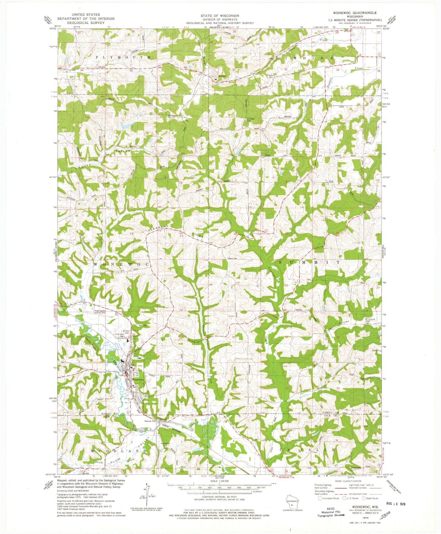
Classic USGS Wonewoc Wisconsin 7.5'x7.5' Topo Map
Couldn't load pickup availability
Historical USGS topographic quad map of Wonewoc in the state of Wisconsin. Map scale may vary for some years, but is generally around 1:24,000. Print size is approximately 24" x 27"
This quadrangle is in the following counties: Juneau, Sauk.
The map contains contour lines, roads, rivers, towns, and lakes. Printed on high-quality waterproof paper with UV fade-resistant inks, and shipped rolled.
Contains the following named places: .15 Reservoir, 0.5 Reservoir, 1 Reservoir, 53968, Alton School, Castle Rocks, Cherney Farms, Cusick Number 1 G3448 Dam, Cusick Number 2 G 3448 Dam, Daylight Hill, Elroy Quarry, Gardner Creek, Hochmuth Cemetery, Leverenz H 35 Dam, Mullin Ridge, Pine Eden Cemetery, Pleasant Ridge, Pleasant Ridge School, Plum Creek, Plum Valley, Potter Cemetery, Potter Ridge, Potter School, Raese Cemetery, Red School, Saint Anns Cemetery, Saint Jerome Church, Saint Paul Cemetery, Saint Paul's Evangelical Lutheran School, Saint Peters Cemetery, Three Castles Airpark, Town of Summit, Village of Wonewoc, Walsh H2198 Dam, Wonewoc, Wonewoc - Center Elementary School, Wonewoc - Center Junior High School, Wonewoc - Center School District, Wonewoc Fire Department, Wonewoc Police Department, Wonewoc Post Office