MyTopo
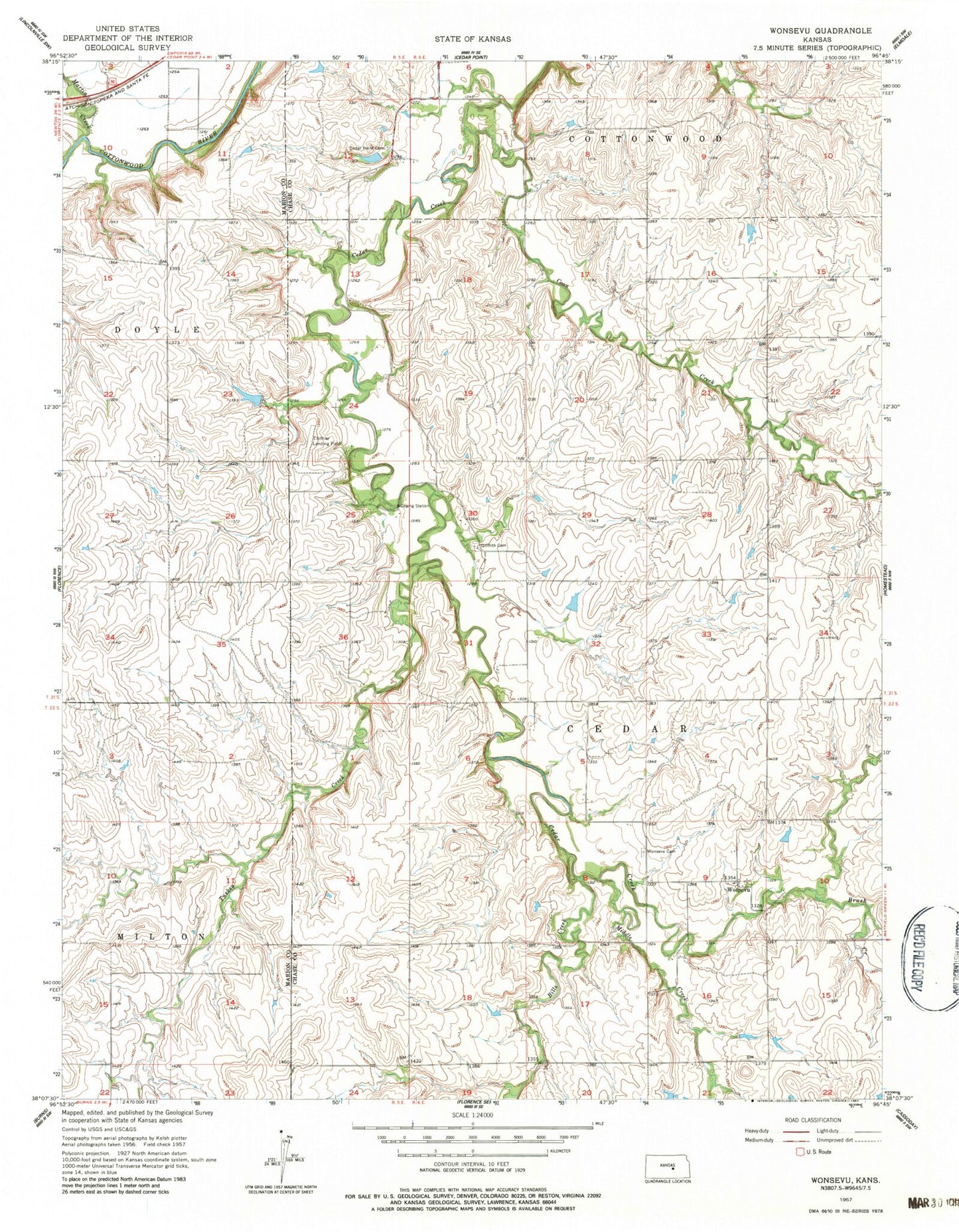
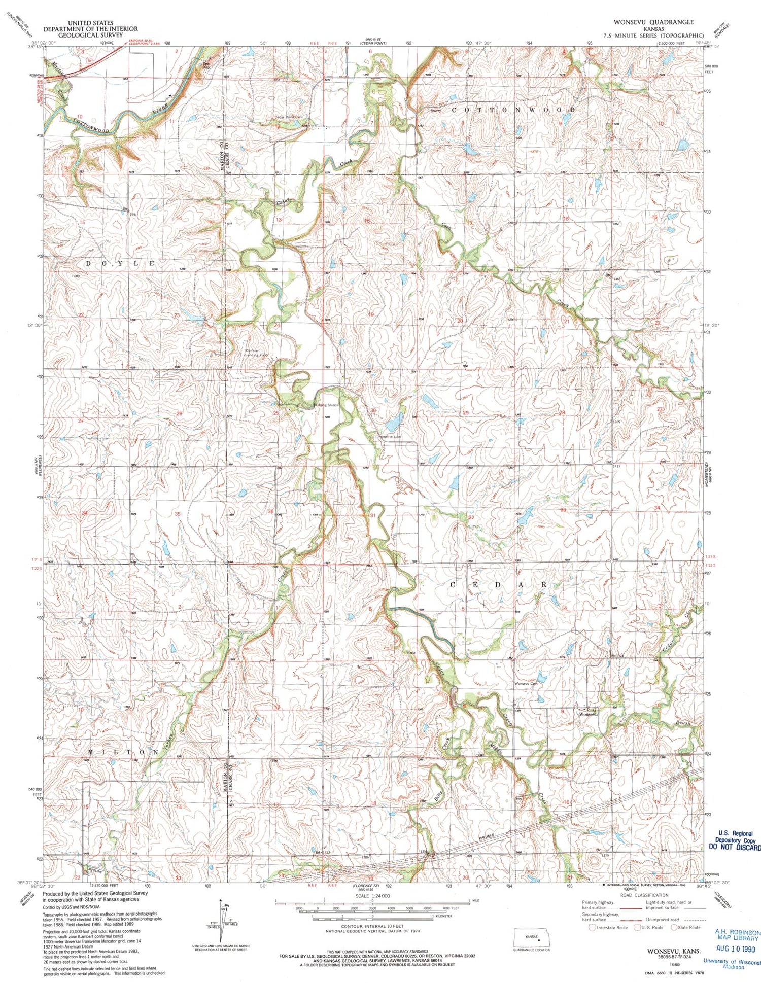
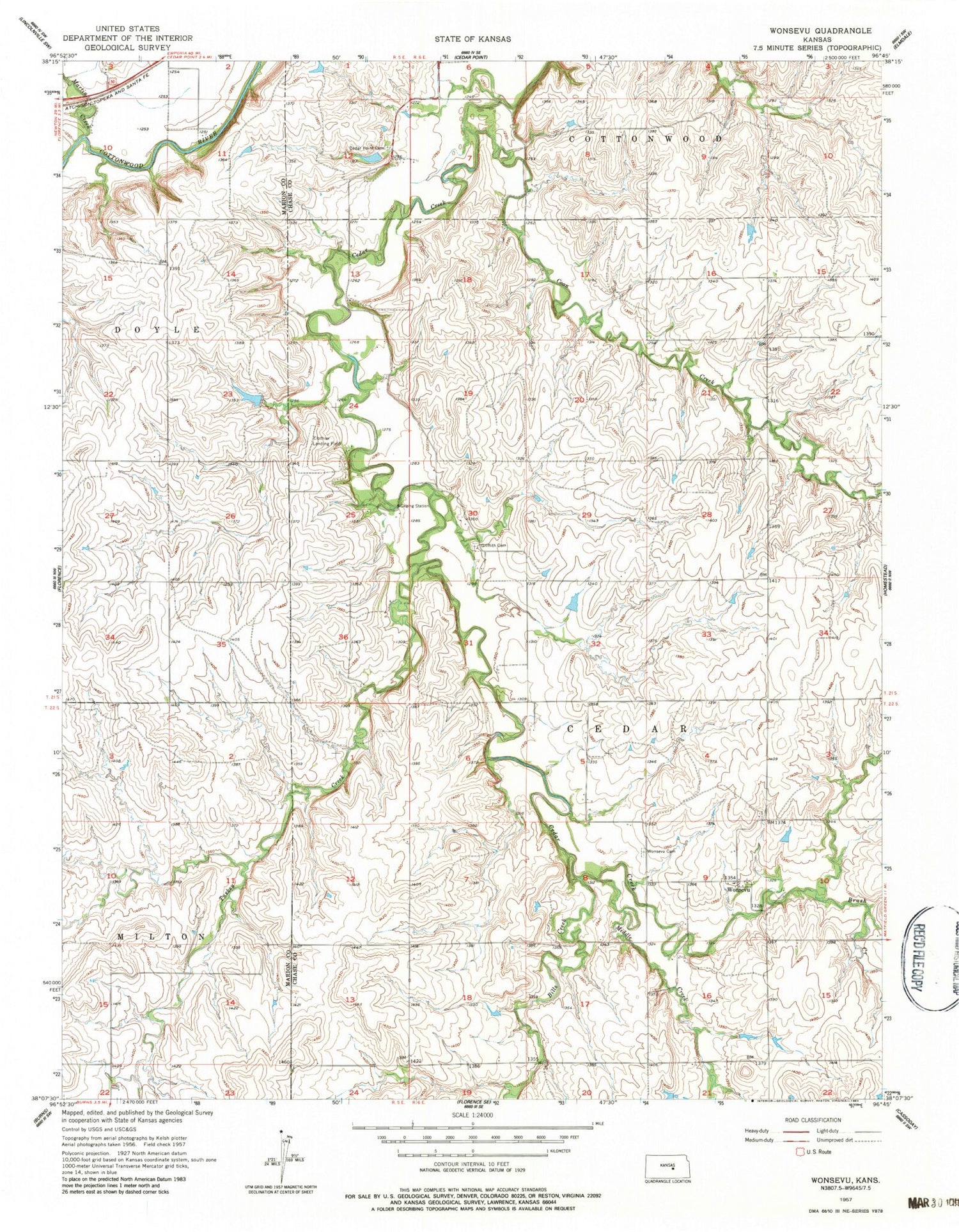
Classic USGS Wonsevu Kansas 7.5'x7.5' Topo Map
Regular price
$16.95
Regular price
Sale price
$16.95
Unit price
per
Couldn't load pickup availability
Historical USGS topographic quad map of Wonsevu in the state of Kansas. Map scale may vary for some years, but is generally around 1:24,000. Print size is approximately 24" x 27"
This quadrangle is in the following counties: Chase, Marion.
The map contains contour lines, roads, rivers, towns, and lakes. Printed on high-quality waterproof paper with UV fade-resistant inks, and shipped rolled.
Contains the following named places: Bills Creek, Brush Creek, Cedar Point Cemetery, Cedar Point Lake, Clothier Landing Field, Coon Creek, Griffith Cemetery, Martin Creek, Middle Creek, Township of Cedar, Turkey Creek, Wonsevu, Wonsevu Cemetery