MyTopo
Classic USGS Wood Butte Oregon 7.5'x7.5' Topo Map
Regular price
$16.95
Regular price
Sale price
$16.95
Unit price
per
Couldn't load pickup availability
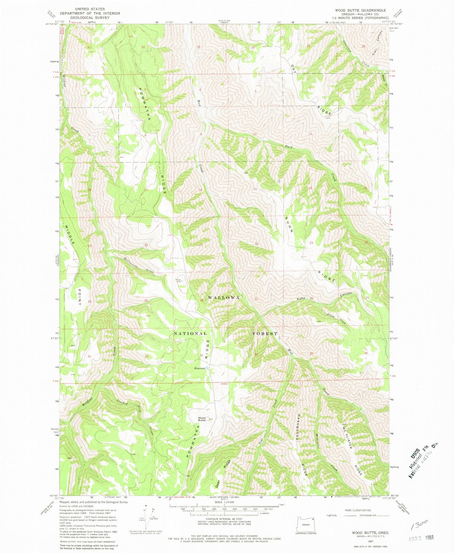
Historical USGS topographic quad map of Wood Butte in the state of Oregon. Map scale may vary for some years, but is generally around 1:24,000. Print size is approximately 24" x 27"
This quadrangle is in the following counties: Wallowa.
The map contains contour lines, roads, rivers, towns, and lakes. Printed on high-quality waterproof paper with UV fade-resistant inks, and shipped rolled.
Contains the following named places: Bobcat Creek, Buck Creek, Crooked Neck Creek, Ditch Creek, Kuhn Canyon, McAlister Creek, Powwatka Ridge Airport, Rattlesnake Creek, Tope Creek, Trail Canyon, Wallupa Creek, Waterhole, Wood Butte