
MyTopo
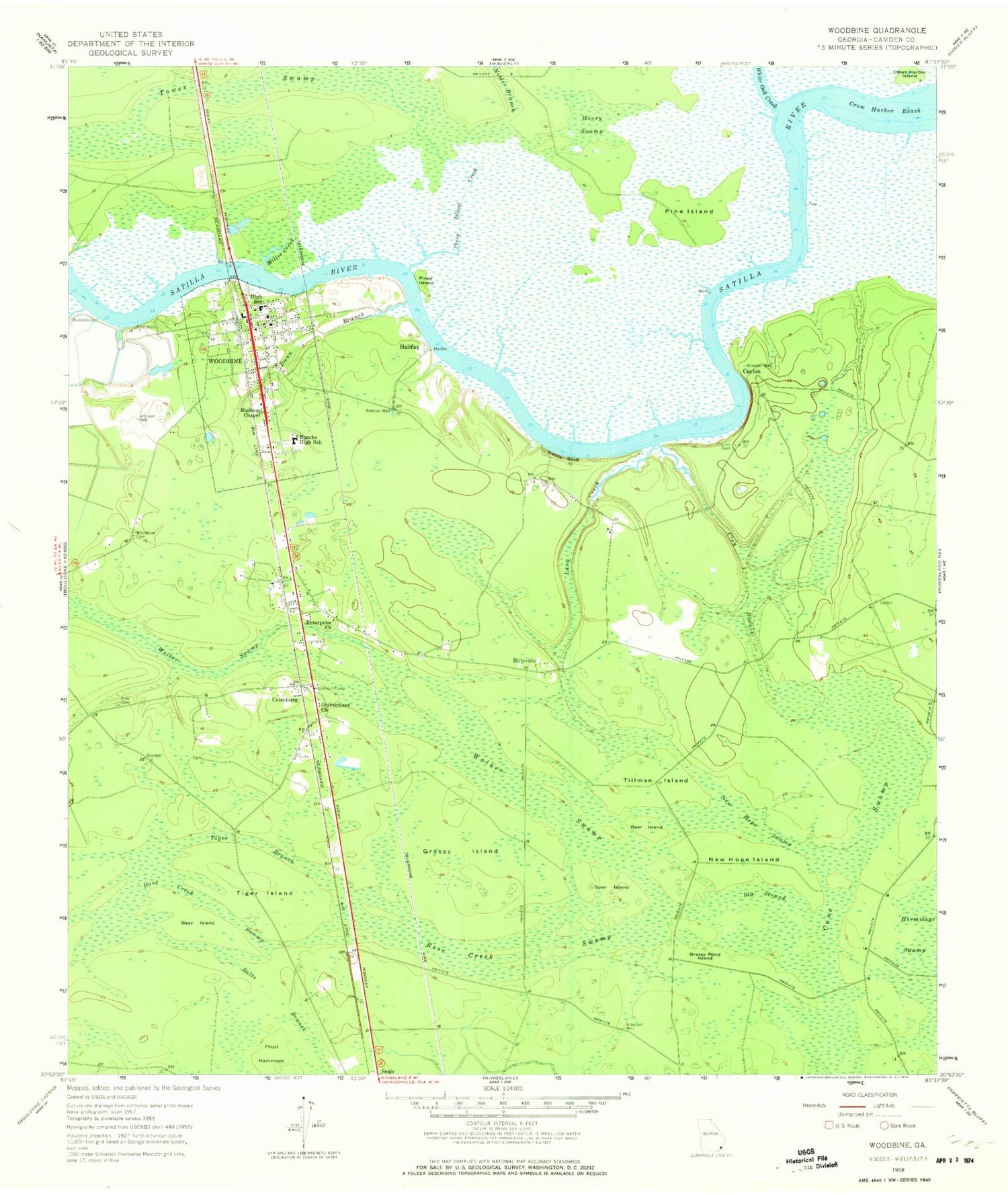
Classic USGS Woodbine Georgia 7.5'x7.5' Topo Map
Couldn't load pickup availability
Historical USGS topographic quad map of Woodbine in the state of Georgia. Map scale may vary for some years, but is generally around 1:24,000. Print size is approximately 24" x 27"
This quadrangle is in the following counties: Camden.
The map contains contour lines, roads, rivers, towns, and lakes. Printed on high-quality waterproof paper with UV fade-resistant inks, and shipped rolled.
Contains the following named places: Balls Branch, Bear Bay, Bear Island, Bible Church, Billyville, Bunche High School, Camden County, Camden County Courthouse, Camden County Fire - Rescue Station 11, Camden County Sheriff's Department, Camden County Sheriff's Office, Camden Street Church, Cane Swamp, Ceylon, Ceylon Cemetery, City of Woodbine, Clay Branch, Cole Cemetery, Colesburg, Crow Harbor Island, Crow Harbor Reach, Dunn Branch, Enterprise Church, Five Cent Branch, Forest View Church, Gap Swamp, Gatehouse Plantation, Gethsemane Church, Grassy Island, Grassy Pond Island, Green Cemetery, Halifax, Hamilton Chapel, Honey Swamp, Kenneth McCarthy Bridge, Kit Swamp, Lang Creek, Madison Chapel, Magnolia Church, Miller Creek, Monkey Island Creek, New Hope Island, New Hope Swamp, Nobles Branch, Pine Island, Piney Island, Piney Island Creek, Plantation Point, Refuge, Rose Creek Swamp, Runnymeade, Satilla Bluff, Satilla River Waterfront Park, Simmons Branch, Spur Island, Tiger Branch, Tiger Island, Tillman Island, Tower Swamp, Walker Swamp, Walker Swamp Island, WCGA-AM (Woodbine), Whitaker Cemetery, White Oak Creek, Wild Neck, Woodbine, Woodbine Cemetery, Woodbine Church, Woodbine City Hall, Woodbine Division, Woodbine Elementary School, Woodbine Plantation, Woodbine Police Department, Woodbine Post Office, Woodbine School, Woodbine Water Pollution Control Plant, ZIP Code: 31569


