MyTopo
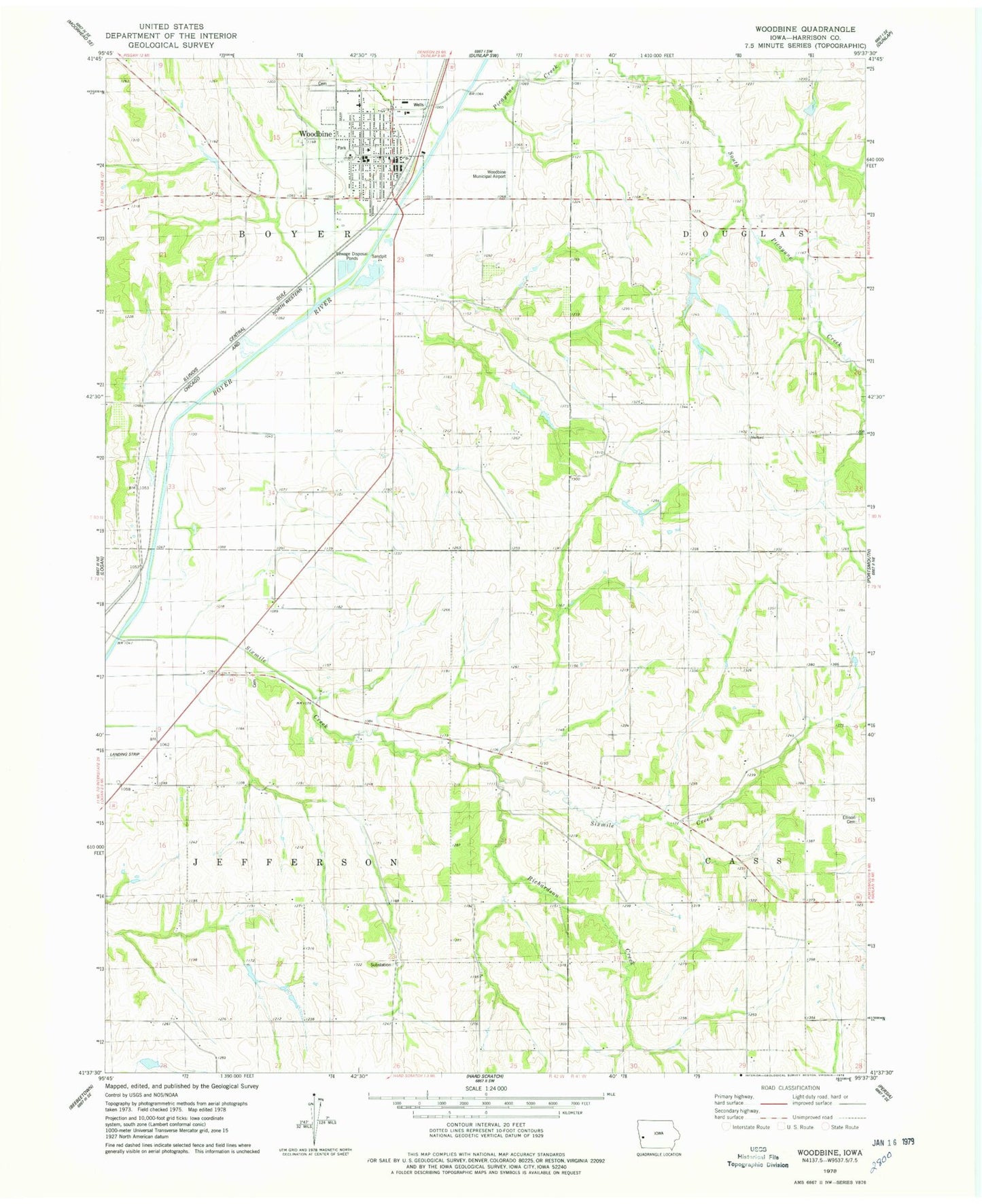
Classic USGS Woodbine Iowa 7.5'x7.5' Topo Map
Couldn't load pickup availability
Historical USGS topographic quad map of Woodbine in the state of Iowa. Map scale may vary for some years, but is generally around 1:24,000. Print size is approximately 24" x 27"
This quadrangle is in the following counties: Harrison.
The map contains contour lines, roads, rivers, towns, and lakes. Printed on high-quality waterproof paper with UV fade-resistant inks, and shipped rolled.
Contains the following named places: Alegent Health Center, City of Woodbine, Cowan-Pardee Cemetery, Ellison Cemetery, First Christian Church, First Presbyterian Church, Followers of Christ Church, Greenwood Cemetery, Hawkins Cemetery, Jeddo City, Jeddo City Post Office, McGavern Cemetery, Mefferd Cemetery, Midlands Dental Center, Needmore Post Office, Ojedo, Ojedo Post Office, Picayune Creek, Reorganized Church of Jesus Christ of Latter Day Saints, Richardson Creek, Sacred Heart Parish, Sixmile Creek, Township of Boyer, Township of Jefferson, Twelve Mile Grove Post Office, United Methodist Church, United Western Co-op Elevator, Whitesboro, Whitesboro Post Office, Willett, Woodbine, Woodbine Cemetery, Woodbine Community Center, Woodbine Elementary School, Woodbine Fire and Rescue Department, Woodbine High School, Woodbine Municipal Airport, Woodbine Police Department, Woodbine Post Office, Woodbine Public Library