MyTopo
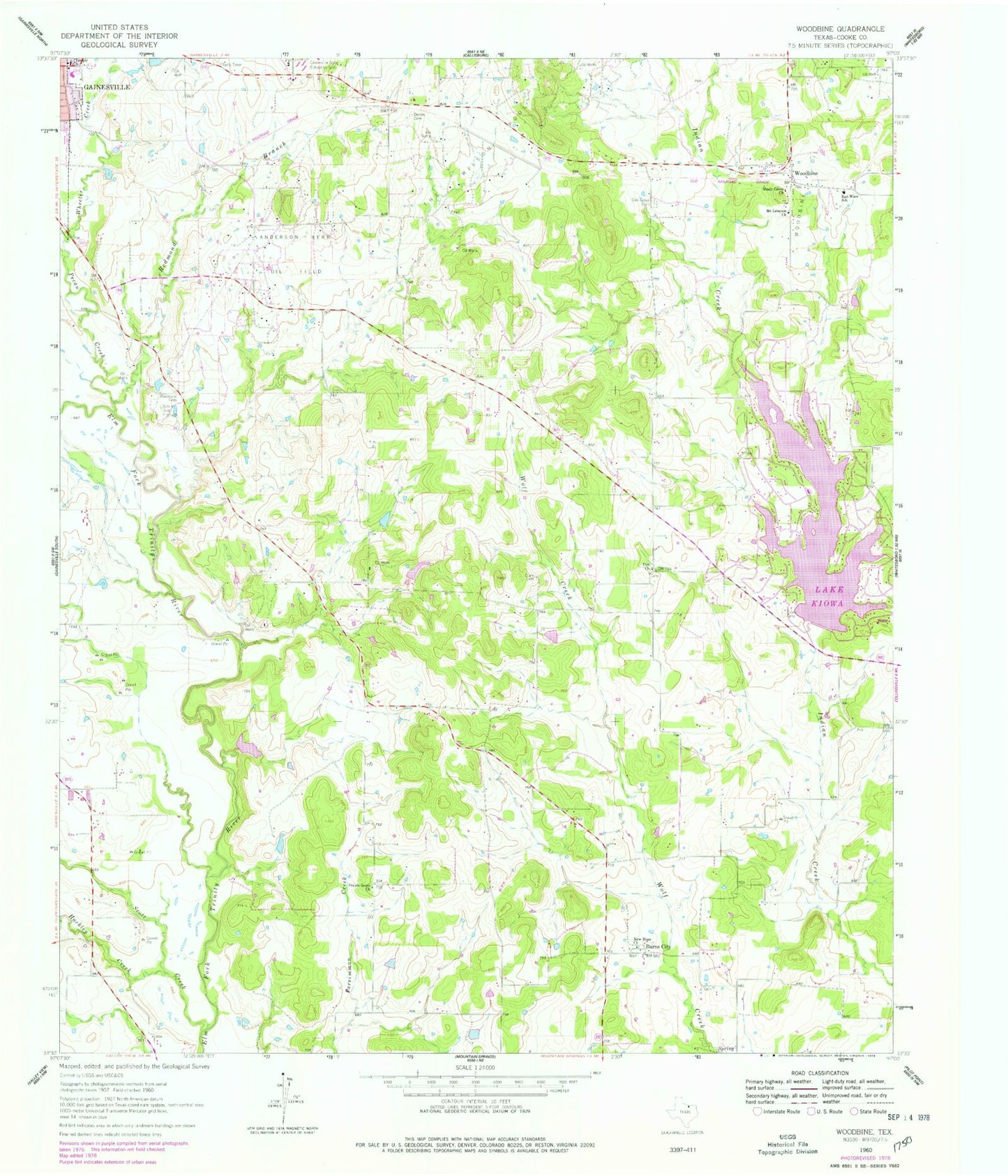
Classic USGS Woodbine Texas 7.5'x7.5' Topo Map
Couldn't load pickup availability
Historical USGS topographic quad map of Woodbine in the state of Texas. Map scale may vary for some years, but is generally around 1:24,000. Print size is approximately 24" x 27"
This quadrangle is in the following counties: Cooke.
The map contains contour lines, roads, rivers, towns, and lakes. Printed on high-quality waterproof paper with UV fade-resistant inks, and shipped rolled.
Contains the following named places: Anderson-Kerr Oil Field, Burns City, Clark County Cemetery, Dervin Cemetery, Dye Church, Edison Elementary School, Este Cemetery, Gainesville Southeast Division, Hackley Creek, Indian Creek Volunteer Fire Department, KDGE-FM (Gainesville), Lake Kiowa, Lake Kiowa Census Designated Place, Lake Kiowa Dam, Lake Kiowa Volunteer Fire Department Station 2, Mount Lebanon Church, New Hope Church, Oak Grove Cemetery, Pecan Creek, Prairie Grove Baptist Church, Prairie Grove Church, Rad Ware Elementary School, Rad Ware School, Redmond Branch, Redmond Cemetery, Robotek Airport, Scott Creek, Shady Grove Church, Site of Fort Fitzhugh, Soil Conservation Service Site 16b Dam, Soil Conservation Service Site 16b Reservoir, Temple Baptist Church, Temple Church, The Wilson Pool, Wheeler Creek, Woodbine