MyTopo
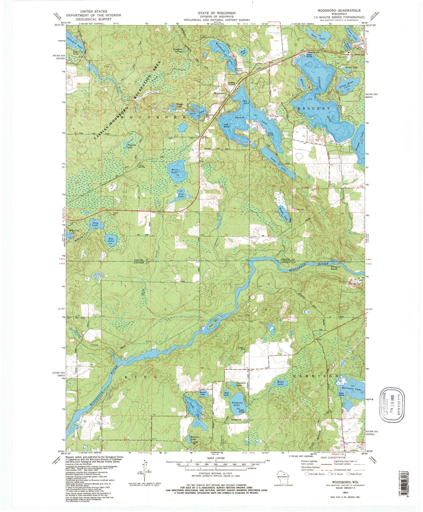
Classic USGS Woodboro Wisconsin 7.5'x7.5' Topo Map
Couldn't load pickup availability
Historical USGS topographic quad map of Woodboro in the state of Wisconsin. Typical map scale is 1:24,000, but may vary for certain years, if available. Print size: 24" x 27"
This quadrangle is in the following counties: Lincoln, Oneida.
The map contains contour lines, roads, rivers, towns, and lakes. Printed on high-quality waterproof paper with UV fade-resistant inks, and shipped rolled.
Contains the following named places: Big Island, Bowles Lake, Capitola Lake, Crescent Lake, Extrom Lake, Finger Lake, Fox Lake, Green Bass Lake, Harrison Lake, Jennie Creek, Little Island, Long Lake, Mazy Lake, Mirror Lake, Mud Lake, Nose Lake, Pickerel Lake, Pontoon Lake, Prune Lake, Reno Lake, Roe Lake, Round Lake, Round Lake, Spring Creek, Spruce Lake, Spur Lake, Stag Lake, Trout Creek, Trout Creek, Washburn Lake, Whirlpool Rapids, Wolf Lake, Woodboro, Woodboro Springs, Camp Ten Lookout Tower, Porcupine Lookout Tower, Lake Clara, Squash Lake, Town of King, Town of Woodboro, Harrison 2WP351 Dam, Harrison Lake 6, Negro Island, Woodboro Cemetery, Highland Flats School (historical), Crescent Flats School (historical)