MyTopo
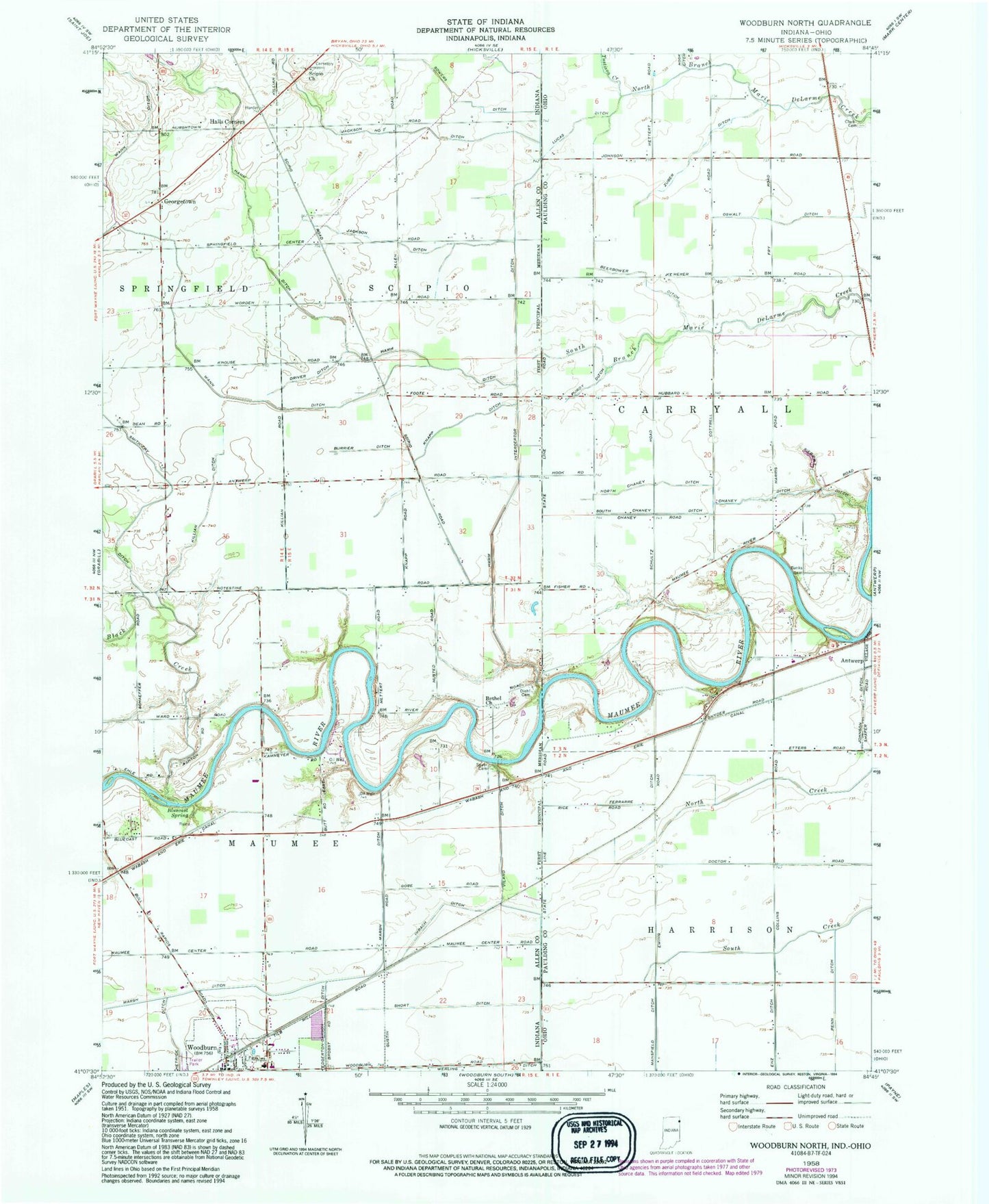
Classic USGS Woodburn North Indiana 7.5'x7.5' Topo Map
Couldn't load pickup availability
Historical USGS topographic quad map of Woodburn North in the states of Indiana, Ohio. Map scale may vary for some years, but is generally around 1:24,000. Print size is approximately 24" x 27"
This quadrangle is in the following counties: Allen, Paulding.
The map contains contour lines, roads, rivers, towns, and lakes. Printed on high-quality waterproof paper with UV fade-resistant inks, and shipped rolled.
Contains the following named places: Banks Cemetery, Beerbower Ditch, Bethel Church, Black Creek, Bluecast, Bluecast Spring, Brenneke Airport, Burrier Ditch, Champion School, Chaney Ditch, City of Woodburn, Clark Cemetery, Diehl Cemetery, Driver Ditch, Enz Ditch, Ferrarre Ditch, Georgetown, Halls Corners, Hamm Ditch, Hamm Interceptor Ditch, Hetrick Ditch, Hook School, Imbach Ditch, Jackson Ditch, Jackson Number Two Ditch, Johnson Ditch, Killian Ditch, Knapp Ditch, Lichtys Parcels, Link, Link Post Office, Lucas Ditch, New Harrison, Nindeville, North Chaney Ditch, Penn Ditch, Purdy Ditch, School Number 1, School Number 2, School Number 5, Scipio Cemetery, Scipio Church, Short Ditch, Sieberi Ditch, South Chaney Ditch, Sowers Ditch, Township of Maumee, Township of Scipio, Tustison Creek, Viland Ditch, Wann Ditch, Werling Ditch, Woodburn, Woodburn Fire Department Maumee Township Fire Station, Woodburn Post Office, Zijlstra Dairy, Zuber Ditch, ZIP Codes: 46743, 46797