MyTopo
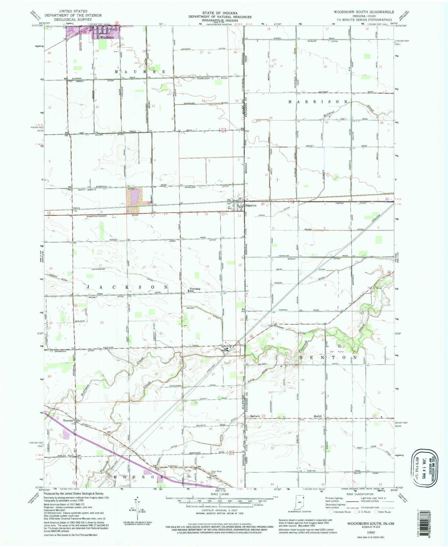
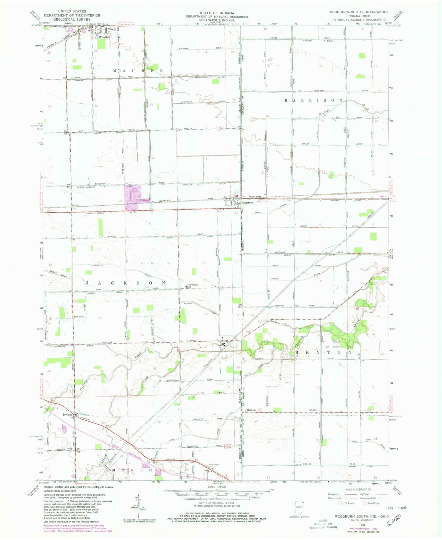
Classic USGS Woodburn South Indiana 7.5'x7.5' Topo Map
Couldn't load pickup availability
Historical USGS topographic quad map of Woodburn South in the states of Indiana, Ohio. Map scale may vary for some years, but is generally around 1:24,000. Print size is approximately 24" x 27"
This quadrangle is in the following counties: Allen, Paulding.
The map contains contour lines, roads, rivers, towns, and lakes. Printed on high-quality waterproof paper with UV fade-resistant inks, and shipped rolled.
Contains the following named places: Anspaugh Ditch, Auer Ditch, Bainbridge School, Baldwin, Basting Airport, Bayer Ditch, Berthaud Ditch, Bethel Church, Bluejay School, Boyer School, Brady Airport, Brady Ditch, Brady School, Brown Ditch, Church of God Camp, Dickerson Ditch, Edgerton, Edgerton Quarry, Edgerton-Carson Ditch, Eibling Ditch, Foster Ditch, Four Presidents Corners, Gideon Ditch, Gromeaux Ditch, Henery Ditch, Hoffman Creek, Imbach Ditch, J Stabler Ditch, Johnson Ditch, Jones Branch Ditch, Jones Ditch, Knoblaugh Ditch, Lennington Ditch, Litzenberg Ditch, Lomont Ditch, Mansfield Ditch, McGill, McGill Post Office, Mercia Ditch, Midwest Quarry, Miller Ditch, Mooney Ditch, Mourey Ditch, Pleasant Grove School, Pleasant Valley Golf Course, Ray Ditch, Romy-Bobilya Ditch, Shilts Ditch, Shisler Ditch, Shugars Ditch, Smiley, Smiley Ditch, Smiley Post Office, Smiley School, Sorgen Ditch, Spangler Farm Airport, Spindler Ditch, Stabler Ditch, State Line Ditch, Steinman Airport, Sugar Ridge Cemetery, Swail Ditch, Townley, Township of Jackson, White Ditch, Wood Ditch, Woodchuck School, Wooding Ditch, Woods Ditch