MyTopo
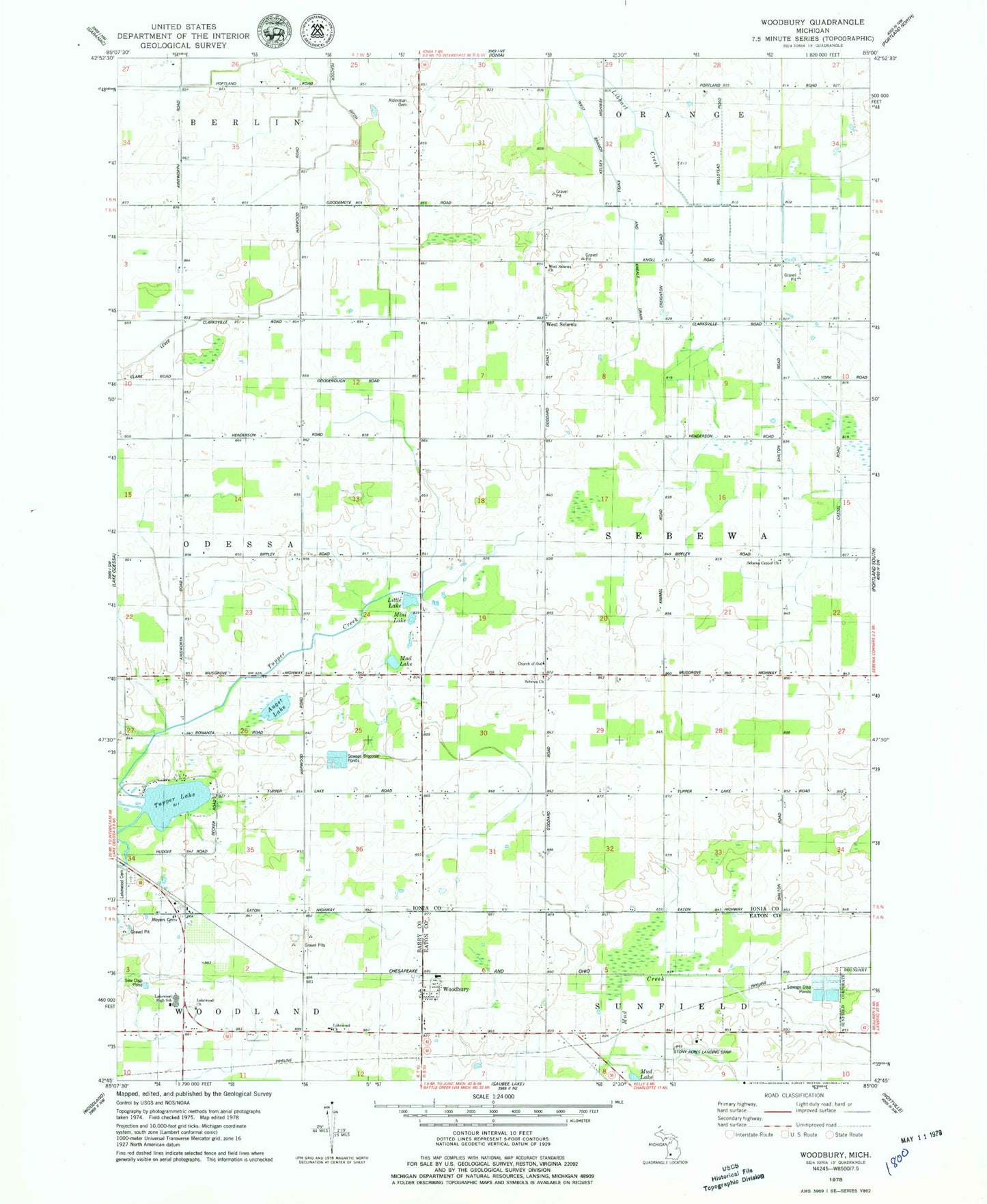
Classic USGS Woodbury Michigan 7.5'x7.5' Topo Map
Couldn't load pickup availability
Historical USGS topographic quad map of Woodbury in the state of Michigan. Map scale may vary for some years, but is generally around 1:24,000. Print size is approximately 24" x 27"
This quadrangle is in the following counties: Barry, Eaton, Ionia.
The map contains contour lines, roads, rivers, towns, and lakes. Printed on high-quality waterproof paper with UV fade-resistant inks, and shipped rolled.
Contains the following named places: Alderman Cemetery, Augst Lake, Church of God, First Baptist Church of Sebewa, Lakeside Cemetery, Lakewood Church, Lakewood High School, Lakewood United Methodist Church, Little Lake, Meyers Cemetery, Mini Lake, Mud Lake, Peacock Ditch, Reeder Cemetery, Rosina Post Office, Saint Herman Orthodox Church, Sebewa Baptist Cemetery, Sebewa Center Church, Sebewa Church, Stony Acres Airport, Township of Sebewa, Tupper Creek, Tupper Lake, United Brethren Church, West Branch Knoll and Kneale Drain, West Sebewa, West Sebewa Church, West Sebewa Post Office, Woodbury, Woodbury Post Office, Woodbury Station, ZIP Code: 48849