MyTopo
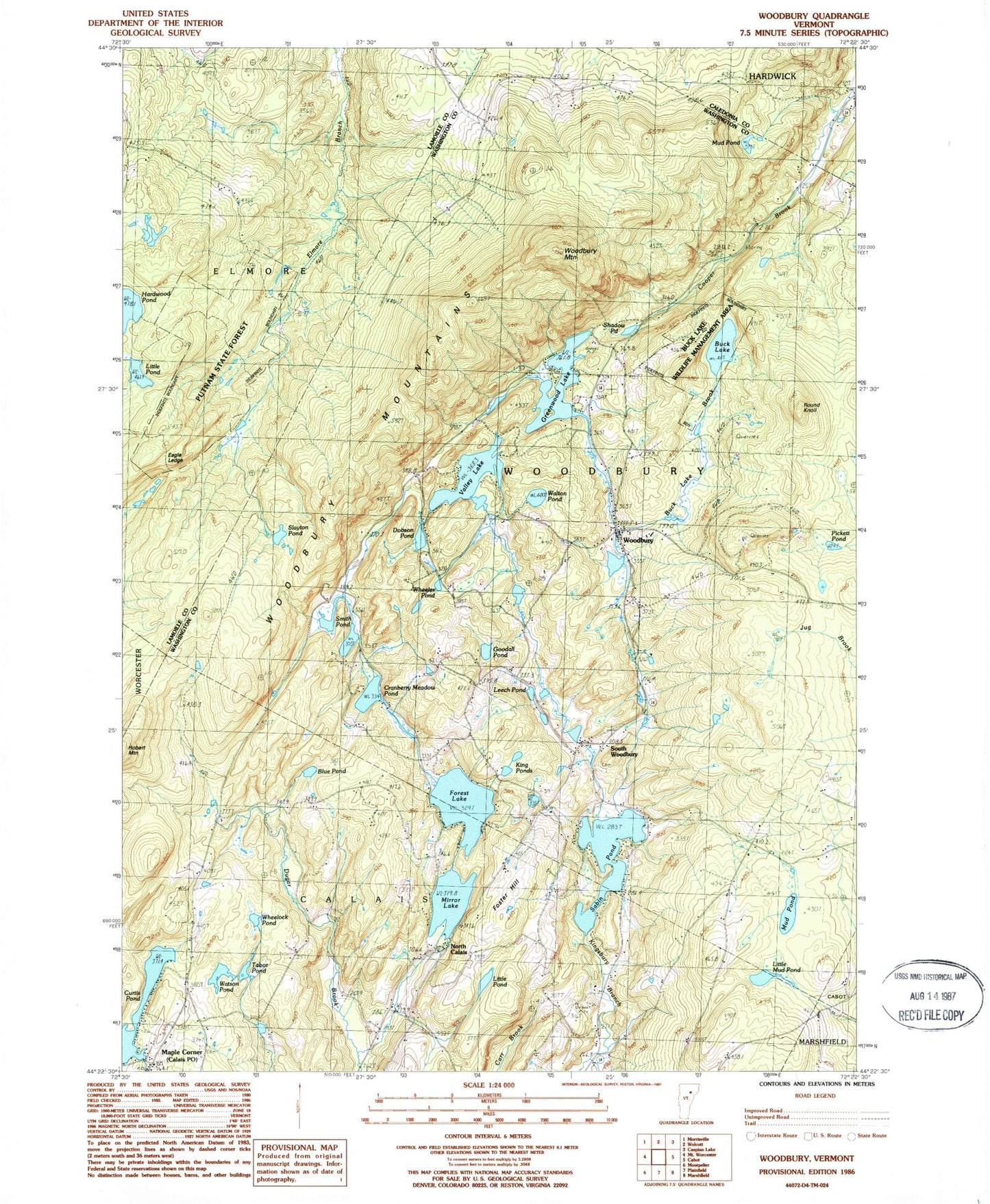
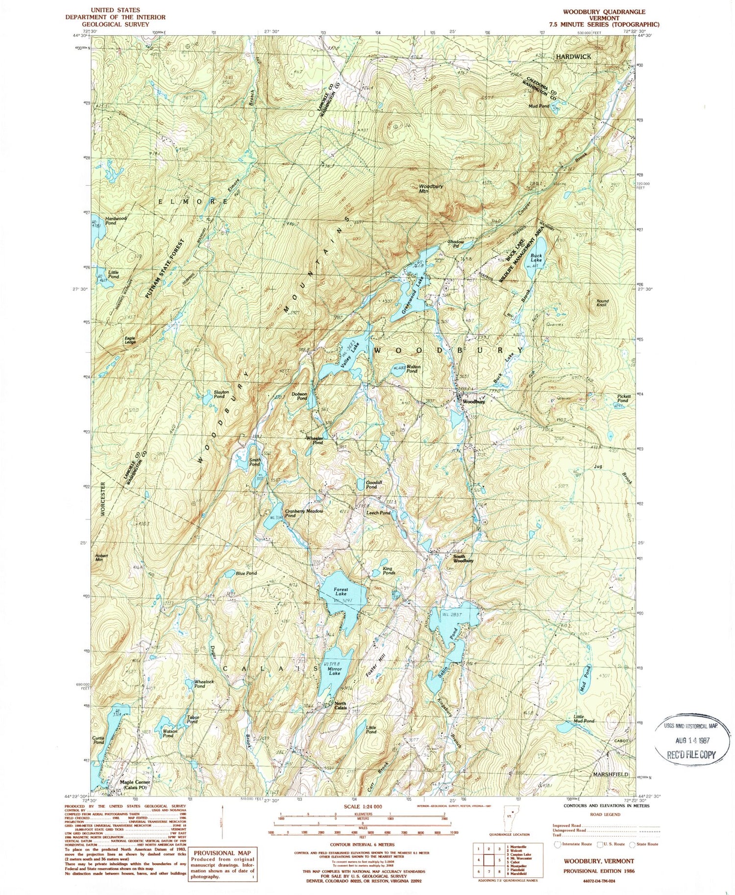
Classic USGS Woodbury Vermont 7.5'x7.5' Topo Map
Couldn't load pickup availability
Historical USGS topographic quad map of Woodbury in the state of Vermont. Typical map scale is 1:24,000, but may vary for certain years, if available. Print size: 24" x 27"
This quadrangle is in the following counties: Caledonia, Lamoille, Washington.
The map contains contour lines, roads, rivers, towns, and lakes. Printed on high-quality waterproof paper with UV fade-resistant inks, and shipped rolled.
Contains the following named places: Blake Falls, Blue Pond, Buck Lake, Buck Lake Brook, Cranberry Meadow Pond, Curtis Pond, Dobson Pond, Dugar Brook, Eagle Ledge, Forest Lake, Foster Hill, Goodall Pond, Greenwood Lake, Hardwood Flats School, Hardwood Pond, Hobart Mountain, King Ponds, Leech Pond, Little Mud Pond, Little Pond, Little Pond, Maple Corner, Mirror Lake, Mud Pond, Mud Pond, North Calais, North Calais School, Pickett Pond, Robinson Cemetery, Round Knoll, Sabin Pond, Shadow Pond, Slayton Pond, Smith Pond, South Woodbury, Tabor Pond, Valley Lake, Walton Pond, Watson Pond, Wheeler Pond, Wheeler Pond, Woodbury, Woodbury Mountain, Town of Woodbury, Calais Post Office, Curtis Pond Dam, Mirror Lake Dam, Valley Lake Dam, Woodbury Upper Dam, Buck Lake Wildlife Management Area, Christian Youth Council Building, Harry Pond, South Woodbury Cemetery, South Woodbury Congregational Church, Woodbury Post Office, Woodbury Town Forest, Woodbury Volunteer Fire Department, Woodbury Elementary School, Woodbury Center Cemetery