MyTopo
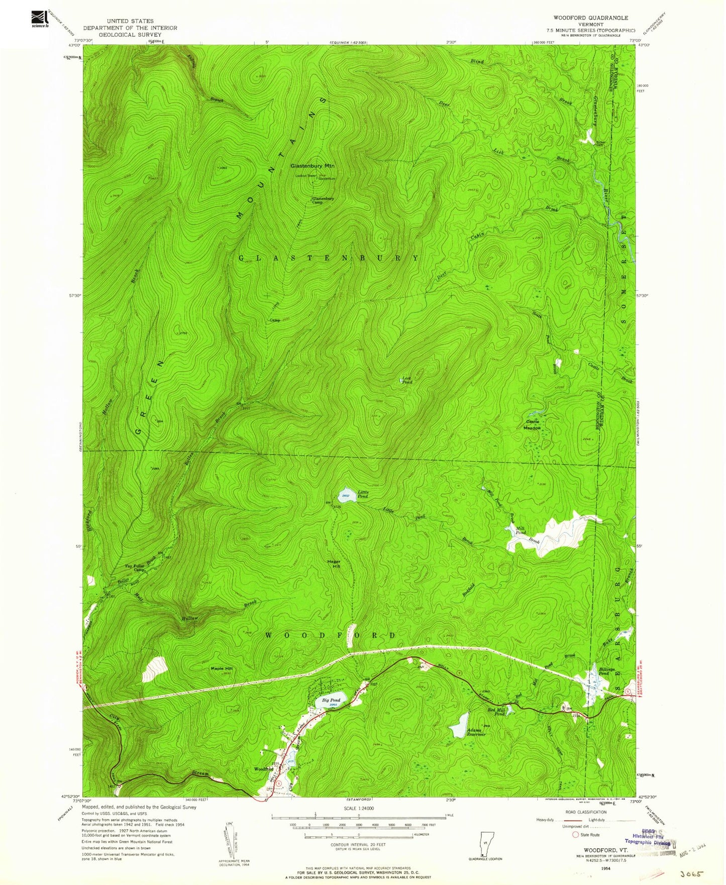
Classic USGS Woodford Vermont 7.5'x7.5' Topo Map
Couldn't load pickup availability
Historical USGS topographic quad map of Woodford in the state of Vermont. Typical map scale is 1:24,000, but may vary for certain years, if available. Print size: 24" x 27"
This quadrangle is in the following counties: Bennington, Windham.
The map contains contour lines, roads, rivers, towns, and lakes. Printed on high-quality waterproof paper with UV fade-resistant inks, and shipped rolled.
Contains the following named places: Adams Reservoir, Bickford Hollow Brook, Big Pond, Billings Pond, Blind Brook, Bolles Brook, Castle Meadow, Deer Cabin Brook, Deer Lick Brook, Dunville Hollow, Fay Fuller Camp, Glastenbury Camp, Glastenbury Mountain, Hagar Hill, Hell Hollow Brook, Little Pond, Little Pond Brook, Lost Pond, Maple Hill, Mill Pond, Mill Pond Brook, Molly Stark Trail, Red Mill Pond, Red Mill Pond Brook, Redfield Brook, Ricker Dam, South Pond Brook, Stamford Stream, Woodford, Glastenbury Mountain Lookout, Red Mill Brook Campground, Mellville Nanheim Shelter, Woodford State Park, Town of Glastenbury, Town of Woodford, Adams Reservoir Dam, Bugbee Pond Dam, Bugbee Mill Pond, Atwood Trail, Greenwood Lodge and Tent Sites, Prospect Mountain Ski Center, Red Mill Brook Camping Area, Union Church, Woodford Cemetery, Woodford State Park, Glastenbury Wilderness