
MyTopo
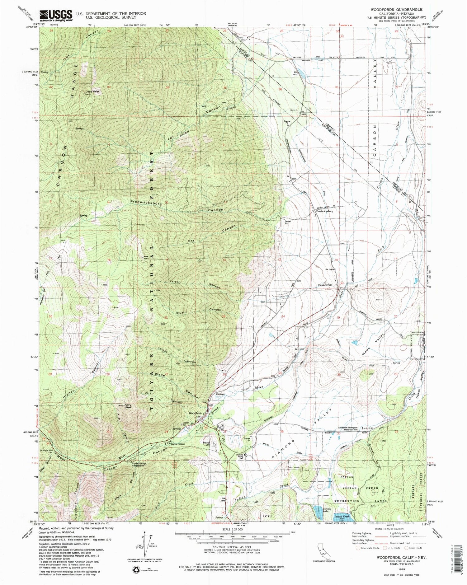
Classic USGS Woodfords California 7.5'x7.5' Topo Map
Couldn't load pickup availability
Historical USGS topographic quad map of Woodfords in the states of California, Nevada. Typical map scale is 1:24,000, but may vary for certain years, if available. Print size: 24" x 27"
This quadrangle is in the following counties: Alpine, Douglas.
The map contains contour lines, roads, rivers, towns, and lakes. Printed on high-quality waterproof paper with UV fade-resistant inks, and shipped rolled.
Contains the following named places: Acorn Canyon, Cary Canyon, Cary Peak, Crystal Springs Campground, Diamond Valley, Diamond Valley Ditch, Diamond Valley Elementary School, Dry Canyon, Fredericksburg Canyon, Jobs Peak, Larson Canyon, Luther Creek, Merk Canyon, Millich Ditch, Scossa Canyon, Scott Creek, Shingle Mill Flat, Cloudburst Canyon, Deep Canyon, Snowshoe Thompson Historical Mon, Stevens Lake, Stuard Canyon, Voight Canyon, Wade Canyon, Wade Valley, Washoe Cemetery, West Carson Canyon, Snowshoe Thompson Ditch Number Two, Fredericksburg, Paynesville, Woodfords, Indian Creek 1062 Dam, Mesa Vista, Alpine Village, Woodfords Community, Woodfords High School, Alpine County Secondary Community Day School, Alpine County Secondary Community Day School, Alpine Village Census Designated Place, Mesa Vista Census Designated Place, Woodsford Volunteer Fire Department, Burns Gravel Pit, Heise Boulder Quarry, Fredericksburg Cemetery, Old Woodfords Cemetery, Fay Canyon, Thoringtons (historical), Olds (historical), Valley View (historical), Fredericksburg Ditch


