MyTopo
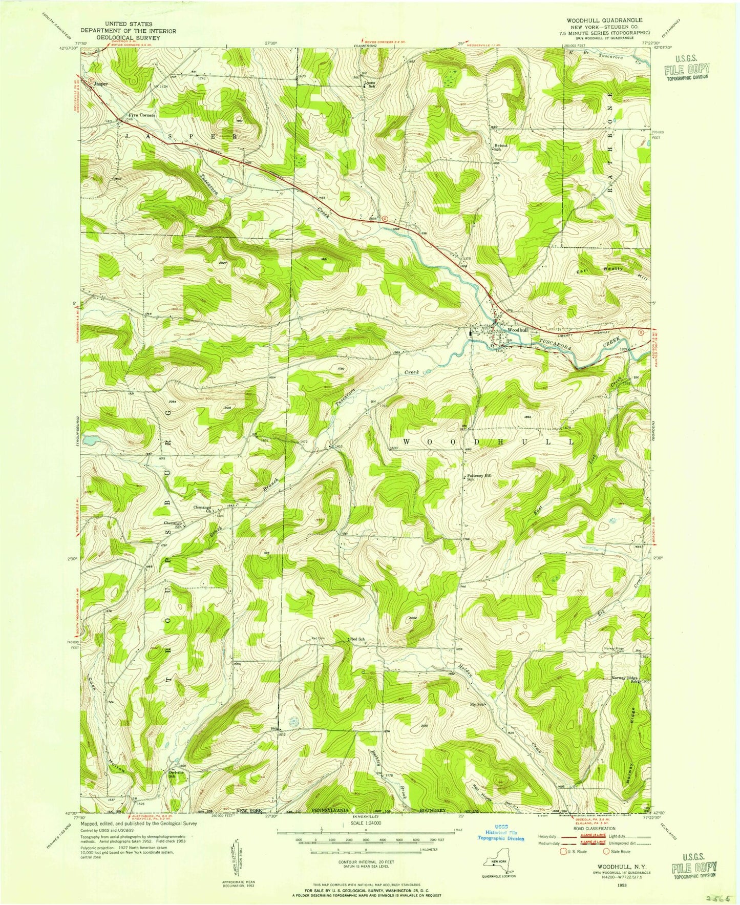
Classic USGS Woodhull New York 7.5'x7.5' Topo Map
Couldn't load pickup availability
Historical USGS topographic quad map of Woodhull in the state of New York. Map scale may vary for some years, but is generally around 1:24,000. Print size is approximately 24" x 27"
This quadrangle is in the following counties: Steuben, Tioga.
The map contains contour lines, roads, rivers, towns, and lakes. Printed on high-quality waterproof paper with UV fade-resistant inks, and shipped rolled.
Contains the following named places: Bebout School, Brown School, Chenango Cemetery, Chenango Church, Chenango School, Cook Hollow School, Earl Beatty Hill, East Lick Creek, Five Corners, Five Corners Cemetery, Five Corners School, Hopperville School, Lyons School, Norway Ridge, Norway Ridge Cemetery, Norway Ridge School, Owlville School, Pulteney Hill School, Red Cemetery, Red School, Sly School, South Branch Tuscarora Creek, Town of Woodhull, Townsley School, Tucker School, Woodhull, Woodhull Ambulance, Woodhull Baptist Church, Woodhull Fire Department, Woodhull Post Office, Woodhull Village Cemetery, ZIP Code: 14898