MyTopo
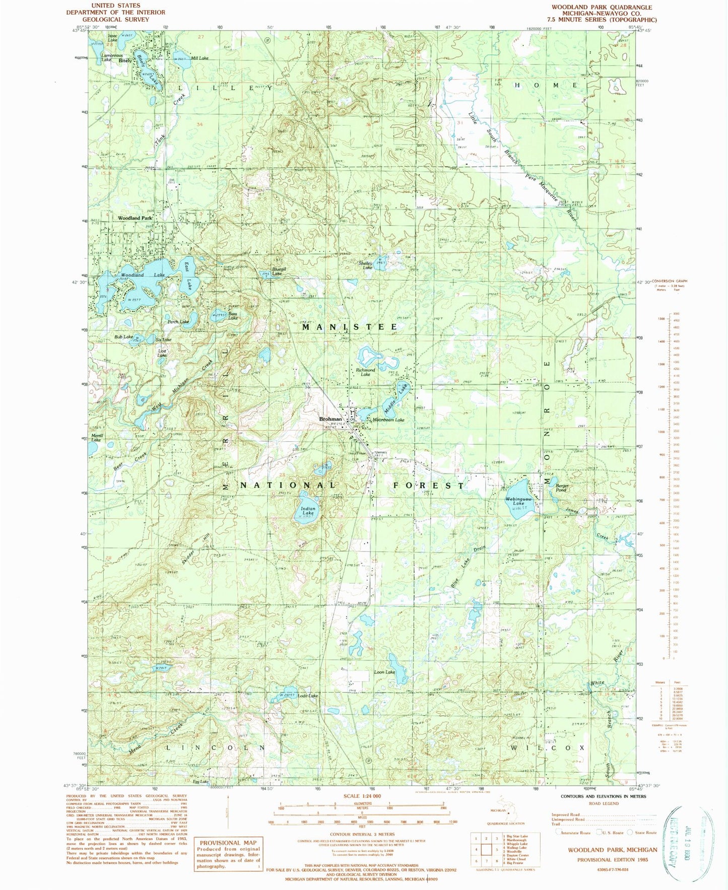
Classic USGS Woodland Park Michigan 7.5'x7.5' Topo Map
Couldn't load pickup availability
Historical USGS topographic quad map of Woodland Park in the state of Michigan. Map scale may vary for some years, but is generally around 1:24,000. Print size is approximately 24" x 27"
This quadrangle is in the following counties: Newaygo.
The map contains contour lines, roads, rivers, towns, and lakes. Printed on high-quality waterproof paper with UV fade-resistant inks, and shipped rolled.
Contains the following named places: Bass Lake, Berger Pond, Biteley Station, Bitely, Bitely Community Church, Bitely Lake, Bitely Post Office, Blue Lake Drain, Bluegill Lake, Broham Station, Brohman, Brohman Post Office, Bub Lake, East Lake, Egg Lake, First Baptist Church of Woodland, Hillers Cemetery, Indian Lake, Isaac Lake, James Creek, Lilley Township Fire Department, Loda Lake, Loda Lake Recreation Site, Loda Lake Wildflower Sanctuary, Loon Lake, Lost Lake, Mena Creek Waterfowl Area, Merrill Lake, Merrill Township Cemetery, Middle Lake, Mill Lake, Moonbeam Lake, Perch Lake, Richmond Lake, Saint Joseph's Catholic Cemetery, Shelley Lake, Sis Lake, Skidder Hill, Township of Merrill, Webinguaw Lake, Woodland Lake, Woodland Park, ZIP Code: 49312