MyTopo
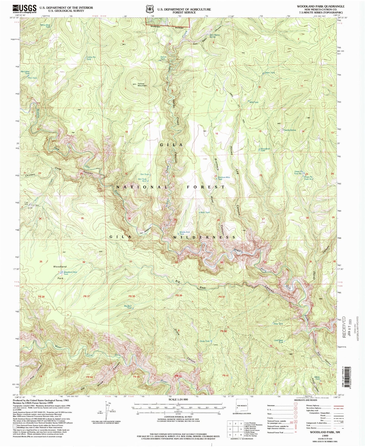
USGS Classic Woodland Park New Mexico 7.5'x7.5' Topo Map
Couldn't load pickup availability
Historical USGS topographic quad map of Woodland Parkin the states of New Mexico, Arizona. Scale: 1:24000. Print size: 24" x 27"
This quadrangle is in the following counties: Catron.
The map contains contour lines, roads, rivers, towns, lakes, and grids including latitude / longitude and UTM / MGRS. Printed on high-quality waterproof paper with UV fade-resistant inks.
Contains the following named places: Adobe Tank, Arrowhead Tank, Basin Tank, Big Bear Canyon, Big Bear Tank, Brothers West Canyon, Brothers West Tank, Cassidy Spring, Chicken Coop Canyon, Coffee Pot Tank, Deep Tank, Dirt Tank, Dirt Tank Number 2, East Water Canyon, Grave Canyon, Grave Tank, Green Fly Tanks, Green Fly Trail, House Log Canyon, Indian Creek, Indian Creek Canyon, Jordan Canyon, Jordan Mesa Tank, Little Bear Canyon, Little Bear Tank, Marceleno Tank, Middle Fork Tank, Nat Straw Canyon, Pino Tank, Prior Cabin, Prior Creek, Ramon Tank, Ring Canyon, Rock Tank, Sam Martin Spring, The Meadows, Wild Tank, Woodland Park, Woodland Park Tank, Woodland Park Trail, Yellow Bear Tank, Yellow Mountain, Green Fly Tank Number One, Gila National Forest, Green Fly Tank Number 2, Gila National Forest