MyTopo
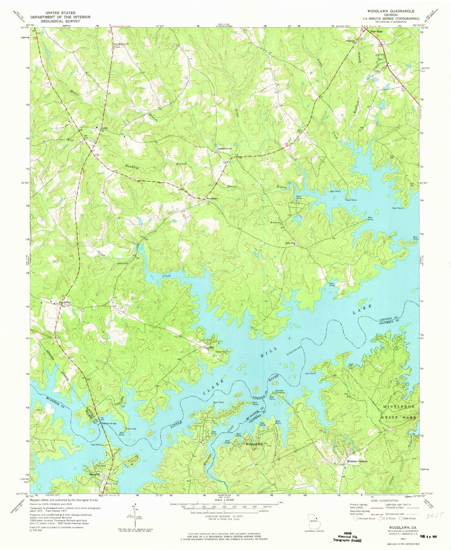
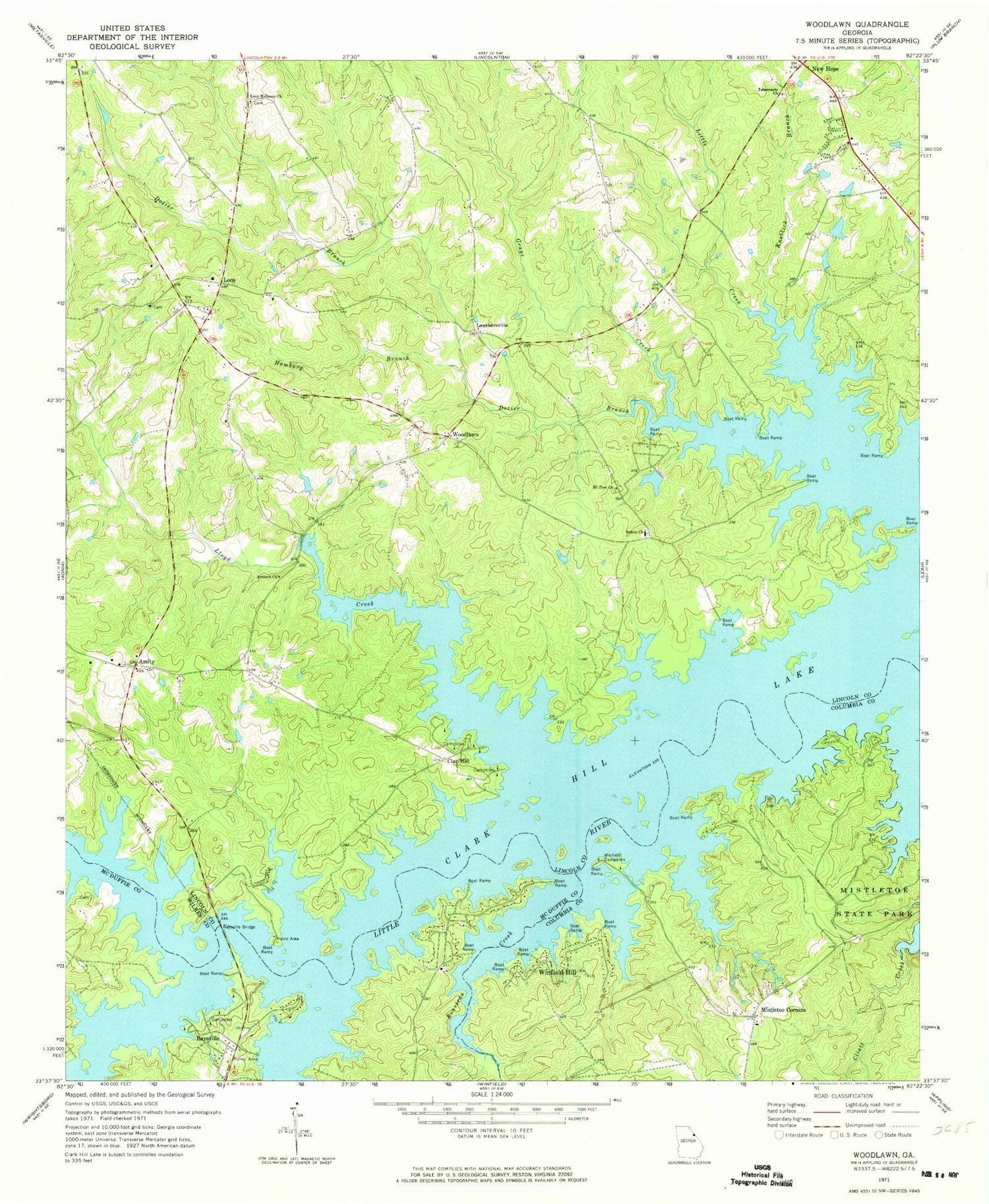
Classic USGS Woodlawn Georgia 7.5'x7.5' Topo Map
Couldn't load pickup availability
Historical USGS topographic quad map of Woodlawn in the state of Georgia. Typical map scale is 1:24,000, but may vary for certain years, if available. Print size: 24" x 27"
This quadrangle is in the following counties: Columbia, Lincoln, McDuffie, Wilkes.
The map contains contour lines, roads, rivers, towns, and lakes. Printed on high-quality waterproof paper with UV fade-resistant inks, and shipped rolled.
Contains the following named places: Big Creek, Dozier Branch, Hamburg Branch, Knoblick Branch, Lloyd Creek, Loco Holiness Church, Mistletoe Corners, Mount Zion Church, Raysville Bridge, Rousseau Creek, Salem Baptist Church, Tabernacle Church, Winfield Campsites, Leathersville, Loce, Woodlawn, Grays Creek, Little Creek, New Hope, Winfield Hill, Agnes School (historical), Arimathea Church (historical), Clay Hill School (historical), Jones Academy (historical), Liberty Hill School (historical), Liberty School (historical), Woodlawn School (historical), Zion School (historical), Hogan Cemetery, Loco Church, Rock Hill Methodist Church (historical), Saint Pauls Church, J. Strom Thurmond Reservoir, Forest Lake Estates Dam, Forest Lake, Agnes (historical), Cade Mill (historical), Salem (historical), Old Griffin Cemetery, Raysville Bend, Amity, Antioch Church, Clay Hill, Germany Creek, South Lincoln Division, Saint Pauls Methodist Church Cemetery, Loco Volunteer Fire Department